Glaciers and Icebergs!
Nature’s stunning ice sculpture.
September 3, 2018
At 6:30 a.m., we were jump started by our alarm clock after a very restful sleep. I managed not to scald myself in the shower – it’s always fun to figure out how to operate European-style plumbing fixtures. It’s also considerate of the designers to incorporate a safety interlock to help prevent inadvertently selecting 100% hot water, which could be life threatening in Iceland given the fact that much of their domestic hot water comes directly from thermal springs.
An hour later we ate a hearty breakfast in our hotel. The typical Northern European hotel buffet included cereals, jams, butters, cheeses, salamis, ham, scrambled eggs, sausages, yogurt, several types of bread, several types of rolls, pastries, fresh fruit, juices, milk, several types of coffee, salmon, etc. The sugar packages contained two lumps (cubes) – that turned out to be the standard wherever we ate.
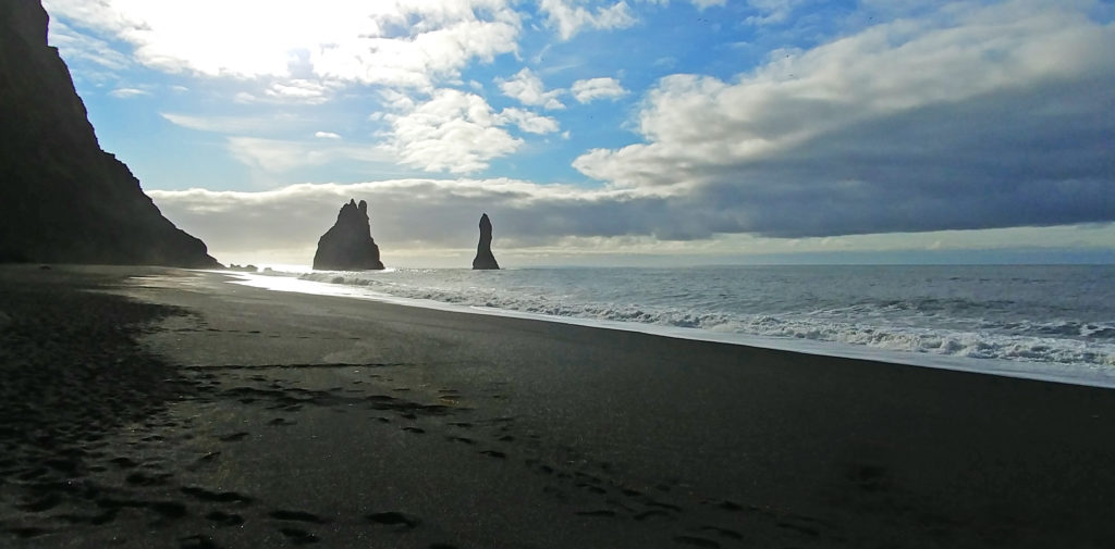
At 9 a. m. we climbed onto the bus. The gear we had donned for the day included many layers with the top being waterproof. That strategy worked out very well throughout the trip given the uncertainty and variability of Icelandic weather. On our continued journey along the South Coast, we arrived at Reynisfjara black sand beach. The beach was gorgeous and covered in coarse, jet black volcanic sand. It was very tough to walk in it due to the loose-packed nature of the sand. The beach was about 100-150 yards deep with portions backed by towering volcanic rock cliffs. Parts of the cliffs were comprised of huge vertical basalt crystals similar to those forming Devil’s Tower in Wyoming. On either side of the crystals were half-round caves. In one of the caves a crew was filming Game of Thrones, a television series on the HBO channel.
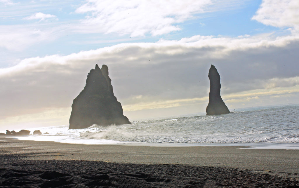
Looking out to sea, tall rock spires jutted out of the water. These were basalt formations–splintered columns of volcanic rock. The beach was striking and very dramatic. One had to be very careful not to get too close to the water because of the strong undertow and dangerous sneaker waves. There were lots of warning signs about the large waves that tend to hit the beach after a series of smaller waves. The sneaker waves routinely carry incautious tourists out to sea to their deaths. The warnings included a picture of a recent example of an unfortunate tourist engulfed in water who became one of those statistics. Our guide provided similar verbal warnings.
Our next adventure was a three-hour glacier hike on a Vatnajokull outlet glacier in Skaftafell National Park. Vatnajokull Glacier is the largest and most voluminous ice cap glacier in Iceland, and one of the largest in area in Europe. It has thirty outlet glaciers flowing from its ice cap. Outlet glaciers, are channels of ice that flow out of ice caps but remained constrained on the sides of the valley. We would have the opportunity to climb one.
At 10:45 we arrived in a parking area where we climbed aboard an old school bus used by the outfitters to house their equipment. We got fitted for crampons and were issued the rest of our gear – ice axe, helmet, and harness. After exiting the back door of the bus, we donned our harnesses and helmets, were divided up into groups of about ten, and met our guides. Ours was a young man from Italy. Then we were off for our “three-hour tour”.
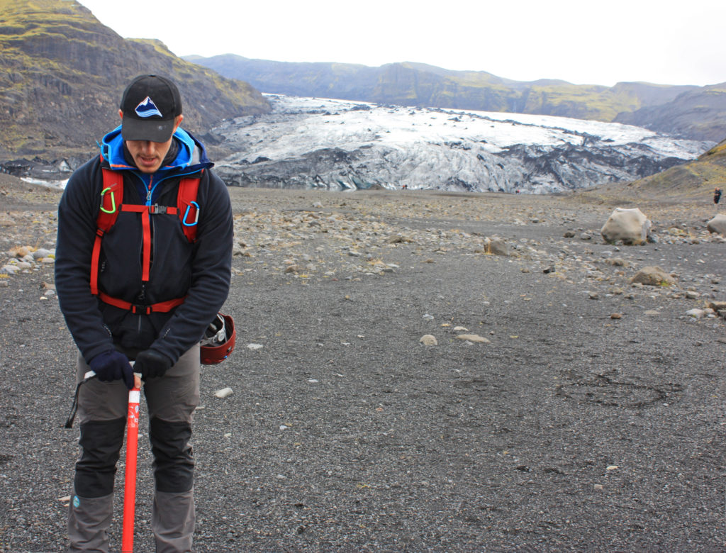
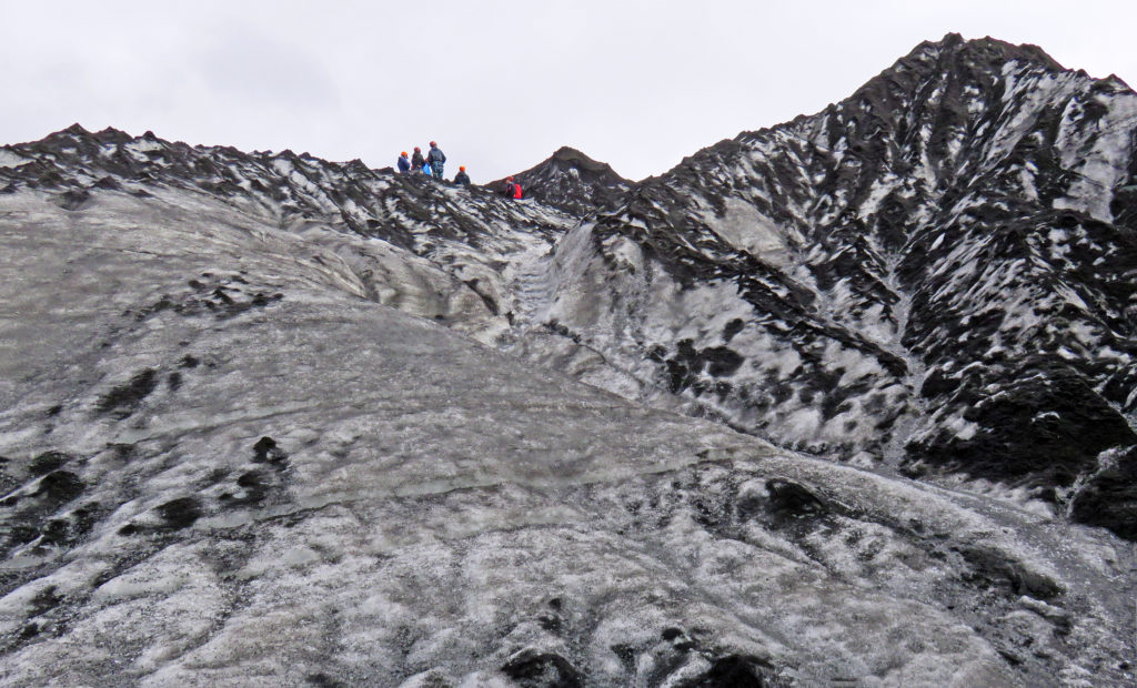
After a thirty-minute walk along the very wide gravel bed of the glacier’s outflow stream, we reached the foot of the glacier. Along the way we paused several times for photo opportunities. Our guide stated that the glacier had retreated one kilometer since 2010, sometimes moving back one meter per day. We moved quickly in single file through a relatively hazardous rock fall area. At the foot of the glacier we stopped to don our crampons. That proved somewhat arduous since we didn’t know what we were doing and the guide had to lead us slowly step-by-step through the procedure to securely lash the crampons to our feet with the crampon straps. Once that was done, we practiced walking with them and headed out up the glacier.
The going was slow as we walked single file. The trek proved more physically taxing than we expected, I think because in walking we were stomping our feet with every step to securely embed the crampon points into the ice. It was tiring. Half-way up the climb to the top of the glacier, I lost my footing and fell backward, landing on my butt and back and slid 8-10 feet back down the trail. All stop! The guide quickly came back, he and another climber helped me stand up, and they checked me out. I was OK (a few minor bruises revealed themselves later in the hotel) and none of my equipment was broken. However, my climb was done. I was pretty tired out and didn’t argue. Rodge elected to stay with me and forego the remainder of the climb.
In any event, we had indeed climbed on a glacier despite not doing quite as much as planned (check off that bucket list item!). Our group proceeded on up while we waited ten minutes to join up with a group coming back down. Our guide had radioed the situation and told us we would go down with a group led by a Swede with a big blond beard (an accurate description as it turned out, and he was great). We joined our new group and made it back down without further incident. Based on comments from that guide, members of his group had also experienced some problems along the way – at least one slight injury – that caused them to fall behind schedule.
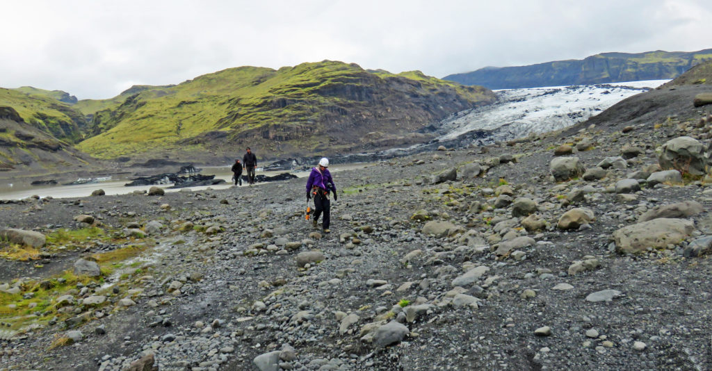
We finally arrived back at the school bus where we dropped off our gear. As it turned out, we only missed about ½ hour of climbing time. We chatted with our Arctic Adventures tour guide and waited for the rest of our group to arrive back from the glacier. It was a quiet group that trudged its way back to the bus – all looked pretty tired out.
Our next stop was in the small town of Vik for lunch. Our guide told us that north of the town is located the active volcano Katla. It last erupted one hundred years ago in 1918 and was due for another eruption. All of the residents of the town had to participate in annual helicopter evacuation drills because when the volcano erupts it causes glacial flooding that inundates the land on which the town sits. We were told Iceland has 150 earthquakes per day. Yikes!
We were now underway again for a 2-1/2-hour drive to our next destination. Our trek would take us along the Ring Road through Southeast Iceland. We were once again traveling along the coast. We passed many glaciers coming off of the vast interior ice sheet glacier. To our right was the ocean. We drove on a wide, flat area that was seabed during the last ice age (after the ice age ended, the land sprung back up several meters as the weight of ice was removed). To our left was a high eroded sea cliff, the top of which was the beginning of the interior highlands. The flat area had scattered farms with hay and innumerable sheep scattered about the flat land and up the slopes. Farm homes and support buildings were typically tucked at the base of the talus or heights on the left. Avalanches and falling rocks must be a constant hazard, but the location probably provides protection from much of the winter winds.
Along the way we drove atop one of the largest lava flows in recorded history. There were miles and miles of strange, twisted, lumpy landscape – a very humbling sight. The stark landscape was the result of the eruption of the Lakagígar fissure which lasted for eight months in 1783. It’s poisoning of the environment killed half of the island’s livestock, destroyed most of the crops, and led to widespread famine in which about 25% of the island’s population perished. The eruption also had a significant impact on the northern hemisphere, producing a very severe winter in 1784 (e.g. the Mississippi River froze in New Orleans). We also passed the Eyjafjallajökull volcano, and its associated lava field, that halted all air traffic in Europe in 2010.
The road we were traveling on had many single-lane bridges. There were no traffic signals as one approached the bridges, just a warning sign in Icelandic and a single flashing yellow light on the right-hand bridge abutment. It was up to the drivers to proceed or not. The longest of the bridges had pullout sidings at the midpoint. Luckily, the generally flat topography along the coast and the lack of trees resulted in pretty long sight lines so seeing oncoming traffic that time of year was not generally a problem.
We finally arrived at our destination, “Diamond Beach”, another black volcanic sand beach at the outflow of a short glacial river. It was named Diamond Beach because the ice looked like glistening diamonds against the background of black sand. We walked along the beach and saw small stranded icebergs melting in the mild temperatures. We watched many small icebergs float by in the fast-moving current on their way to the sea. Several seals were hunting for food in the river. They appeared focused on their work with no time to pose for the tourists wandering along the shoreline.
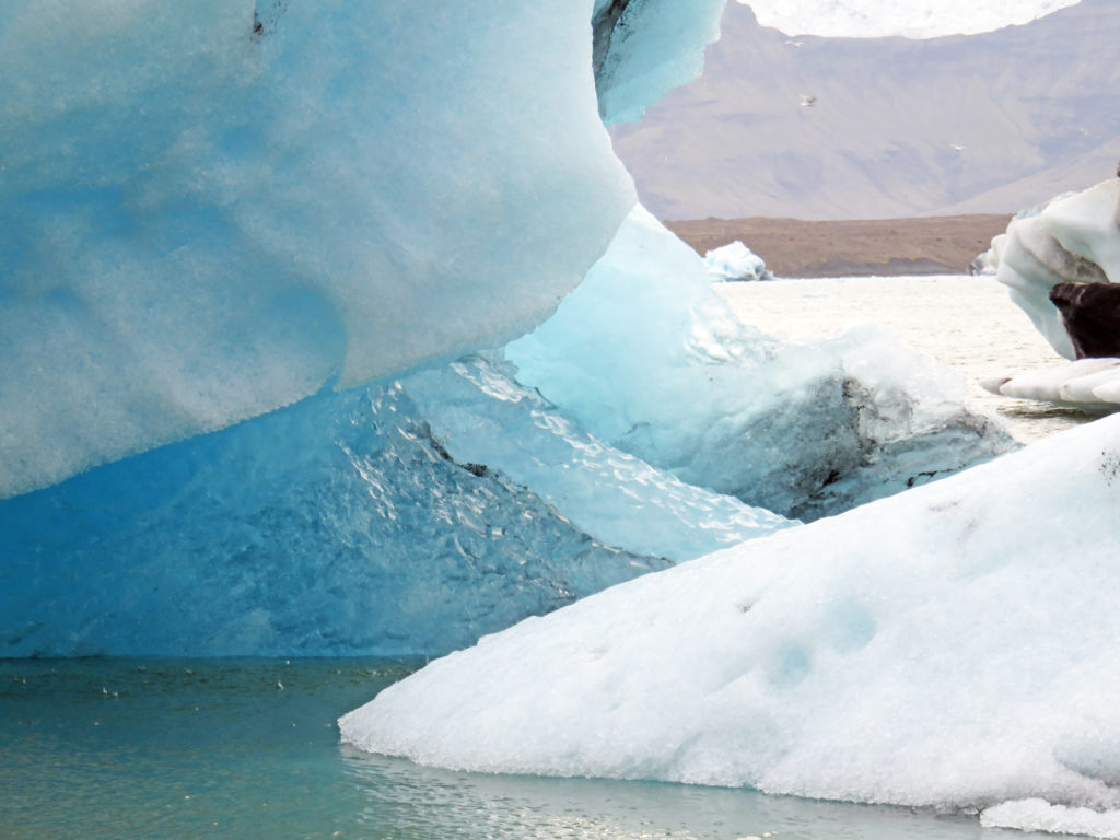
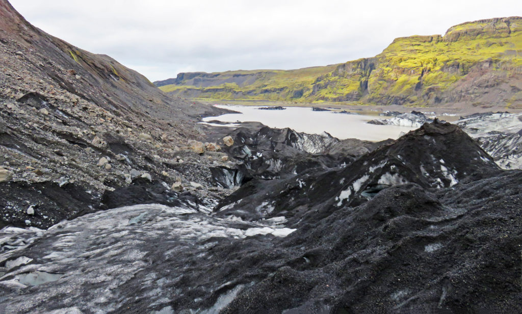
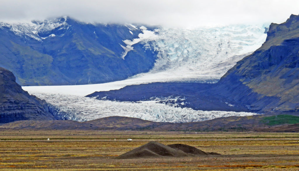
A half mile away we visited Jokulsarlon glacier lagoon. It was an enormous lagoon, 800 feet deep, filled with huge chunks of ice that had broken free from Breiðamerkurjökull, an outlet glacier of the famous Vatnajökull (the largest icecap in Europe). Our guide related that one day he watched a group of excited tourists exit their car and rush to see the iceberg-filled pool. Alas, they failed to set the parking brake on their car which is still at the bottom of the lake along with their passports. While we were there, the lagoon was very busy with companies offering kayaking and amphibious boat tours. It was truly gorgeous with many small bergs dancing within it. Although the air was very chilly with a brisk wind, the views were awe-inspiring.
It was 7 p.m. and time to head to our hotel. We arrived in the small seaside town of Hofn where we stayed at Hotel Smyrlabjorg. It was another country hotel with a magnificent ocean view. The hotel was started by a farmer and his family and is still a working farm that produces all of the lamb served in the restaurant. Lots of baa-ing was evident as we walked around the front of the hotel. That night we ate as a group in the hotel restaurant and all enjoyed the outstanding food and each other’s company.
Bless,
Kathy
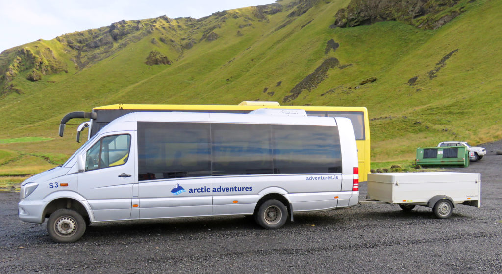
Our Artic Adventures van welcomes us to a new day on the road.
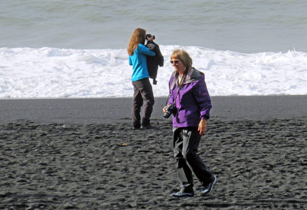
Kathy walks on Reynisfjara black sand beach.
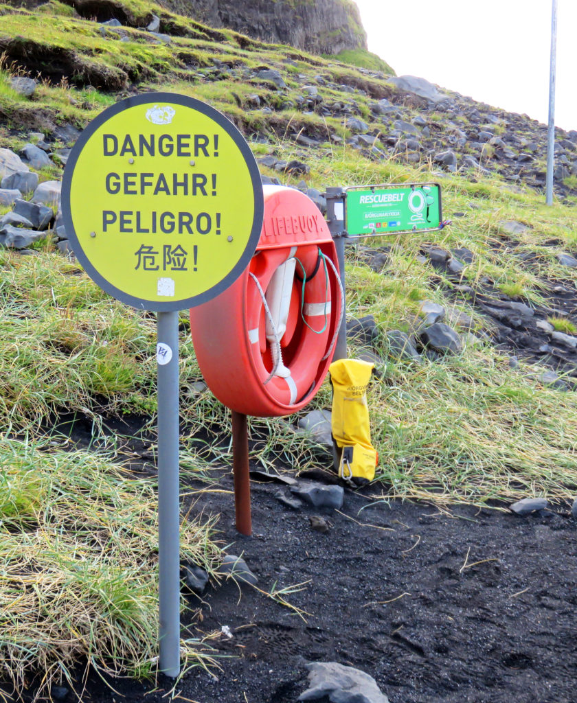
Danger sign and life guard buoy for sneaker waves.
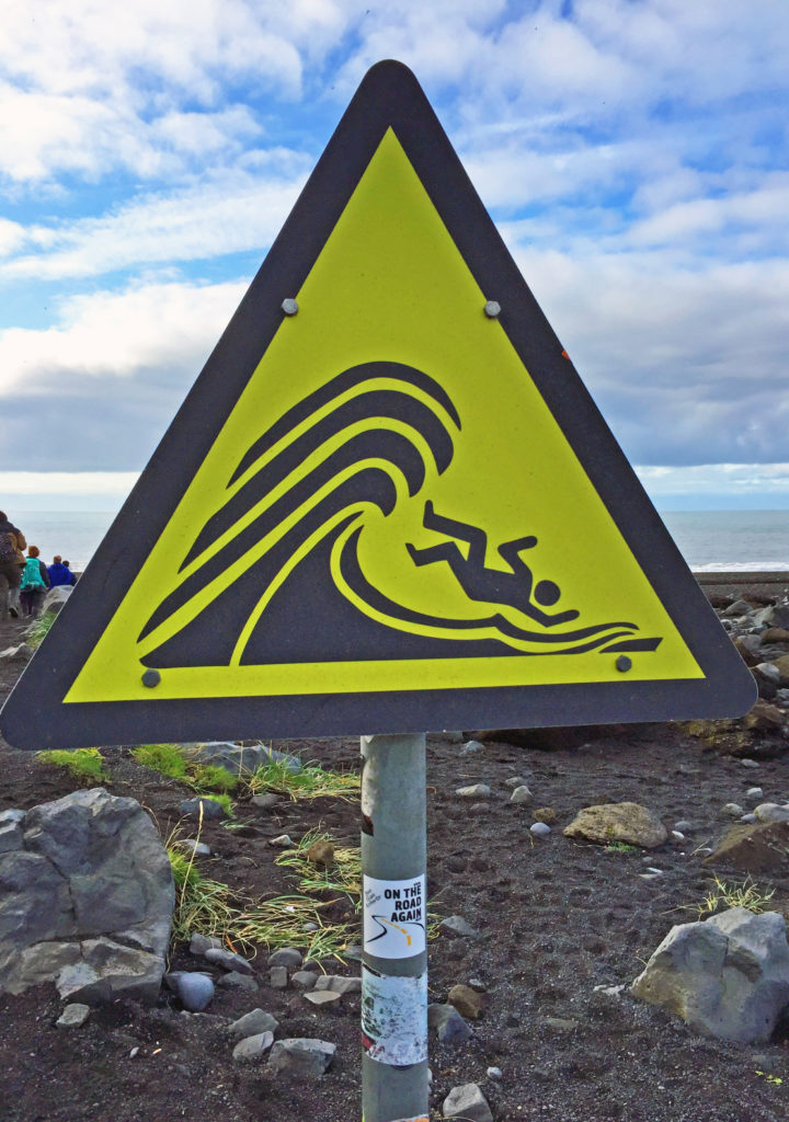
Sneaker wave sign.
Towering volcanic rock cliffs rise out of the sea.
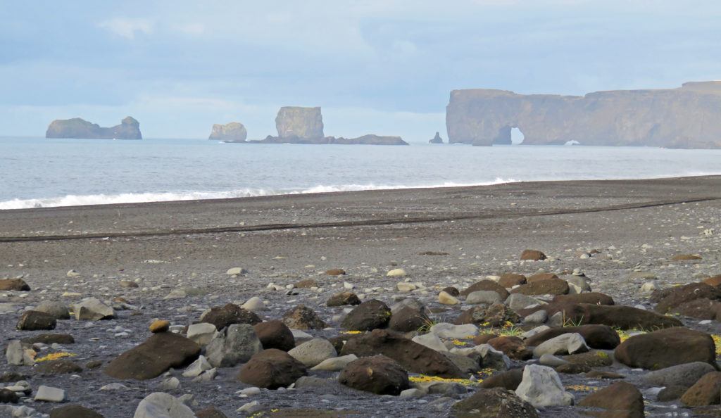
In the distance one can see a natural sea arch and off shore rock formations.
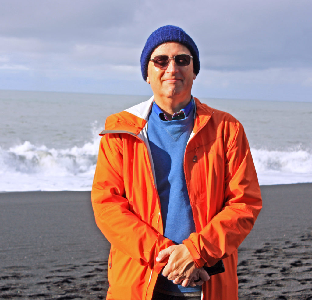
Rodge, striking a pose on Reynisfjara black sand beach.
More early morning sea views.
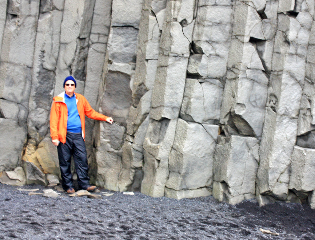
Rodge standing near towering volcanic rock cliffs.
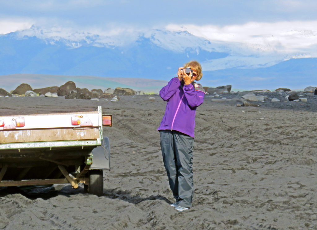
Kathy taking a photo of the beach.
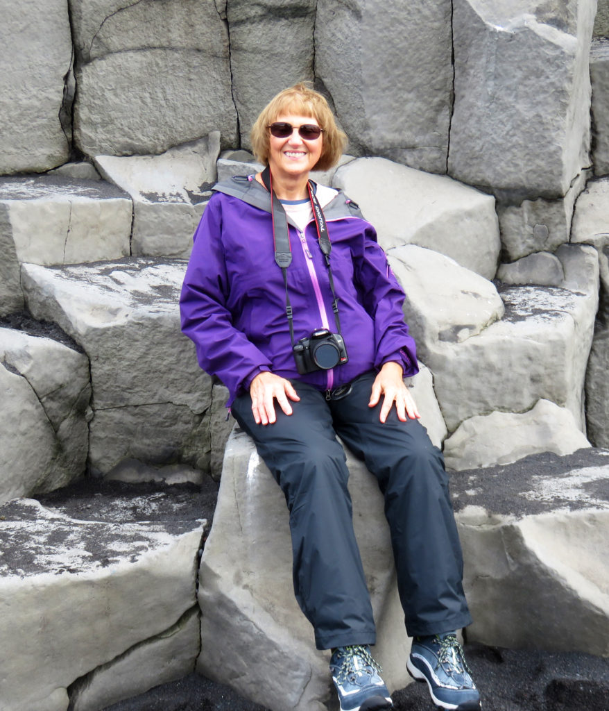
Kathy sitting near the basalt cliffs.
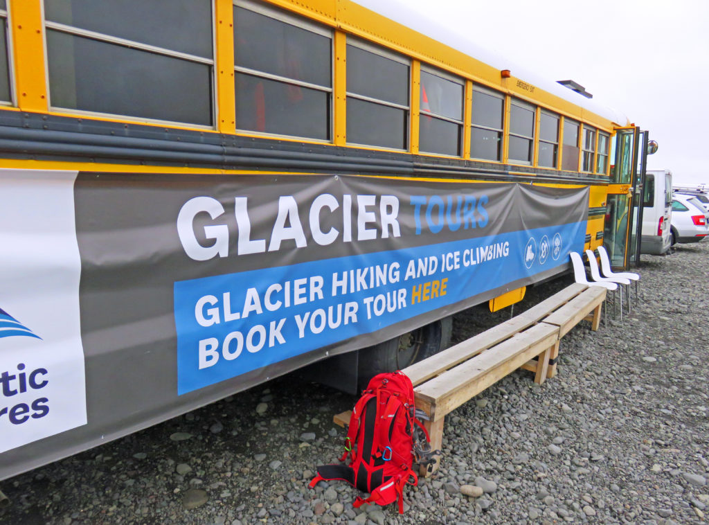
Glacier Tours outfitter bus.
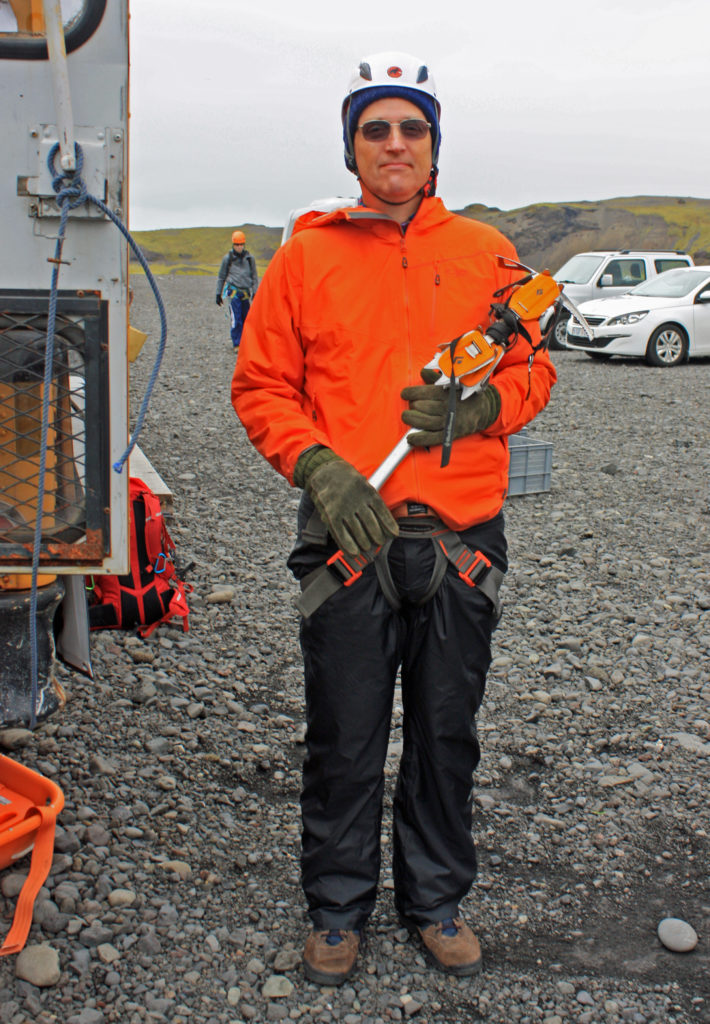
Rodge ready to hike the glacier.
Our glacier tour guide from Italy.
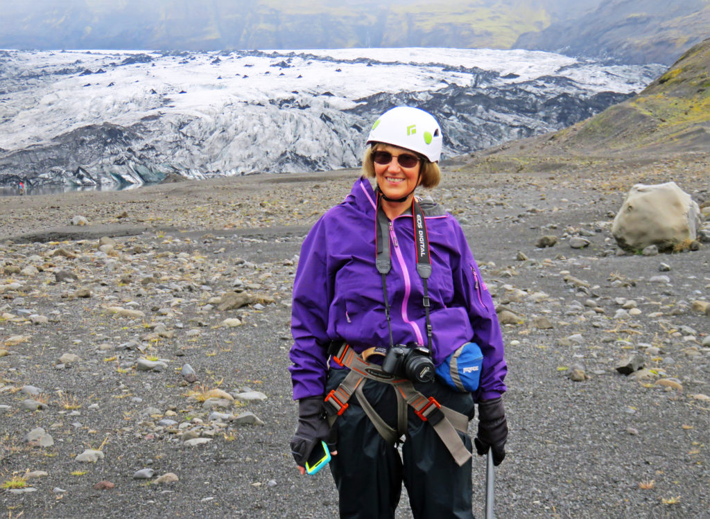
Kathy all ready to go.
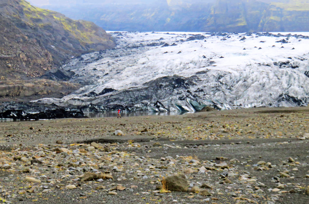
The wide gravel bed at the foot of the glacier.
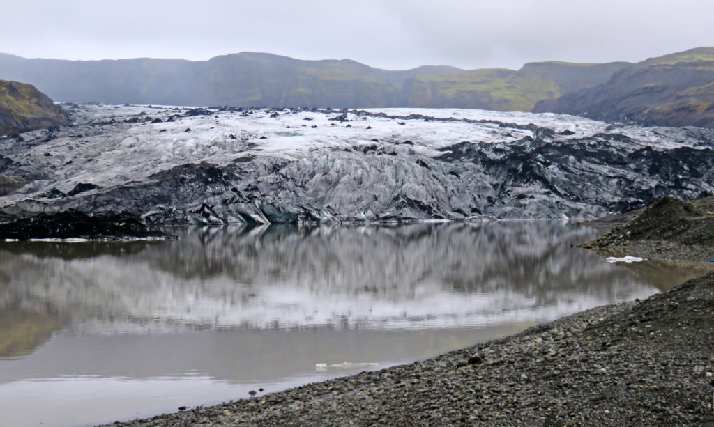
A small lake formed by the glacier’s outflow stream.
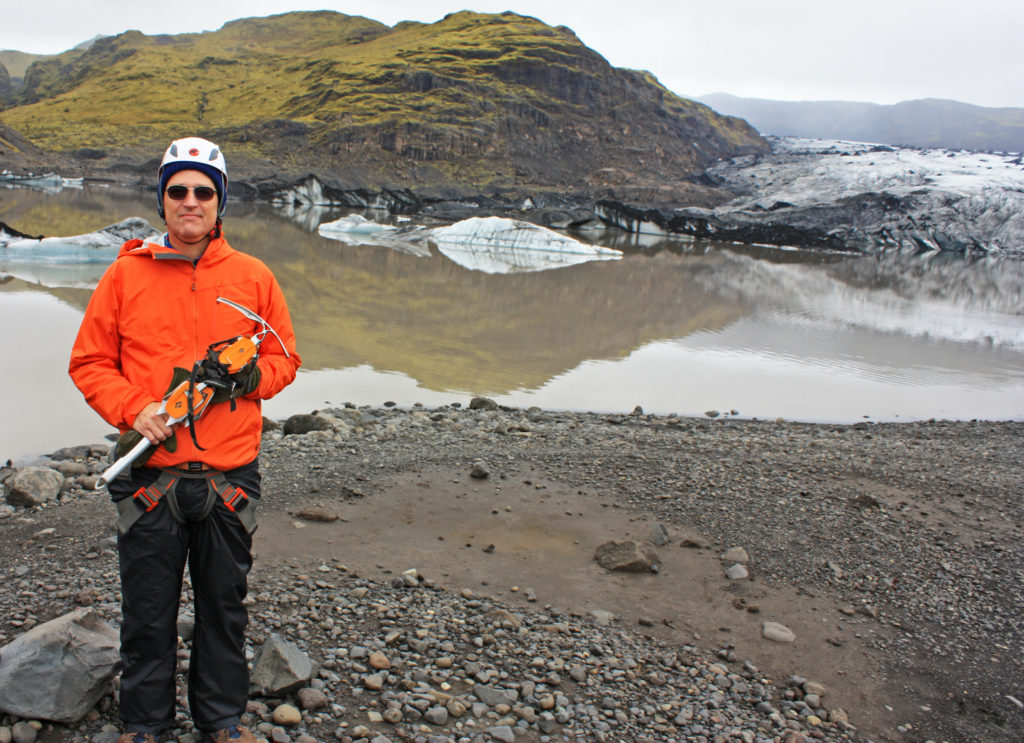
Rodge ready to take on the glacier.
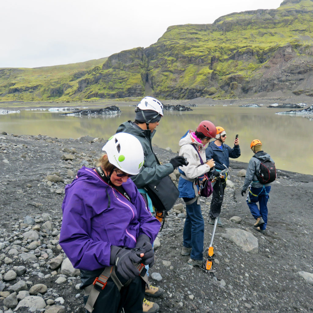
We learn to put on our crampons.

We will be climbing up the side of the glacier to the top.
Another tour group ahead of us.
A view part way up the glacier.
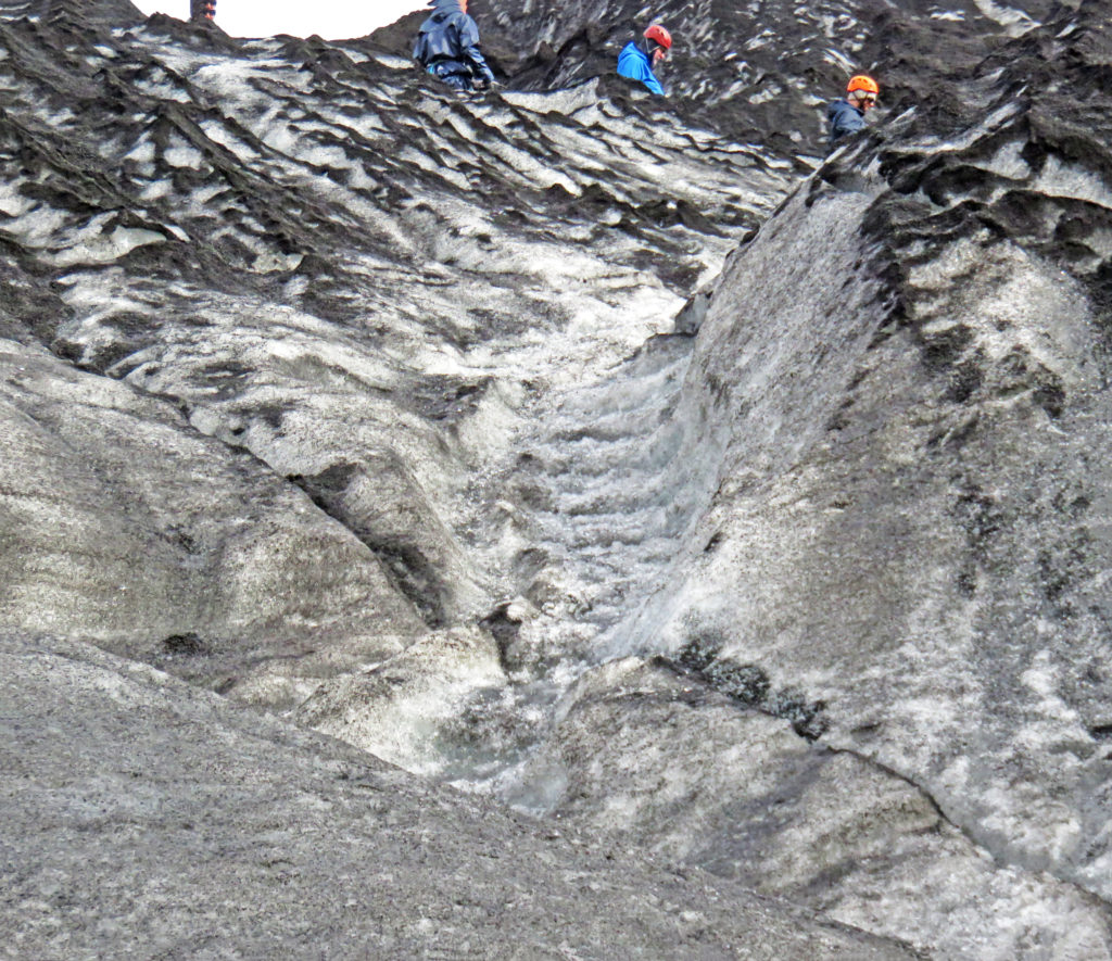
The icy stairs where I took a tumble.
My crampons are off…my bucket list checked off!
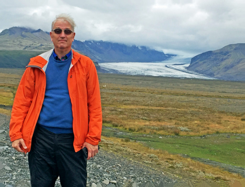
Rodge posing with a glacier.
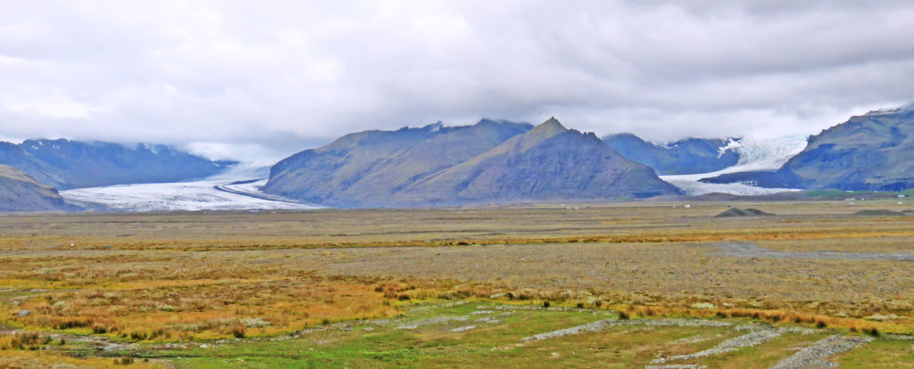
A view of a glacier divided by a huge rock formation.
“Hang Ten” Iceland style!
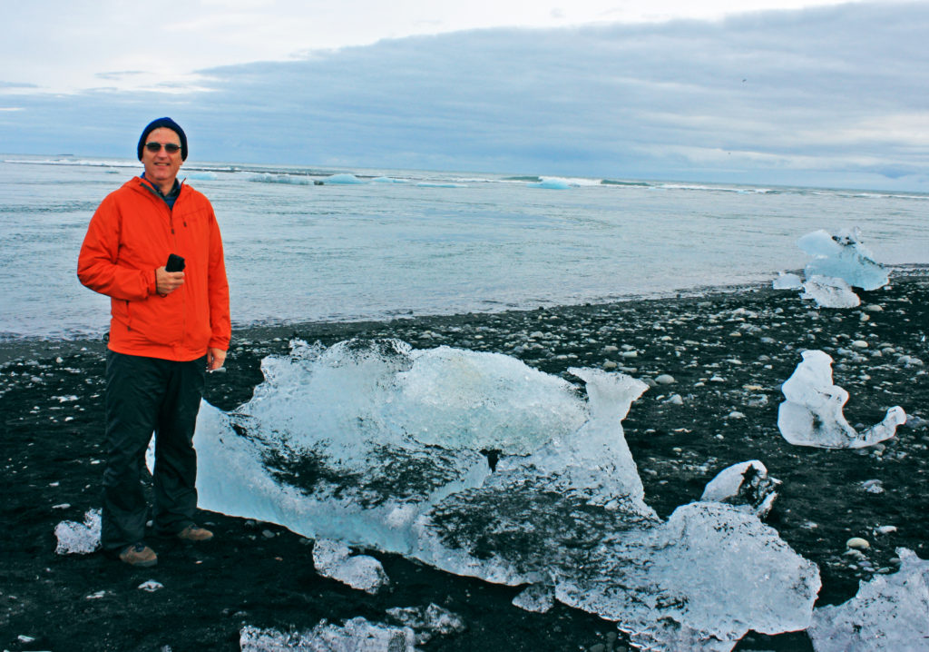
The ice looks like glistening diamonds on Diamond Beach.
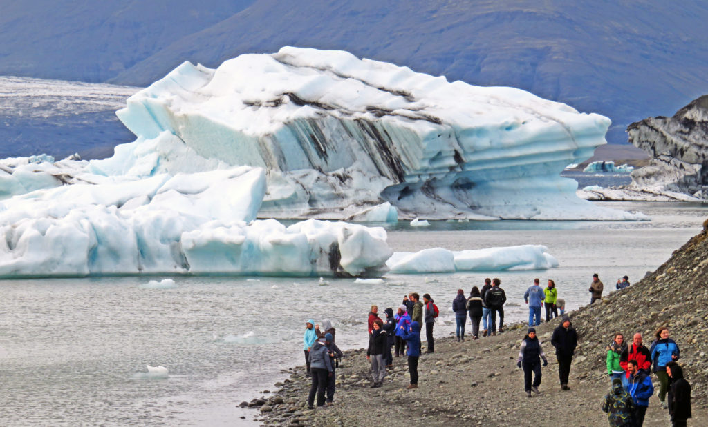
Jokulsarion glacier lagoon filled with chunks of ice.
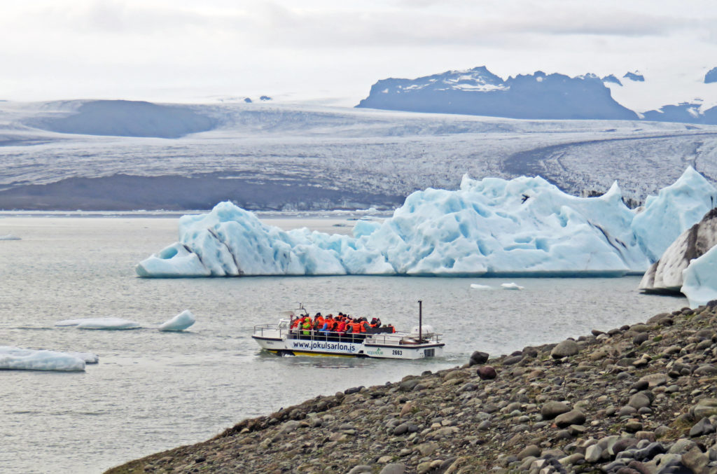
People get ready to leave on a boat tour of the lagoon.
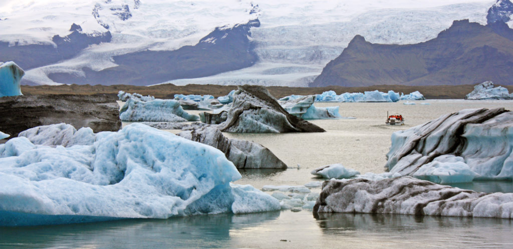
The huge ice chunks in the lagoon have broken free from the distant glacier.
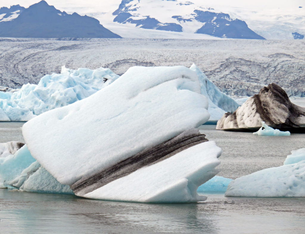
The glacier in the background formed this humongous ice chunk.

Leave a Reply