Iceland: The land of Fire and Ice!
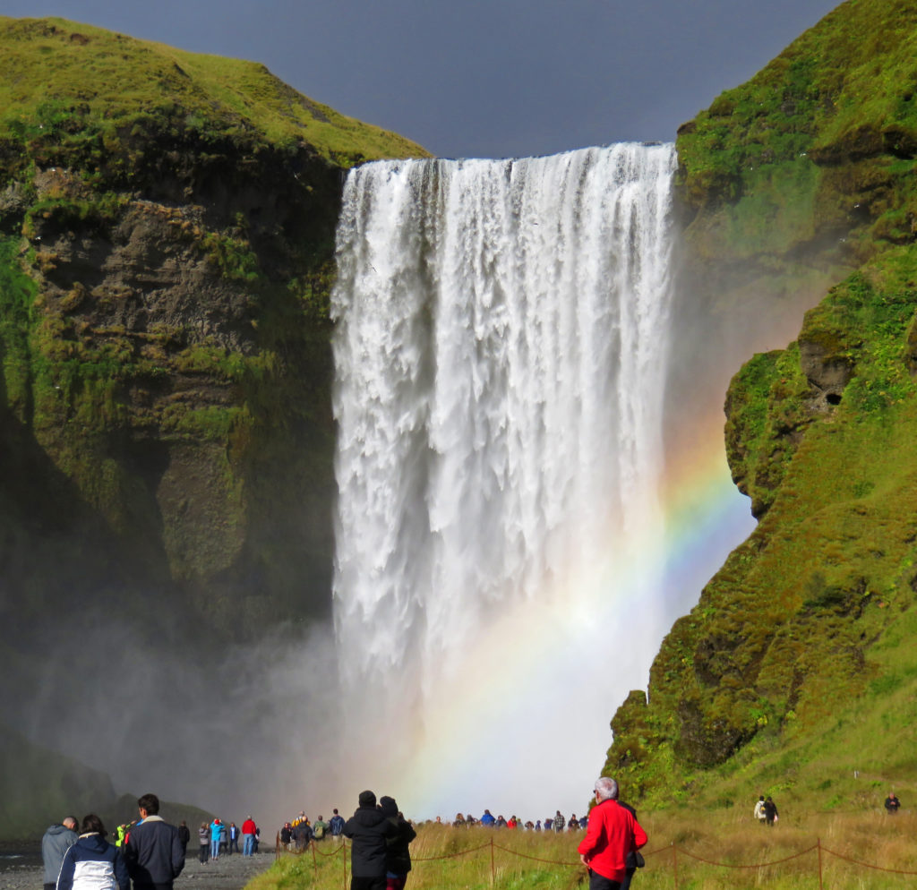
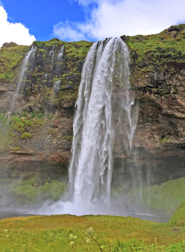
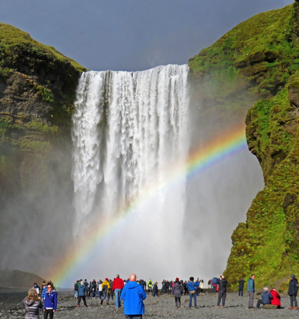
We were mesmerized by the beauty of Skogafoss and its magnificent rainbow.
September 2, 2018
It was the first day of our Artic Adventures Tour around Iceland’s Ring Road. We awoke at 6 a.m. and after a hearty breakfast in the hotel we walked a block to Bus Stop # 7 to wait for our tour bus. At 8:20 a.m. a nineteen-passenger bus bearing the “Artic Adventures” logo and towing a small trailer pulled up. We were greeted by our guide, a tall, robust, somewhat weathered man of fifty, who would be our guide for the week. Over the course of the next few days, we would learn quite a bit about him in snippets.
Although he and his family currently lived about a forty-five minutes north of Reykjavik, he was born and raised in a small fishing village in northwest Iceland. His family had been in Iceland for the last 1000 years. After finishing school, he fished on many vessels until he eventually served on and captained a large vessel (100-150 foot) that remained at sea for weeks at a time. He later obtained his masters license and served as the captain of a small touring vessel that plied the waters around Norway, Great Britain and Iceland. For the last few years he worked year-round as an Iceland tour guide. Both his English and his skills as a tour guide proved excellent. His driving prowess and ability to maneuver the bus and its attached trailer were akin to that of a mountain goat navigating a hillside.
With our luggage loaded and all nineteen of us aboard, we headed out for our seven-day excursion. Our trek would take us in a counter clockwise direction around the perimeter of Iceland on the 800-mile long Ring Road.The first area we explored was the Golden Circle, an area east of Reykjavik. After riding an hour, our first stop was Pingvellir National Park, a UNESCO World heritage Site. Its dramatic gorge marked the pulling apart of the Eurasian and North American tectonic plates and historically it was the area where in 930 AD the Icelandic people established their parliament.
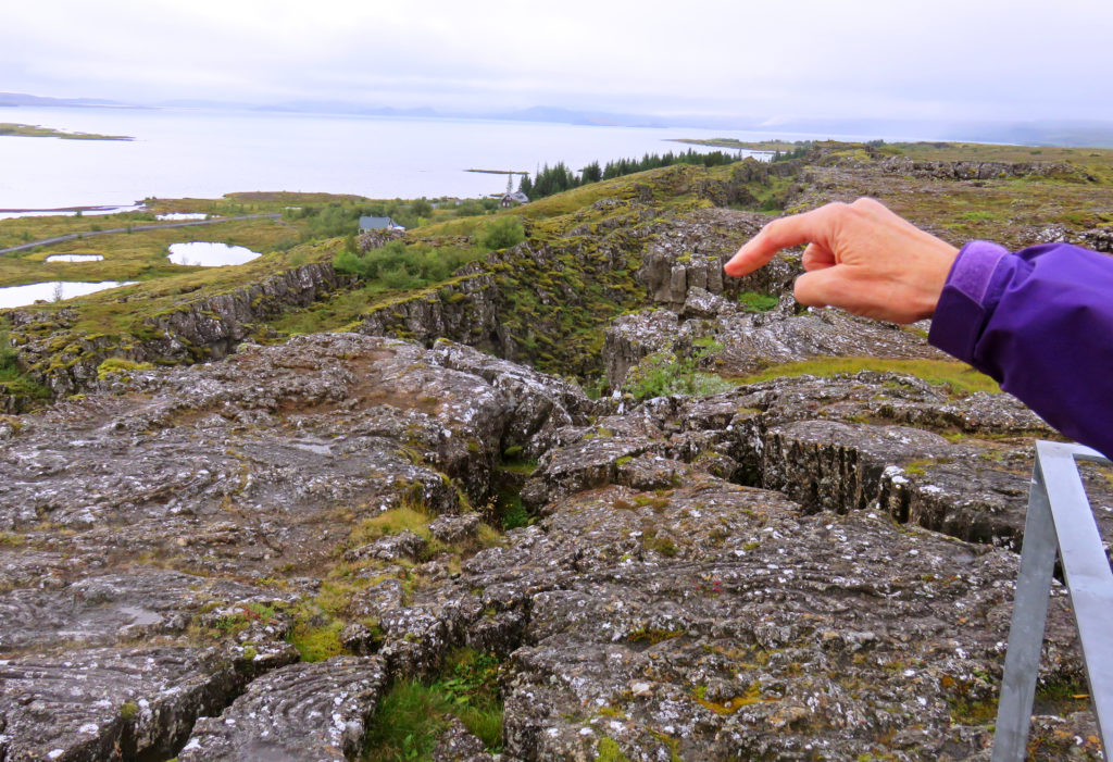
We pulled up to the Visitor Center and walked to a viewing platform which overlooked the Pingvellir Rift Valley. In the distance we could see Pingvellir Lake and beautiful rock features littered with ravines, many of which were filled with crystal clear spring water. We walked along the edge of the North American Plate by weaving our way through the Almannagia Gorge. Along some parts of the gorge we could see across the valley to the Eurasian Tectonic Plate. The plates continue to move apart at 2.5 cm. a year.
Our next Golden Circle discovery was Gullfoss waterfall or “Golden Waterfall”. As we approached the falls from a footpath, we could hear the roar of the water and see a sparkling cloud of mist. The breathtaking waterfall is fed by the Hvita River which is created by Iceland’s second biggest glacier, the Langiokull. The two-tiered waterfall plummets thirty-five feet into a narrow gorge which is seventy feet deep and 1.5 miles long. We stood on the lower viewing platform and were mesmerized by the sheer power and beauty of the cascading water.
The next area to explore was Iceland’s beautiful, rugged South Coast. After driving for ninety minutes we arrived at our first destination, Seljalandsfoss Waterfall. Like most waterfalls in Iceland, Seljalandsfoss was also fed by a glacier. The melting waters from the glacier-capped Eyjafjallajokull volcano flowed to form the Seljalands River which then cascaded 213 feet over steep cliffs into a pretty meadow.
There was a footpath which ran along the bottom of the cliff and allowed access behind the waterfall. We decided not to hike there because we didn’t want to get drenched by the drizzle. It is the only known waterfall in Iceland where it’s possible to walk behind the falling sheet of water.
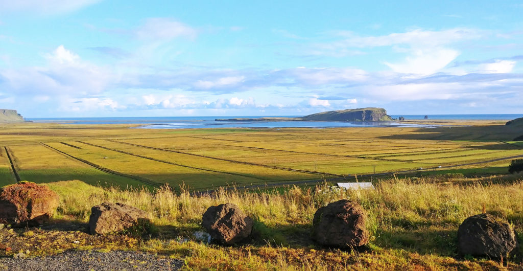
As we continued west along the South Coast, we had the sea on one side and on the other side a flat stretch of land about three miles wide bordered by dramatic cliffs running parallel to the sea. We rode by beautiful bright green meadows dotted with wooly sheep. Sheep were grazing everywhere even on the highest cliffs.
As we approached our next waterfall, Skogafoss we were mesmerized by its beauty and the magnificent rainbow encircling it. We immediately jumped off the bus and ran to capture a picture. The sound of the roaring cascade was deafening. As we walked closer to it, we were drenched in a cloud of spray. The falls, formed by the Skogar River, dropped 200 feet to its bottom. A staircase (527 steps) led up to an observation platform above Skogafoss where you could view not only the waterfall but south Iceland’s coastline.
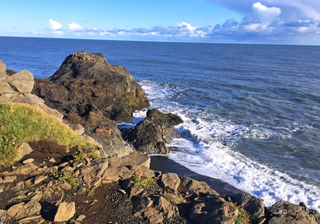
Our last stop of the day was Dyrholaey Promontory, a peninsula on the south coast famous for its lighthouse, natural sea arches, picturesque off shore rocks and sweeping views of black sand beaches. We walked up to an overlook and spent time bonding with the natural beauty of the sea. The promontory also served as a bird sanctuary. In the summer, many Atlantic puffins and Arctic terns could be found nesting on the cliff faces.
At day’s end, we pulled into a country inn, the Hotel Dyrholaey. It was located in the middle of nowhere with a great view of the southern coast in the distance. The back view out our hotel room window was equally awesome – lots of green mountains in the background. We thoroughly enjoyed our first day on the Ring Road and looked forward to what tomorrow would bring!
Bless,
Kathy
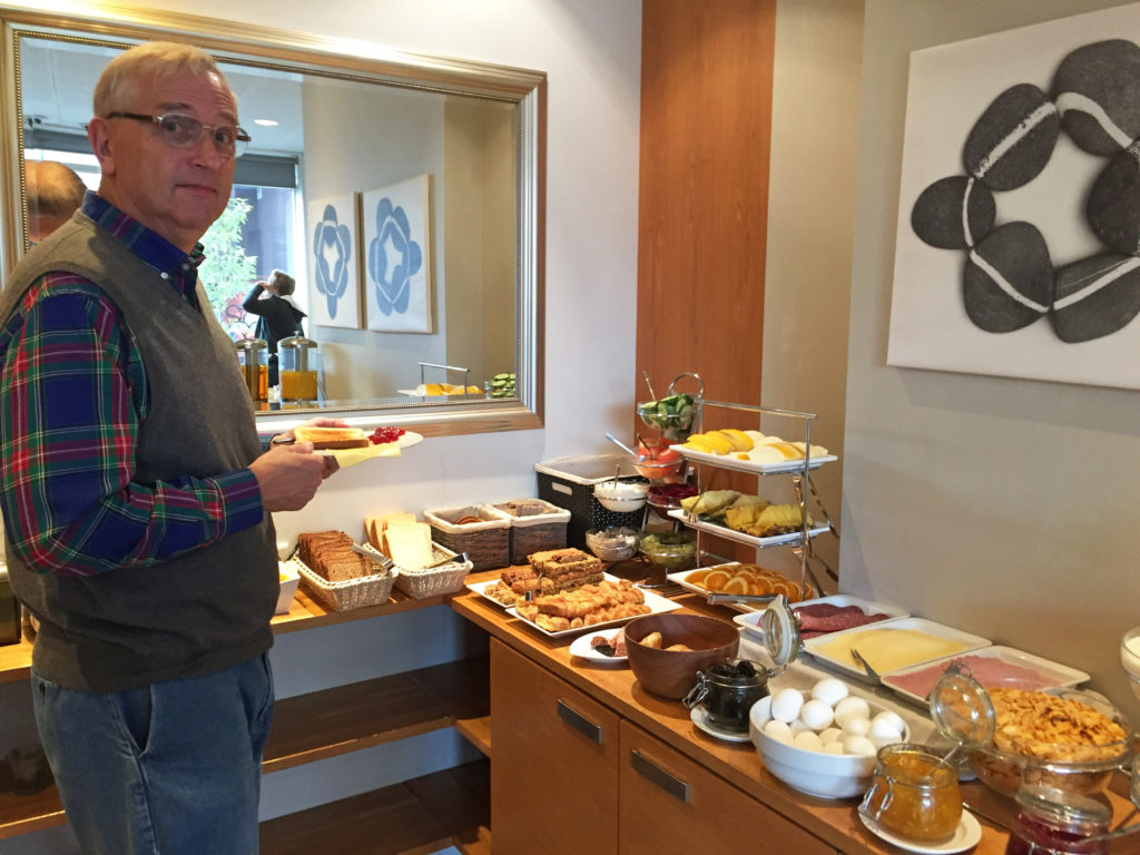
Rodge, checking out the hotel breakfast bar.
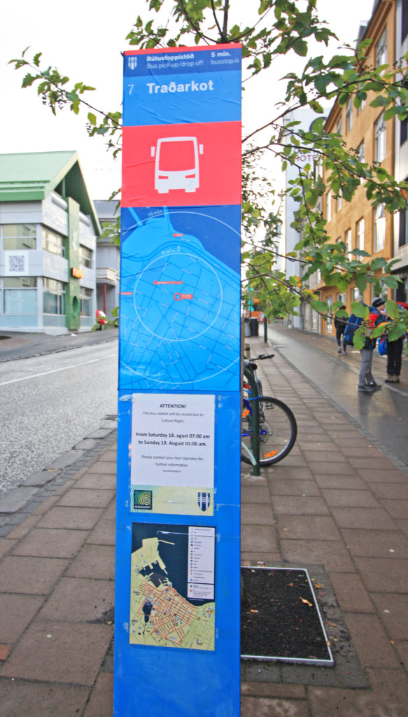
We wait for the tour bus at Bus Stop #7.
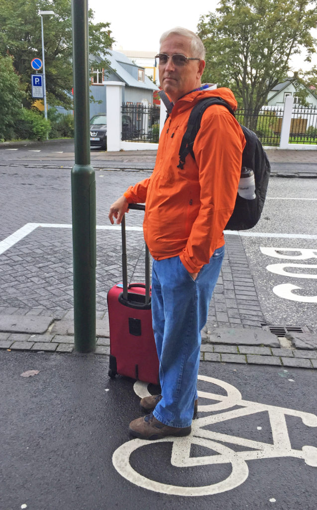
Rodge waiting for the Artic Adventures tour bus.
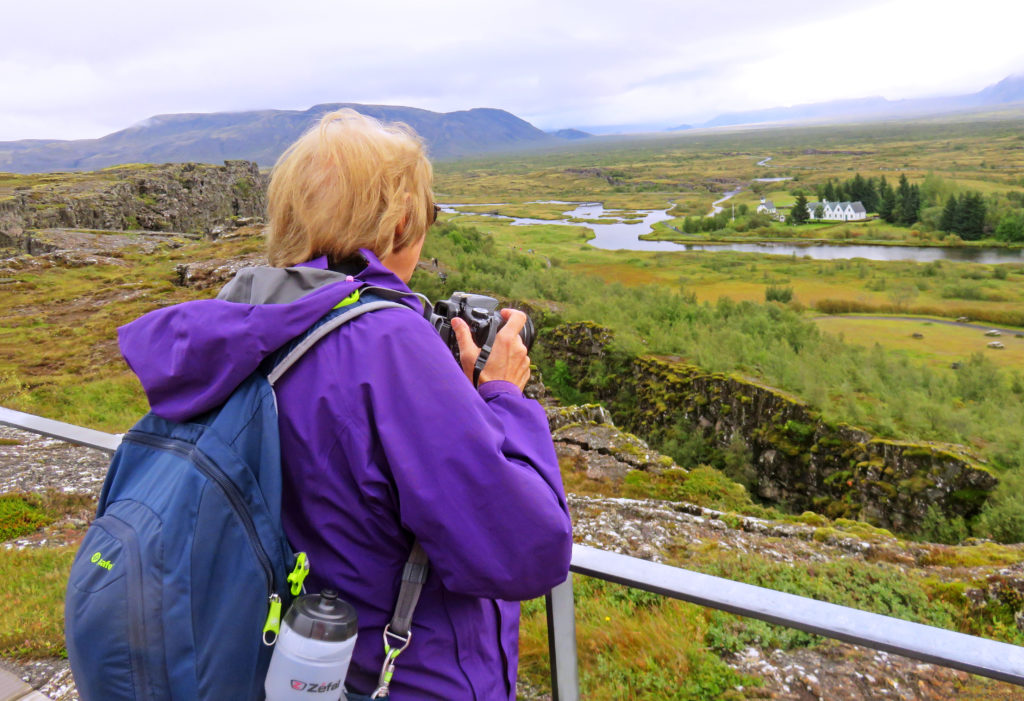
Kathy viewing the Pingvellir Rift Valley.
Rocks littered with ravines in Pingvellir National Park.
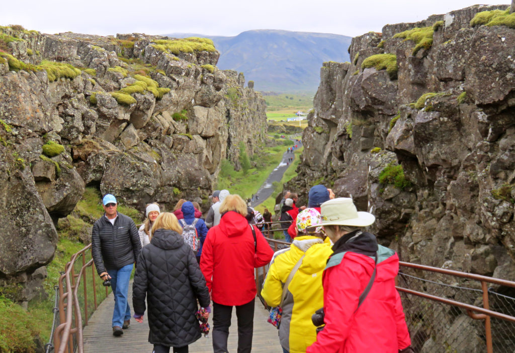
People walking through the Almannagia Gorge along the North American Plate.
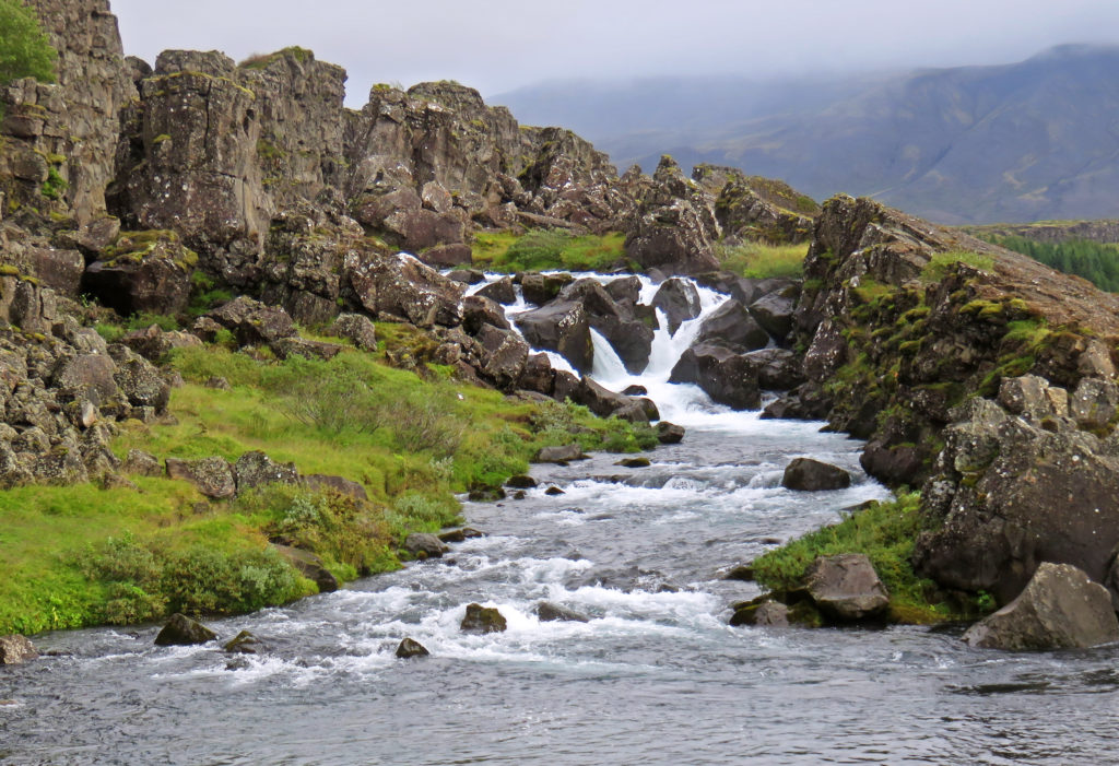
Oxararfoss waterfall which eventually flows into Lake Pingvallavatn.
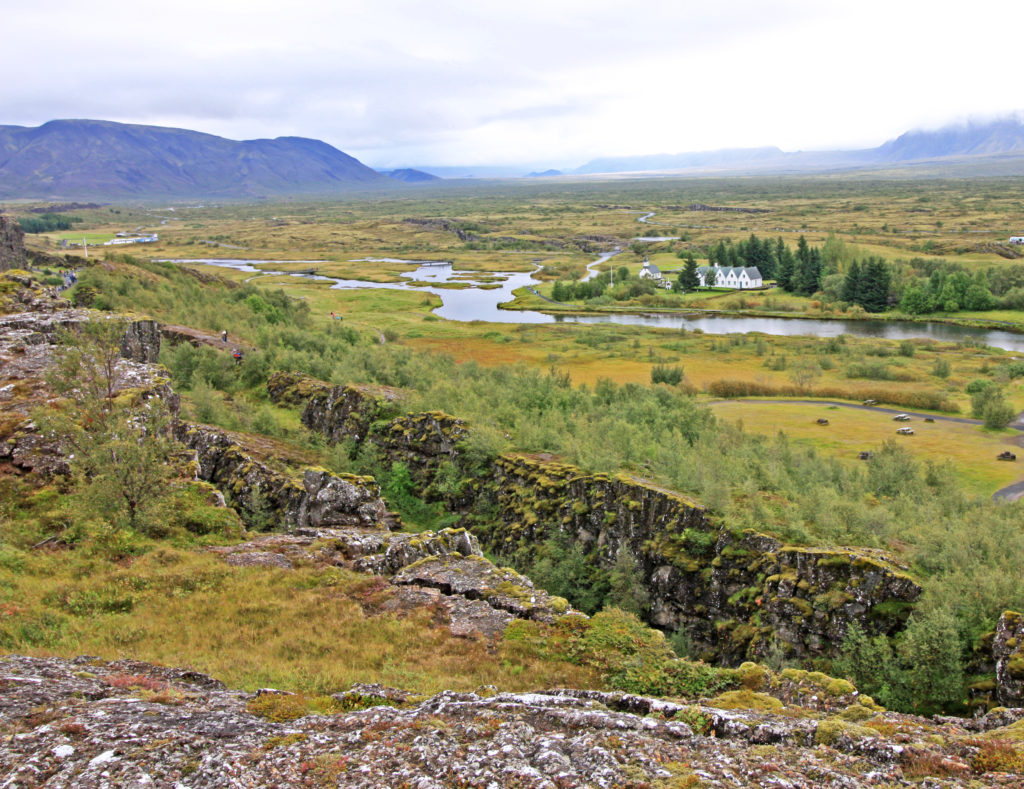
A ravine in the Pingvellir Rift Valley with the Oxara River in the background.
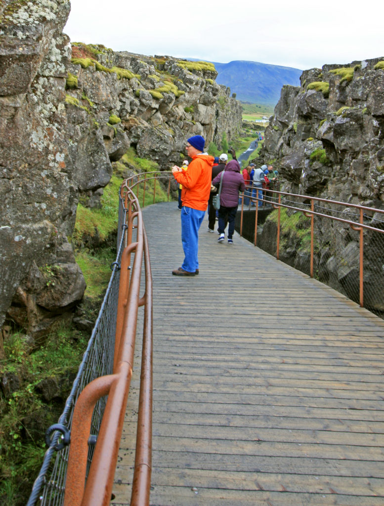
Rodge on the boardwalk in Almannagia Gorge.
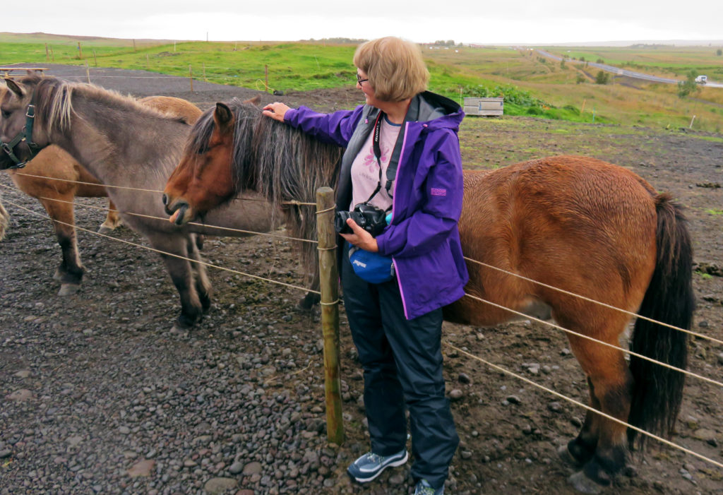
Kathy posing with an Icelandic horse.
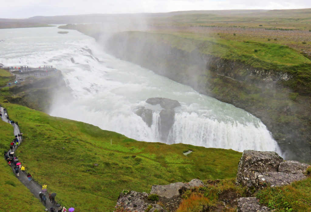
As we approached Gullfoss from a footpath, we could hear the roar of the water.
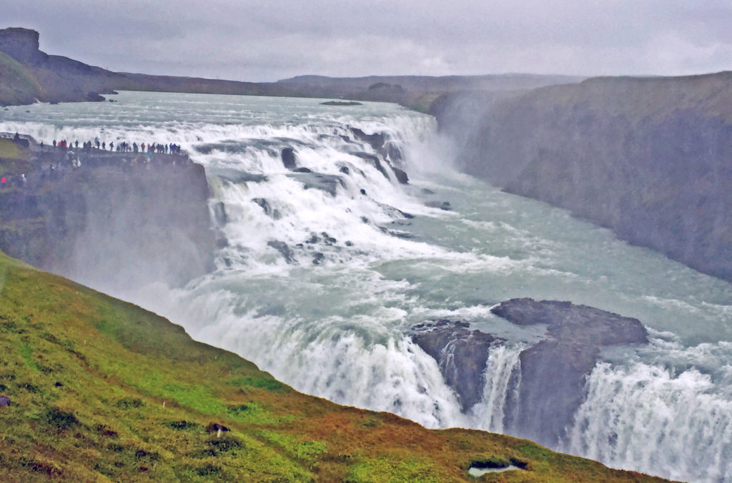
Gullfoss, a breathtaking two-tiered waterfall plummets thirty-five feet.
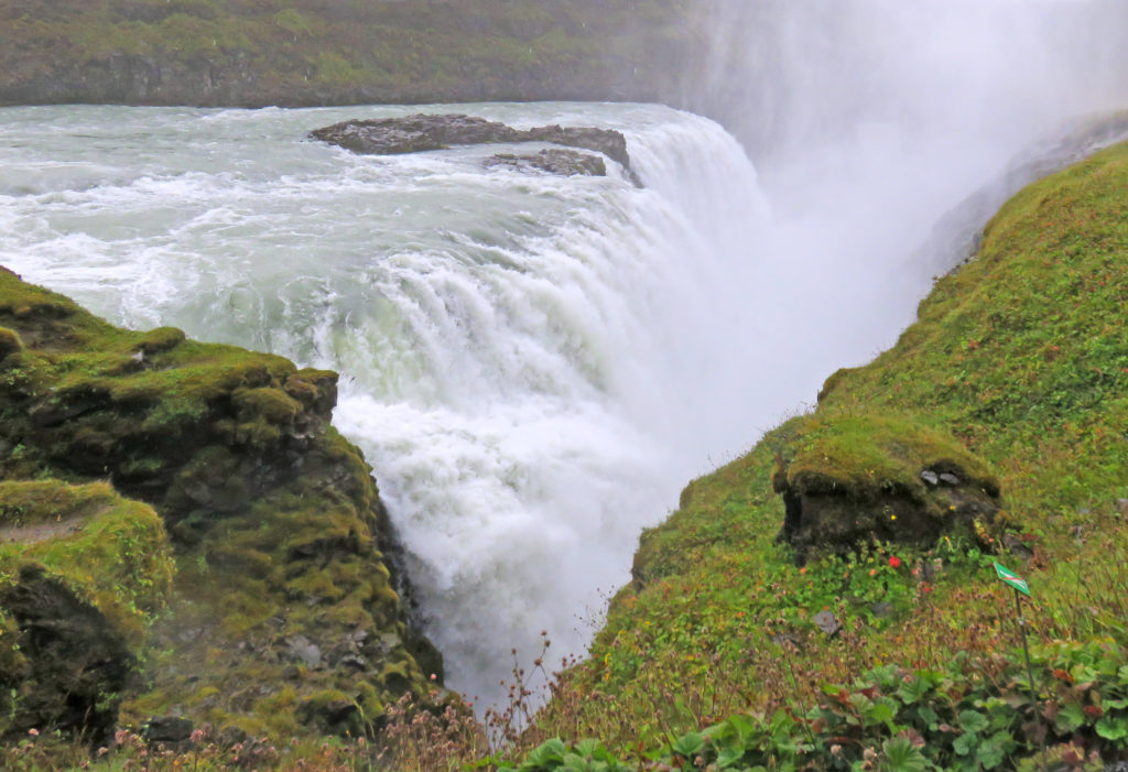
A sparkling cloud of mist rises from the lower tier of Gullfoss.
Seljalandsfoss Waterfall along Iceland’s rugged South Coast.
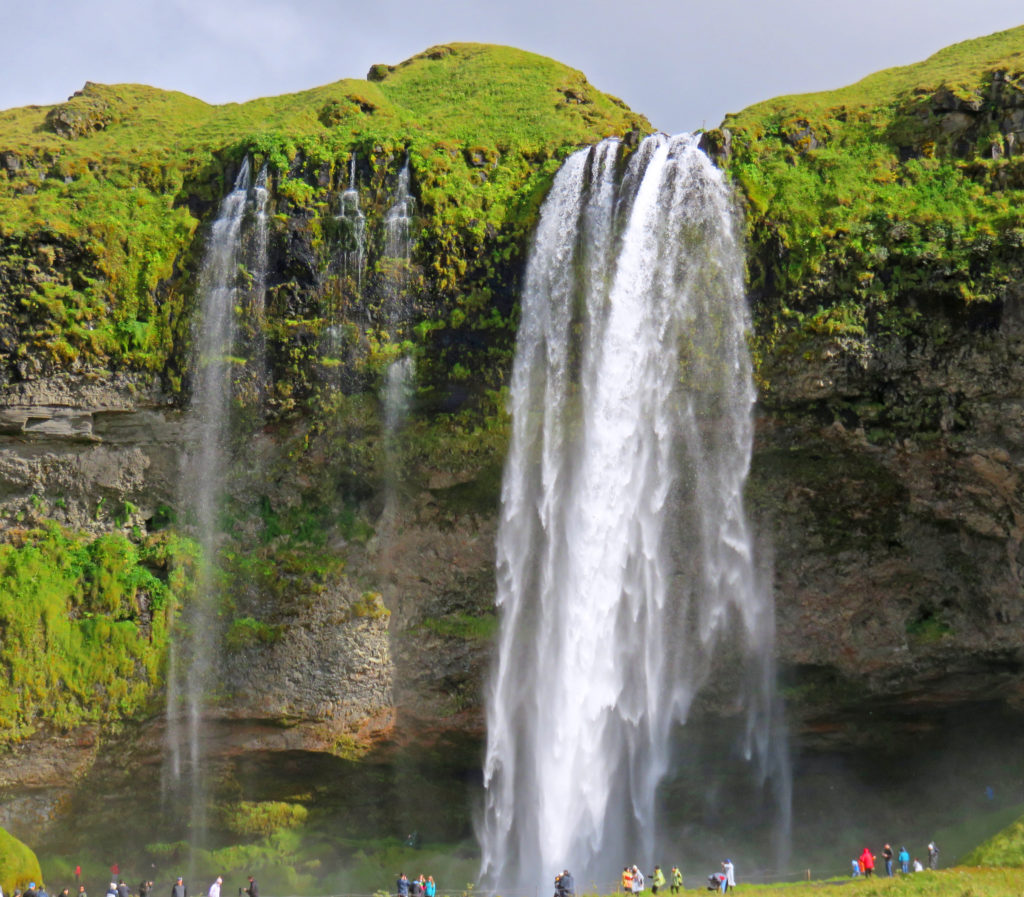
People are able to walk behind the waterfall which plummets over a steep cliff.
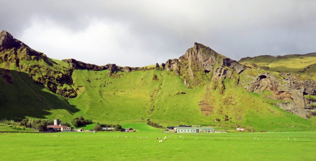
We rode by a stretch of land about three miles wide bordered by dramatic cliffs.
As we walked closer to Skogafoss, we were drenched in a cloud of spray.
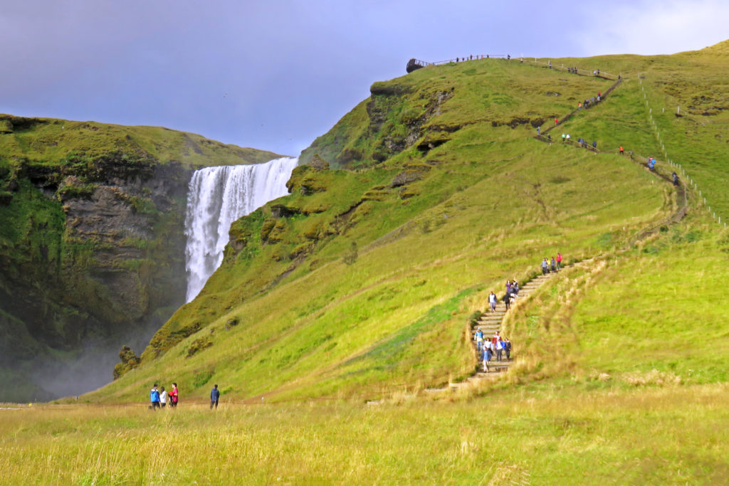
A staircase (527 steps) led up to an observation platform above Skogafoss.
Bonding with the natural beauty of the sea at Dyrholaey Promontory.
Hotel Dyrholaey was located in the middle of nowhere with a great coastal view.
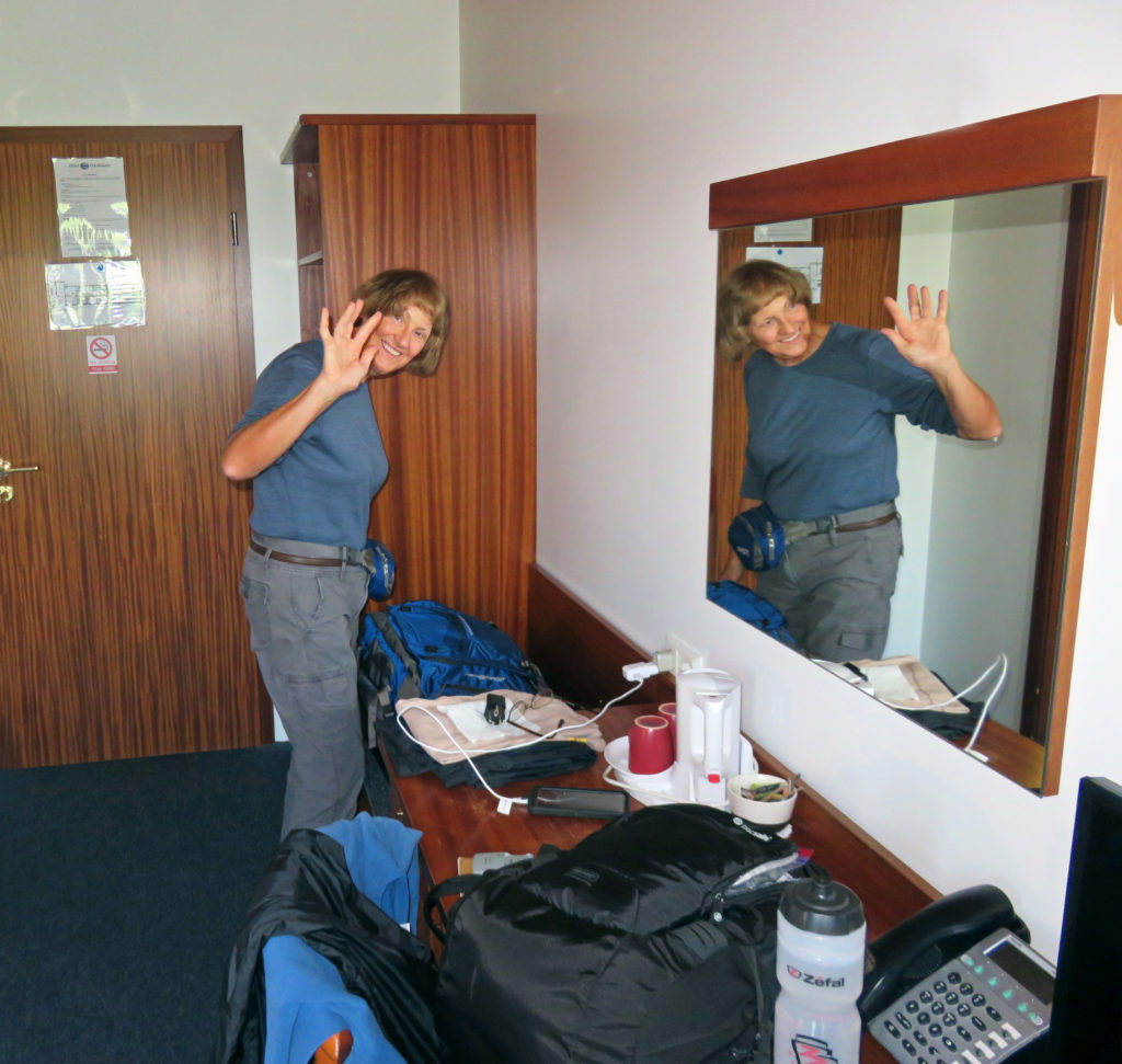
Kathy striking a pose in our Hotel Dyrholaey room.


Leave a Reply