Home » Archive for category 'Uncategorized'

Uncategorized Archive

Portland, Maine

Posted October 23, 2020 By admin


Portland, Maine


September 23, 2019

In the early morning light, we cruised into Portland harbor by Portland Head Lighthouse and two mid -1800 fortifications built on islands. It was another beautiful day to go exploring and Portland, Maine was waiting for us. The ship anchored out in the harbor so we had to take a tender ride into port.

Portland is the largest city in Maine with a population of 204,000. We had no pre-planned tours at this stop so we had the whole day open to ourselves. We spent most of our day walking around the waterfront to Fort Allen Park. The views of Casco Bay were picturesque. We passed by some vintage trains sitting on nearby tracks and realized it was part of the Maine Narrow Gauge Railroad Museum. Along with many trains to explore they had a train one could ride that circled the main city peninsula every hour.

After exploring parts of Old Portland, we made our way back to the ship and spent the rest of the day lounging in the sun on the Lido deck while snacking from the taco bar. When the Zuiderdam pulled out of Portland we cruised by Portland Head lighthouse one more time. The oldest lighthouse in Maine was built in 1791. Now the light station is automated, and the tower, beacon, and foghorn are maintained by the United States Coast Guard.


We cruise by Portland Head Lighthouse.


The beacon shines bright.


A view of the Portland waterfront.


A view of the cruise ship from our waterfront walk.


An interesting find.


Some beautiful Fall foliage along the waterfront.


Be the first to comment

Saint John, New Brunswick

Posted October 19, 2020 By admin


We pull into Saint John, New Brunswick.


September 22, 2019

On a beautiful fall morning the Zuiderdam pulled into Saint John, New Brunswick, population 70,000. The ship was moored wharf side in the Saint John River across from the spacious Bay of Funday. Centered in the relatively small city, we spent our day walking around and exploring the city and waterfront. Upon exiting the gangway, we found ourselves at a road running parallel to the shore. We chose to head southeast along the sidewalk towards the mouth of the river. Our walks, quickly led us through an undeveloped area along the river, much of which was fenced off and appeared to have once served some industrial purpose.

After a while, we came to a path that led us through a strip of parkland covering the tip of a small peninsula. At the end of the park area, we turned around and continued to enjoy a leisurely stroll back to the cruise ship berth. As the day was pleasant and still young, we continued past the ship and into the city. We were not especially anxious to undertake a lot more walking because there didn’t seem to be any noteworthy walking destinations in the immediate vicinity of the harbor.

However, we went to sample the local cuisine. Rodge was especially interested in looking for more of his favorite English/Canadian confectionaries – Scotch Mints.  After a 15-minute walk, we came to more complex civilization in the guise of the “Super Market Mall” located in Loyalist Plaza. It was a relatively small, multi-story, indoor mall housed in a non-descript red-brick building. Inside, Rodge found his mints in a small grocery store.

On our walk we saw two decorated salmon sculptures. In the fall of 2017, a partnership between the city’s tourism agency and the provincial government made way for ten sculptures to be placed around the city. Artists from the region added their own designs to help decorate the six-foot sculptures. The salmon were chosen because the Saint John River is a corridor to the fish’s spawning grounds. The painted sculptures were amazing and added a colorful addition to the city landscape.

It was time for lunch and fortunately the bottom level of the mall contained a number of small cafes that featured both indoor and outdoor seating. What followed was another relaxing meal and a taste of some local beer. Afterward, we strolled along the Harbor Passage waterfront. The 1.4-mile paved biking/walking trail led us around the head of the harbor where the sights were breathtaking.


A small downtown cafe perfect for lunch.


Some of Saint Johns street side art work.


Kathy posing with a colorful salmon.


A view along the harbor with our cruise ship in the distance.


a shot of Saint John’s from the deck of the Zuiderdam.


Once again aboard our floating home away from home.


Be the first to comment

Halifax, Nova Scotia

Posted September 23, 2020 By admin


Peggy’s Cove in beautiful Halifax, Nova Scotia.


September 21, 2019

Rise and shine! At 8:15 a.m. the ship arrived at Halifax, Nova Scotia and moored at one of the cruise ship berths. Halifax, the provincial capital of Nova Scotia, is 250 miles southwest of Sydney. The cosmopolitan city of 400,000 has the largest natural harbor on the Atlantic coast, including the United States.

We exited the ship and walked by Halifax Seaport Farmer’s Market. We were overwhelmed with the smells, sights, and sounds of entertainment, fresh vegetables, baked goods, cheese, honey, wine, crafts and a mountain of ethnic cuisine. The Halifax Farmers’ Market was created by a Royal Proclamation in June of 1750, a year after the founding of Halifax. The Market has operated in several locations across the city since its inception in 1750. It moved to the Halifax Seaport in 2010 where it is now known as the Halifax Seaport Farmers’ Market – the longest continuously running Market in North America and proudly hosting over 250 vendors!

After working our way through the market, we boarded a tour bus and were on our way to the quaint fishing village of Peggy’s Cove, an hour away. Peggy’s Cove is a small rural community located on the eastern shore of St. Margaret’s Bay in Nova Scotia’s Halifax Regional Municipality. We were riding there to see Peggy’s Point Lighthouse. Nova Scotia is home to over 160 historic lighthouses and the majestic beacons can be found throughout the province. Peggy’s Point Lighthouse was built in 1915 and is one of Nova Scotia’s most well-known lighthouses.

At Peggy’s Cove we exited the bus and entered a land of stunning rugged beauty with working lobster boats and colorful houses perched along a narrow inlet. The locals have earned a living off the sea since the early 1800s when six fishermen and their families-built homes there. They found this to be a sheltered cove offering close proximity to the large populations of fish in St. Margaret’s Bay. The main livelihood was catching groundfish like cod, pollock and haddock which they would clean, split and salt before shipping overseas.

As we looked toward the ocean, we immediately saw Peggy’s Point Lighthouse, a striking red and white beacon standing atop a granite outcrop. Built on rolling, rocky formations near the edge of the ocean, it had a commanding presence from all around. We hiked over huge boulders to get a better look. As we got closer to the lighthouse, we could hear the waves crashing on the rocks around the beacon. We could have stayed there much longer taking in the beauty and uniqueness of Peggy’s Cove but had to head back to Halifax.

After we left our tour bus we stopped for lunch in the market and then began an exploration of the beautiful waterfront. The waterfront in Downtown Halifax was the site of the Halifax Harbourwalk, a popular two-mile long tourist attraction. Many mid-sized ships dock at the many wharfs. The Harbourwalk was home to the Halifax Transit ferry terminal, hundreds of stores, historic properties and several office buildings.

We grabbed a map and headed north on the Harbourwalk. It was a beautiful sunny day with a nice northerly breeze. The wide, wooden boardwalk provided pedestrian access to a myriad of activities and sights including harbor tour boats, museums, hotels, restaurants, outdoor entertainment and an old Canadian Navy ship on display. The harbor was full of sailboats taking advantage of the gorgeous weather and sailing conditions.

This was one of the best waterfront experiences of any city we had ever visited. At one point in the middle of the boardwalk was a large cement “wave” caught just at the point of breaking – a pretty unusual sculpture. During our walk we stopped at a “Cows” store take-out window for some excellent Canadian ice cream. Halifax was definitely one of our favorite cruise port visits and we would be back!


Scenes from Peggy’s Cove.


A lobster stands guard!


A narrow inlet with lobster boats and bungalows.


A colorful fishing boat ready to head out.


Cottages abound on Peggy’s Cove.


Puffin tours anyone?


A derelict boat on display.


A weathered rugged building guarded by a fisherman.


Boat art.


Colorful Adirondack chairs waiting for weary tourists.


Be well informed on Peggy’s Cove.


Peggy’s Point Lighthouse stands tall near the edge of the ocean.


Peggy’s Point Light lantern.


Peggy’s Point Lighthouse from a distance.


Sights of the Halifax waterfront from our cruise ship.


A reflection of the Canadian flag in an office building window.


Another chance to enjoy a “Beavertail” delight.


Pigeons enjoying a “bird’s eye” view.


Sailboats bob up and down in the harbor.


A small lighthouse in the harbor.


A ship-side view of Halifax from our cruise ship.


Be the first to comment

Sydney, Nova Scotia

Posted September 8, 2020 By admin


The Big Fiddle on the Sydney waterfront.


September 20, 2019

We awoke to a crisp fall morning and readied ourselves for our first day exploring the province of Nova Scotia. We were anchored in Sydney Harbor and once again had to take a tender ride to shore. Sydney is located on Cape Breton Island on the northeastern part of the province.

When we arrived in port the first thing we saw as we strolled along the waterfront was the Big Fiddle. The giant replica standing 60 feet high was unveiled in 2006 as a tribute to the folk music and traditions of the province’s Celtic community. We would have loved to explore the nearby shops and catch a concert but we had to board a tour bus for our ride to Baddeck and the Alexander Graham Bell Museum.

Baddeck, a town of 800, was a 50-minute bus ride from Sydney. We traveled through hilly countryside dotted with colorful trees and expansive bodies of water. It wasn’t long before we arrived at the museum and Bell’s favorite summer escape. In 1885 the Bell family vacationed in Baddeck and were so taken with the area they returned the following year to build a summer home. Two years later, a larger complex of buildings was built including a new laboratory. Bell would spend his final, and some of his most productive years in residence in both Washington, D.C., where he and his family initially resided for most of the year, and in Baddeck.

We thoroughly enjoyed the museum. It was outstanding and showed Bell’s involvement in the telephone and work with the deaf (including his wife who was deaf from the age of five). Exhibits displayed how he and his associates achieved Canada’s first powered flight with their airplane The Silver Dart, produced the world’s fastest watercraft, and built advanced recording equipment, an early metal detector and huge tetrahedron kites.

The museum included both actual vehicles and reconstructions. Some of the latter were quite large. Original artefacts, films, and family photographs highlighted his scientific and humanitarian work. It truly opened our eyes to the broad scope of his interests, energy and inventiveness. It was certainly a world-class exhibit and well worth the stop.

After touring the museum, we walked around the gorgeous grounds overlooking Baddeck Bay and Kidston Island with its picturesque lighthouse. It was a wonderful fall day to be exploring the beautiful sights of Baddeck, Nova Scotia.


Rodge posing by Bras d’Or Lake on our way to Baddeck.


A scenic view of Bras d’Or Lake.


Rodge posing at the Alexander Graham Bell Museum.


A plaque displayed outside the museum.


Flowers decorating the grounds of the museum.


Replicas of the first telephones in the museum.


Kidston Island lighthouse in Baddeck, Nova Scotia.


One of the tenders that will take us back to the Zuiderdam.


A tender moment in Sydney harbor.


Be the first to comment

Charlottetown, Prince Edward Island

Posted September 5, 2020 By admin


We enter Charlottetown, Prince Edward Island.


September 19, 2019

At 8 a.m. we pulled into Charlottetown Harbour. After a day at sea we were ready to explore Prince Edward Island, Canada’s smallest province. Twice the size of Rhode Island, P.E.I. is located in the Gulf of St. Lawrence and Charlottetown is its capital city. The ship was not able to moor pierside because another cruise ship was tied up there, so instead we took a five-minute tender ride to shore. When we arrived at the pier, we jumped on a bus for a 40-minute ride to Green Gable Heritage Place.

On our drive through the countryside we rode by gentle rolling hills, woods and fertile farmland. The pastoral land is a result of glacial deposition. Most of the original forests of mixed spruce and broadleaf are confined to stream beds and tiny woodlots as the majority of the land is devoted to agriculture. Prince Edward Island is called the “Spud Island” because of its major potato crop. It is also known for its fruit orchards, blueberries and cranberries.

The look and feel of the island were a dramatic contrast to the province of Quebec. There were no French accents or influences apparent anywhere we went. Instead, the look was more like that of New England towns, farms, and landscape with outstanding natural beauty. We noticed many recently-downed trees and flattened corn along the way due to storm damage from Hurricane Dorian the previous week.

At 10 a.m. we arrived on the northern side of the island in the community of Cavendish.  Just down the road, we stopped at the Green Gables Heritage Place. Our group quickly disembarked for a tour of the farm and its historic home. The large farmhouse was the original structure where L.M. Montgomery, the author of “Anne of Green Gables,” lived as a young girl and later used as the backdrop for her popular novel.

The house was beautifully designed. Its many rooms were lovingly restored and maintained to reflect a late 1800’s/early 1900’s look with well-appointed period furnishings. Park Canada did a fine job of restoring the house and the other farm buildings. The adjacent interpretive center was superb along with the popular snack bar where we purchased a “Beaver Tails”- essentially a large piece of fried whole-wheat dough. There were several options for toppings; we tried the version coated in cinnamon sugar with lemon squeezed over it. The confection was very sweet and the lemon provided a unique tang.

On our way back to Charlottetown we took a detour and stopped on the northern shore to view the red sandstone cliffs at Cavendish. Part of Prince Island National Park, the coastline has a combination of long beaches, dunes, cliffs, salt water marshes and numerous bays and harbours. The beaches, dunes and cliffs consist of sedimentary rock and other material with a high iron concentration, which oxidizes upon exposure to the air. Severe erosion by the sea-flung waves had created a cliff structure that was undermined a bit more by each storm. There were warning signs posted in the most dangerous areas.

Back in Charlottetown, we strolled along the waterfront and ended up at Peak’s Wharf. It was a great place to browse in little shops and grab a bite to eat. We ended up at the famous “Cows” for some delicious ice cream. It was so good we had to fight off a squadron of yellow jackets for the privilege of eating the cold slice of heaven.


Shimmering water along Prince Edward Island’s shoreline.


Another cruise ship entering port.


Gardens and  buildings in the Green Gables Heritage Place.


The farmhouse where L. M. Montgomery lived as a young girl.


A barn in the Green Gables Heritage Place.


A barn and garden in the Green Gables Heritage Place.


Inside the Green Gable farmhouse.


Another wonderfully restored room in the farmhouse.


One of the bedrooms inside the farmhouse.


Yummy Beaver Tails whole-wheat pastries.


The red sandstone cliffs in Cavendish part of Prince Island National Park.


We browse through shops in Charlottetown.


A great place to relax at Peak’s Wharf.


Bessie a mascot for the ice cream shop, “Cows”


Todays ice cream flavors at “Cows”.


Views of Charlottetown from the Zuiderdam.


Relaxing on the Zuiderdam.


Be the first to comment

Saguenay, Quebec

Posted September 2, 2020 By admin


We are greeted by French-Canadian dancers.


September 17, 2019

While we were sleeping the ship cruised down the St. Lawrence River to our next port, Saguenay, Quebec. The city is situated on the Saguenay River at the midway point of a long fjord that runs roughly northwest from the St. Lawrence River. Saguenay is situated at a point where the fjord is no longer navigable by large ships. The city is divided into three boroughs and we were in the borough of La Baie. We were roused by the sound of loud music and a speaker-amplified French-Canadian voice from pierside. It turned out to be a group of locals in period dress cavorting to lively French-Canadian music at the head of the pier to welcome the ship and its passengers.

We departed the ship at 10:30 a.m. to board a shuttle bus to take us to Saguenay Fjord National Park. We drove for 45 minutes along a wooded two-lane road.  Along the way we caught glimpses of colorful fall foliage. We pulled into the park and stopped at a visitor center where we met our hiking guide, a 50-something French-Canadian ranger. After she filled us in on the basics of the hike, we started our trek through the woods. The sunlight filtering through the trees caused colorful leaves to shimmer. Wildflowers joined in with their gold and red hues. Mother Nature was putting on a fall display for all to see.

Our hike led us along the shoreline of the fjord. The tide was out so we walked on a raised wooden path by muddy tidal flats. The path protected the landscape from our shoes and our shoes from the sometimes-soggy landscape. We walked at a comfortable pace with many stops at scenic outlooks and near flora and fauna of interest. A crane perched on a big grey rock sunk in the tidal flats watched us as we walked by. In the distance the cliffs of the fjord rose some 500 to 1,000 feet above the river. A sailboat anchored in the distance floated lazily in calm waters. It was a great time to commune with nature.

When we got the Welcome Center it was time to board the bus and head back to the Zuiderdam. To recover from our hike, we spent the rest of the day relaxing and eating. At 4 p.m. the ship got underway for our cruise down the St. Lawrence River. We would spend the next day (September 18) at sea slowly steaming to the Gulf of St. Lawrence and Charlottetown, Prince Edward Island.


We watch  locals in period dress dance to lively French-Canadian music.


Our view of Saguenay from the Zuiderdam.


On our drive to the park we caught glimpses of colorful fall foliage.


We start our hike through Saguenay Fjord National Park


The tide was out so we walked on a raised wooden path by muddy, tidal flats


An anchored An anchored sailboat in the distance floated lazily in calm waters.


The sunlight filtering through the trees caused colorful leaves to shimmer.


The Zuiderdam in port.


A beautiful sunset at sea.


Cruisin’ on our day at sea.


Be the first to comment

Cruising Canada and New England

Posted February 23, 2020 By admin


Our view of the Quebec City skyline from our cruise ship.


September 16, 2019

We awoke to a beautiful morning in Quebec City after arriving on a late-night Air Canada flight. We were aboard the Holland America cruise ship Zuiderdam and ready to start our twelve day “Colors of Canada and New England” cruise. We looked forward to our day touring Quebec City, the oldest city in Canada, and its surrounding areas.

After a hearty breakfast we climbed aboard a tour bus and readied ourselves for a four- hour journey through the countryside. Our guide was a Quebec native who gave us an almost continuous narration as we crossed over the St. Lawrence River to the island of Orleans.

The entire island is a designated historical area and has a traditional French countryside feel. Orleans was one of the first parts of the province to be colonized by the French, and a large percentage of French Canadians can trace ancestry to early residents of the island. Some of the houses are 300 to 400 years old and limited to the height of four stories in support of the government’s historical preservation efforts.

The island, about the size of Manhattan, supports farming and many forms of agriculture all year-round. We passed by cows, corn, strawberries, apples, grapes and many homes decorated with colorful flower boxes. The vineyards on the island feature cold-tolerant grapes that can survive to -30 degrees C. Many maple sugar products are produced on the island. The province of Quebec generates a large percentage of the world’s supply of maple sugar.

Our first stop was at the L’ En-Tailleur sugar shack, a popular place for the locals during the maple sugar season. The collecting of maple water to use as a sweetener was first practiced by indigenous people who tapped maple trees each spring. During the sugaring-off season, days were filled with trudging through the snow to collect maple water from buckets. At night, families would gather for a meal of hearty homemade delights and celebrate with the sound of fiddles.

In the shack the ninth-generation owners gave us a presentation on maple sugar production and showed us the vats where the maple water was boiled down to produce a taste of heaven. The highlight of the stop was sampling maple syrup that had been dribbled in a line onto man-made snow which instantly solidified into a soft mass and then was rolled up onto a large flat stick for tasting.  Before we left, we were ushered into the sugar shack store where we were confronted with a mouth-watering array of maple sugar products.

After crossing the bridge into Quebec, we drove to Montmorency Falls. The falls are located at the mouth of the Montmorency River and plunge 275 feet into the St. Lawrence River. We walked down a wood-paved path to a scenic overlook and had a magnificent view of the cascade falling from a high bluff to sea level. We also had an excellent view of helmeted and harnessed zip liners crossing the ravine within feet of the falls. At the base of the falls on a small sand beach amid scattered driftwood someone had spelled out a “Will you marry me” message in logs. We hope the answer was “yes”.

We arrived back at the ship and boarded another shuttle for Old Quebec City. After many twists, turns and climbing, we arrived in the center of the old fortified section of the city. It was the only fortified wall city remaining in North America and a UNESCO World Heritage Site. We were dropped off next to Le Chateau Frontenac. The 5-star, 600 room hotel was built by the Canadian Pacific Railroad as part of a string of hotels the company constructed across the country at every major stop.

We walked around the upper town area on narrow winding one-way streets lined with bistros, boutiques, antique shops and horse drawn carriages. We had a dramatic view of the St. Lawrence River from the escarpment fronting the Le Chateau Frontenac. Quebec City was founded by the French explorer Samuel de Champlain early in the 17th century. The ramparts, gates, and other fortifications that surround the city serve as a rock-solid reminder of its role in the colonial wars for control of the Americas. Fountains and bronze statues abound with a representation of the explorer Champlain being particularly prominent. It truly was a magnificent city and we would be back to explore again.


Early morning views of Quebec City.


Rodge standing at the sugar shack entrance.


Waiting for our tour of the sugar shack.


The L’ En-tailleur sugar shack.


Maple syrup dribbled in a line onto man-made snow.


Rolling solidified syrup onto a stick.


A solid mass of maple syrup.


Ready to sample a taste of heaven.


The Manour House at Montmorency Falls.


Gardens at Montmorency Falls.


The waters of Montmorency Falls plunge 275 feet into the St. Lawrence River.


Zip lines cross in front of Montmorency Falls.


Our view of a cruise ship on the St. Lawrence River.


Le Chateau Frontenac in Quebec City.


Rodge standing by a bistro in Quebec City.


The upper town area in Quebec City.


Rodge standing next to a horse drawn carriage.


A tour bus driving through Quebec City.


Kathy capturing memories in Quebec City.


The statue of French explorer Samuel de Champlain.


Be the first to comment

Exploring Reykjavick!

Posted March 30, 2019 By admin


The Harpa Center, a modernistic-looking city opera building on the waterfront.


September 9, 2018

After yet another fine buffet breakfast in the hotel, we donned our backpacks for a day of self-guided adventure in Reykjavik. The day was cool, pleasant, and partly cloudy – probably about as good as it gets for sightseeing at this time of year. We walked toward the waterfront and discovered a modernistic-looking city opera building, Harpa, located on the water.

The 8-10 story building had an outer wall made almost entirely of colored glass – mostly a blue hue but some of the panes appeared almost clear and others a pale purple. The multiple reflections of city, sea, and sky combined with the intrinsic color of the glass to yield an interesting view. Unlike many modern office buildings, you could see the interior structure of the building. The inner core was the actual opera house. The lower levels contained various shops and tourist information areas, where we purchased tickets for the city’s hop-on/hop-off sightseeing bus.

At 10:15 a.m. we boarded a red double-decker tour bus. We grabbed a guide map and earphones and climbed the interior spiral staircase to the upper level. Earphone plugs were conveniently located next to the seats, along with volume and language selection dials. The slow pace of the bus allowed us plenty of time to view the city. The traffic was dense and the roads narrow and twisty. It would not be fun to commute by car into the center of Reykjavik, but certainly better than Atlanta or L.A.

After staying on board through an entire circuit, we debarked at the largest cathedral in the country. Hallgrimskirkja Lutheran Church was located at a high point in the center of the city. The modern stone structure was very dramatic, looking like a spaceship about to take off for the sky. Morning services had just ended and the building was engulfed by tourists. We elected to forego the cost of the elevator ride to the viewing area at the top of the cathedral’s spire. Instead, we enjoyed the marvelous vaulted interior and incredible pipe organ (there’s definitely a trend here with Icelandic churches and pipe organs).

In the area outside the cathedral’s entrance, we spent time watching a photo shoot. It was clearly meant to be a bride and groom doing some kind of fashion spread for a magazine (possibly a Japanese publication since everyone involved in the photo shoot was Japanese). In the same area we saw a statue of Leif Erikson, a Norse voyager and the first European to discover North America in 1000 A.D. The statue was a gift from the United States in 1930 to honor the 1,000th anniversary of the Icelandic Parliament at Pingvellir in 930 AD.

After exploring the waterfront, it was time for lunch. We opted for the Reykjavik Hard Rock Café. It wasn’t traditional Icelandic cuisine, but it served the purpose. The restaurant was across the street from the Prime Minister’s office, a modest two-story building which up until 1816 served as a prison. Iceland clearly didn’t believe in expending piles of money on imposing government structures. Their modesty was refreshing.

We continued our tour through beautiful flower gardens and around a small pond containing many ducks and swans. We explored City Hall where the ground floor was open to the public. Several maps of Reykjavik and Iceland were on display along with information kiosks. We had a great time looking at a huge wooden relief map of Iceland where we retraced our van trip around the island.

Outside City Hall we walked by a statue of a man wielding a briefcase. It was a depiction of the everyday “faceless” city officials on their way to work. However, the statue of the official is literally faceless. A large slab of Icelandic volcanic basalt sits where you would expect to see a torso and head. The unique statue was sculpted by Magnús Tómasson in 1994 and called “The Unknown Bureaucrat.”

We finished up the day at the Old Harbor where we walked around the pier and viewed three Icelandic naval vessels. It had been a great day and a wonderful way to end our Icelandic vacation. Our trip around the perimeter of Iceland on the 800-mile long Ring Road would be something we would treasure for a long time.

Bless,
Kathy


Harpa


The 8-10 story building had an outer wall made almost entirely of colored glass.


The glass was mostly a blue hue but some panes were clear and a pale purple.


The inner core of the Harpa Center was the actual opera house.


Hallgrimskirkja Lutheran Church was the largest cathedral in the country.


The modern stone structure was very dramatic looking.


Leif Erickson and a wedding photo shoot outside the church’s front entrance.


The pews were reversible-seat backs could be flipped over to face the organ.


The massive pipe organ filled the church with beautiful music.


The vaulted interior of the church with its Gothic pointed arches.


A statue of Leif Erikson, the first European to discover N. America in 1000 A.D.


The gift from the U. S. in 1930 honored the 1,000th anniversary of Parliament.


A street scene in downtown Reykjavik.


A tree in downtown Reykjavik turning beautiful fall colors.


Beautiful tulip sculptures lined the city street.


A great way to block off the street.


The office of the Prime Minister of Iceland.


A street scene in Reykjavik where Coca-cola is advertised.


Another city scene with Hallgrimskirkja Lutheran Church in the background.


A great way to advertise.


A sculpture in front of Reykjavik Junior College.


A statue of the faceless “Unknown Bureaucrat”.


Another city view of Reykjavik.


A colorful artscape in Parliament Square.


Wow bikes could be used to ride around the city.


A  “water closet” or public bathroom in a nearby park.


An Icelandic Navy vessel docked in Old Harbor.


Be the first to comment

The Magnificent Snaefelles Peninsula!

Posted March 29, 2019 By admin


Breathtaking Kirkjufellsfoss waterfall.


September 8, 2018

We awoke early and enjoyed a hearty breakfast. It was an overcast rainy day but we looked forward to exploring the Snaefelles Peninsula in West Iceland. We boarded the Artic Adventures van with fifteen new tourists who would share the day with us. Our first stop was Ytri-Tunga. The beach was home to a large seal colony. In Iceland most of the beaches were covered with black volcanic sand but here the sand was a golden-brown color.

We walked along the misty beach climbing over huge rocks covered with algae. Rodge was able to see and capture pictures of harbour seals basking on rocks in the distance with his telephoto lens. Seals live there year-round, but the months of June and July are a more favorable time to see them.

Twenty miles down the road we stopped at Arnarstapi, a beautiful coastal village at the foot of Mt. Stapafell. Arnarstapi used to be an important trading post and vibrant fishing village but now is a busy center for tourism. We walked around the small harbor surrounded by basalt columns, ravines and grottoes. The boats in the protected harbor were lodged up against the basalt walls. We didn’t stay too long because of the rain.

On the way to our next stop, we drove along the shore where we were surrounded by the ocean on our left and flat land and tall volcanic mountains on our right. It was a pretty dramatic contrast. When we arrived at our destination, we were at Djupalonssandur Beach. We hiked down a steep pathway to the beach. Along the way we passed through incredible lava formations. The black pebble beach was breathtaking with powerful huge waves crashing against the rocks.

Along the beach, we found pieces of a shipwreck randomly strewn around. The wreckage was from a British fishing ship called the Epine GY7 that was destroyed there on March 13, 1948. Fourteen men lost their lives that day and five lived. The ruins from the ship were kept on the beach as a memorial to the fishermen.

At 1 p.m. we arrived at Snaefellsness National Park. We stopped for a caving tour at Vatnshellir lava tube cave, created in a volcanic eruption some 8,000 years ago. We did not elect to pay extra to go underground (been there, done that already in a previous spelunking adventure that was enough to last the rest of my life) so we stayed in the van and finished off our lunches while relaxing and watching the drizzle outside.

After our spelunkers boarded the van, we continued on to Saxholl crater. The worn-down basaltic cone of lava was composed of red rock and coated in young vegetation. The crater was formed when the volcano erupted four thousand years ago. Saxholl was easy to climb because it had stairs with rusty-orange iron steps going right to the summit. The 109-meter-tall crater was a popular spot to see views of the Atlantic Ocean and the surrounding Snaefellsjokull glacier but since it was cloudy, we were only treated to views of the oval shaped crater.

As we rounded out our day we headed to our last destination, Kirkjufell “Church Mountain”, one of the most majestic mountains in Iceland. Kirkjufell takes its name from its resemblance to a church steeple, sharpened at the top with long curved sides. The mountain rises 1,519 feet above sea level and many people recognize it as being “Arrow Head Mountain” on Game of Thrones. Kirkjufell is not a volcano but is a stack of layers of sedimentary and extrusive igneous rocks. During the last Ice Age, it was shaped by erosion. The mountain changes color every season from summer green to winter white.

Close by we visited Kirkjufellsfoss waterfall. From a distance, the waterfall appeared as one mass stream, but as we got closer there were actually three falls all running in the same river. It was fed by the glacial waters of the Snaefellsjokull glacier and dropped fifty-four feet over a rocky hill. We spent time photographing the picturesque mountain and waterfall.

It was time to get underway for our return to Reykjavik. It was a two-hour non-stop traverse of coastal areas and then a cut cross-country (rural of course) to the south. We ended up going through the Hvalfjordur Tunnel, a four-mile road under the Hvalfjordur fjord 541 feet below sea level. When we arrived in Reykjavik, we said good bye to our guide and fellow travelers. It had been another amazing day exploring Iceland.

Bless,

Kathy


Ytri-Tunga Beach is one of the few golden-brown beaches in Iceland.


Ytri-Tunga Beach is home to a large Harbour seal colony.


Kathy exploring Ytri-Tunga Beach.


Ytri-Tunga Beach is covered with seaweed, moss, rocks and little pools of water.


We stopped at Arnarstapi, a beautiful coastal village at the foot of Mt. Stapafell.


Arnarstapi is surrounded by ravines and basaltic rock from volcanic activity.


The boats in the protected harbor are lodged up against basalt walls.


Arnarstapi, once a vibrant fishing village is now a center for tourism.


We saw breathtaking mountains to the north as we drove along the ocean shore.


More spectacular countryside draped in moss covered lava.


Looking down on Djupalonssander, a black pebbled beach.


The black beach was breathtaking with powerful waves crashing against rocks.


A fresh water lagoon by Djupalonssander Beach.


A trail down to Djupalonssander Beach.


The wreckage from a British fishing ship Epine GY7, that was destroyed in 1948.


Tall basaltic columns on Djupalossandur beach.


People trek down a steep trail to Djupalossandur beach.


Hikers pass through incredible lava formations on their way to the beach.


Saxholl Crater is a worn-down basaltic cone of lava coated young vegetation.


Saxholl  is a 109-meter-tall crater that formed 4,000 years ago.


People walking down the rusty-orange iron steps from the crater summit.


Mount Kirkjufell is one of the most majestic mountains in Iceland.


Kirkjufellsfoss waterfall drops fifty-four feet over a rocky hill.


The waterfall flows into the turbulent Kirkjufellsa River


The waterfall is fed by the glacial waters of the Snaefellsjokull glacier.


Kirkjufell is made up of layers of sedimentary and extrusive igneous rocks.


Be the first to comment


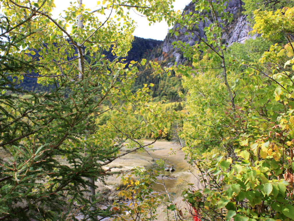
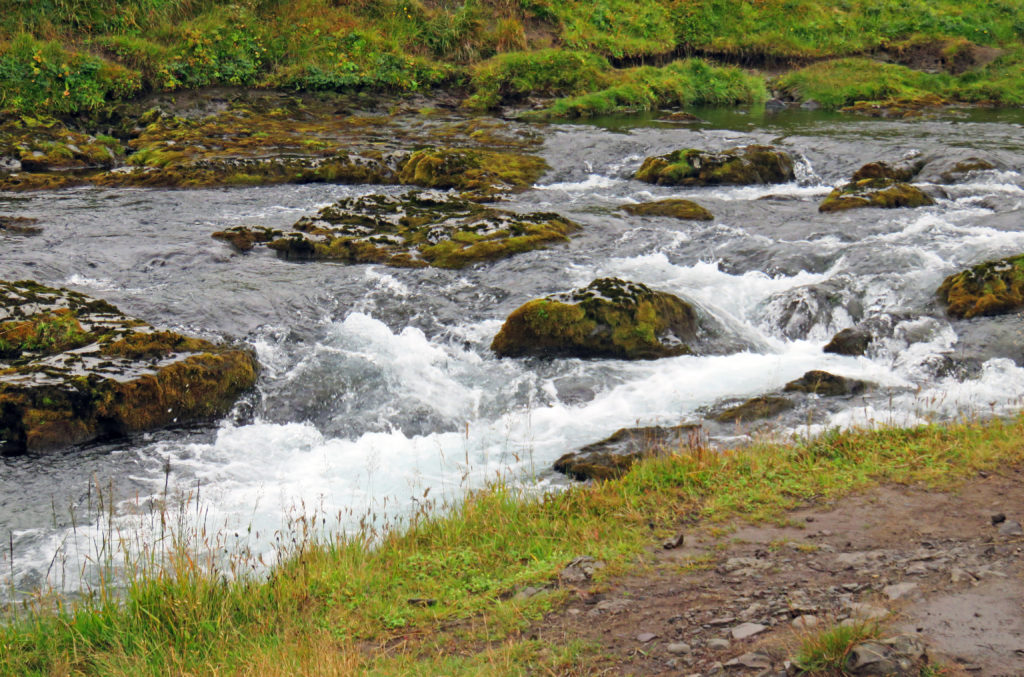
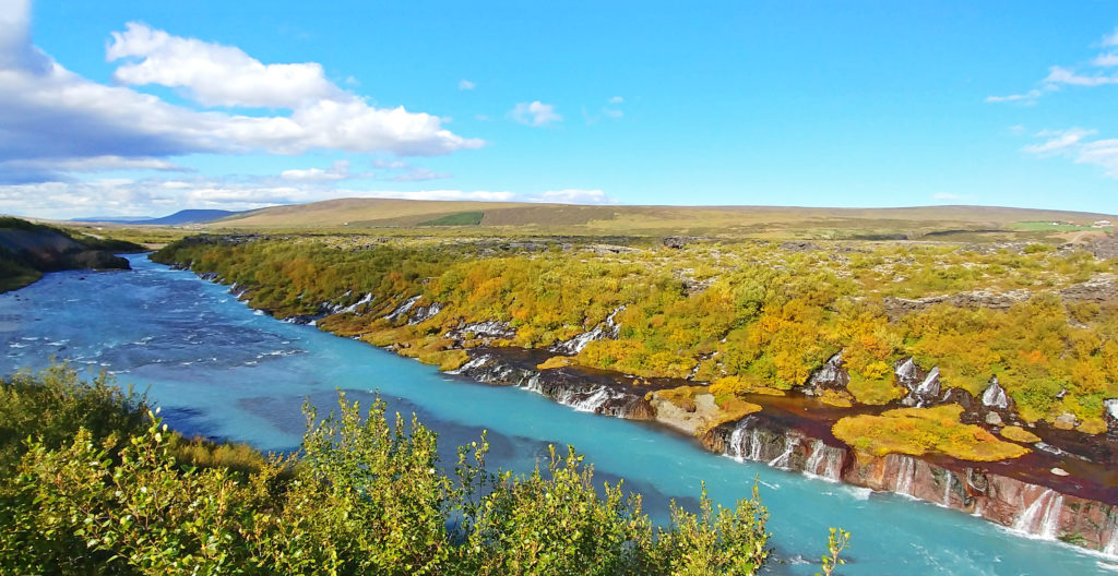
A view of the Hvita River in the Borgarfjordur Area of Iceland.


September 7, 2018

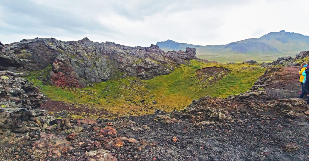
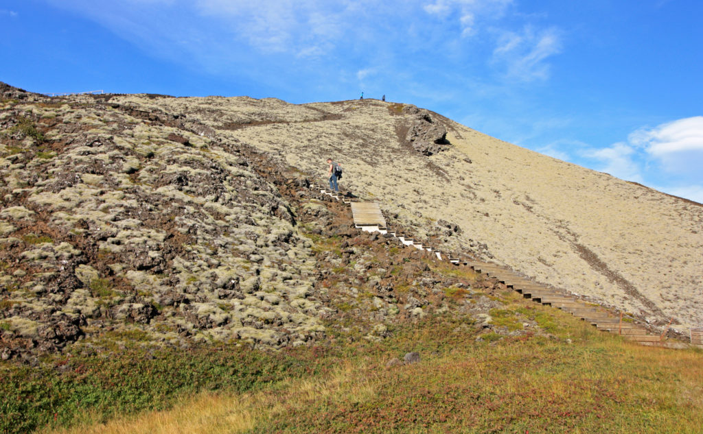
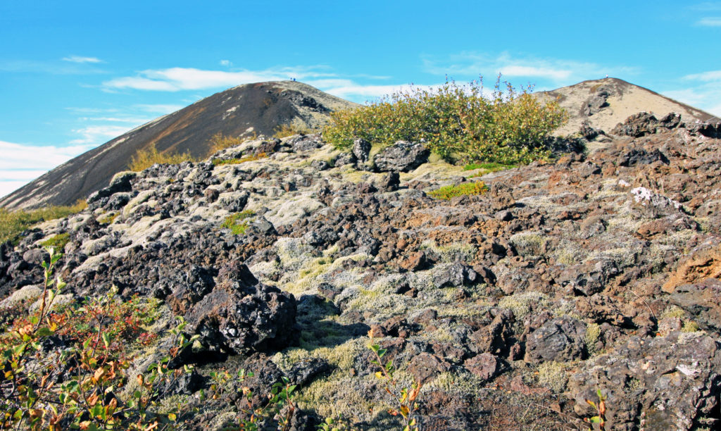
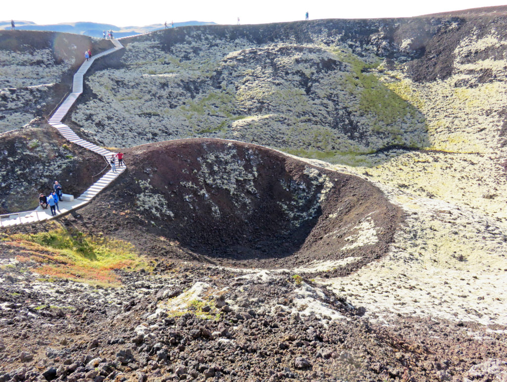
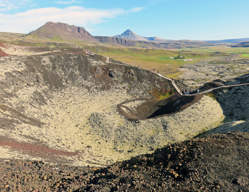
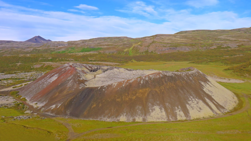
We awoke to a beautiful sunny and warm day but it would be bittersweet. Exploring the Borgarfjordur area of West Iceland would be incredible but it would be our last day with our guide and most of our tour group. Our first stop was at the Grabrok volcano craters. The volcanoes last erupted 3,000 years ago. We climbed up ~300 vertical feet via wooden steps and ash paths to the top of the tallest cone, Grabrok. It had a conical crater in the center – a perfect shape. There were amazing views of a smaller cone, Grabrokarfell, from the rim of Grabrok. We walked all around the rim of Grabrok and viewed its extensive lava field in the distance. Most of the terrain was draped in yellow moss.

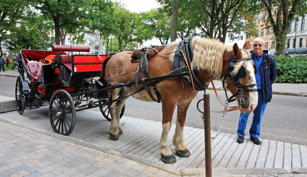
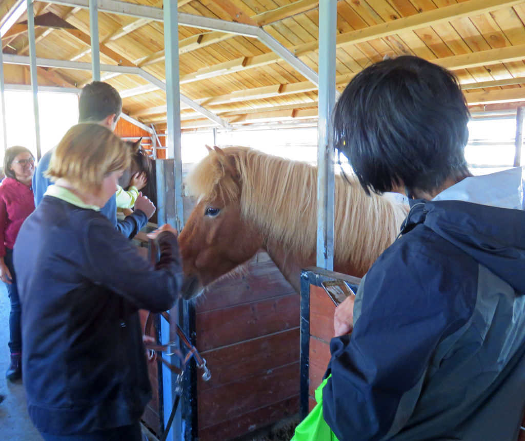
Next, we were on our way to an Icelandic horse farm. When we arrived, we were greeted by a very friendly dog who loved having his belly scratched. The owners bred and maintained sixty horses and opened up their facility for visitors. There was a hot spring on the property – hot water was piped to heat the home, horse barns, etc. The horses were wonderful, docile creatures – very friendly. They provided lots of opportunities for selfies. The owner led us on a tour of the property (horse barns, hot spring), told us all about Icelandic horses, introduced us to several of them, and provided guidance and encouragement for up-close photo opportunities.

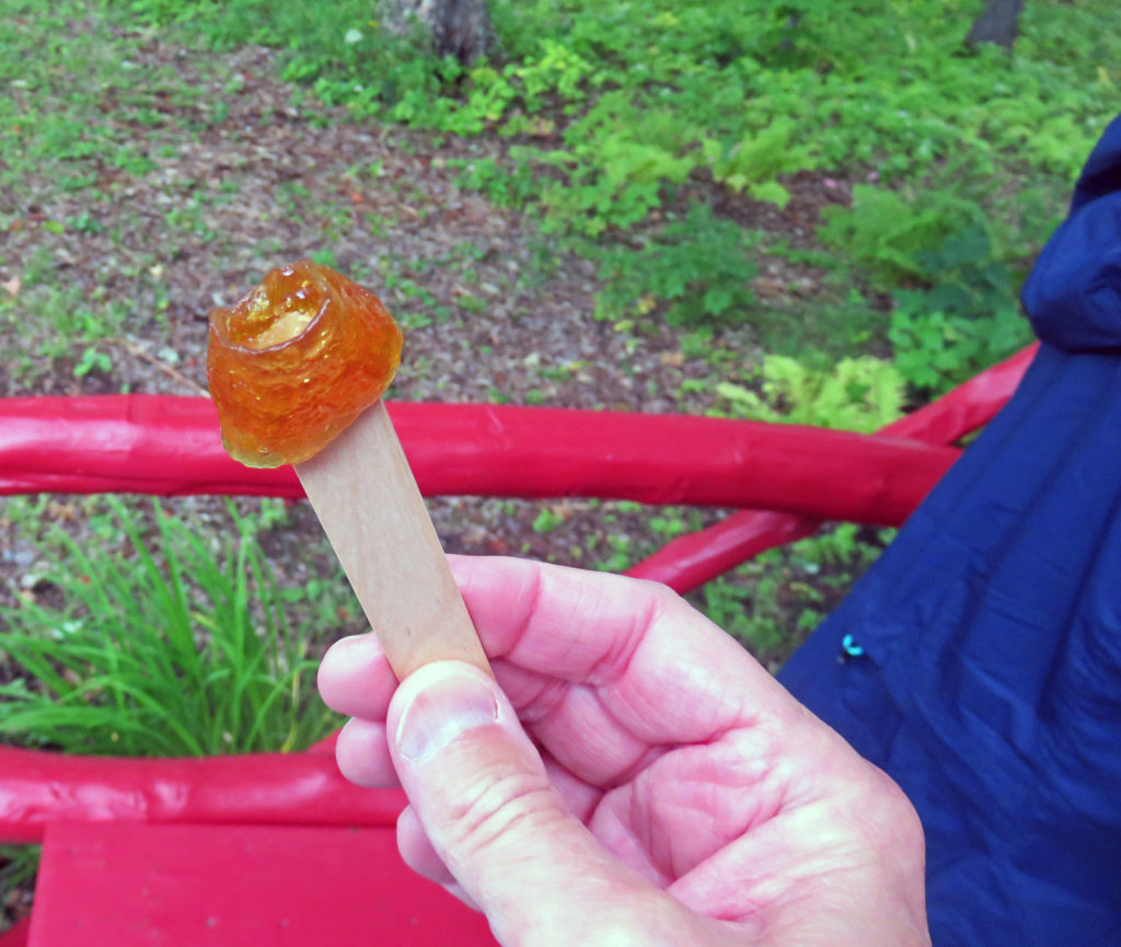
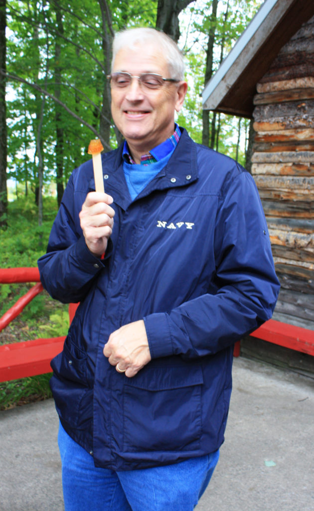
The farm had been in her family since 1886. At the end of the tour she served us coffee, hot cocoa, and rye bread (a special family recipe) that she baked for 25 hours in the hot spring. It was all very good. The farm only used about 5% of the hot spring water. The rest simply flowed into the watershed. What a wonderful time…one of my favorites.

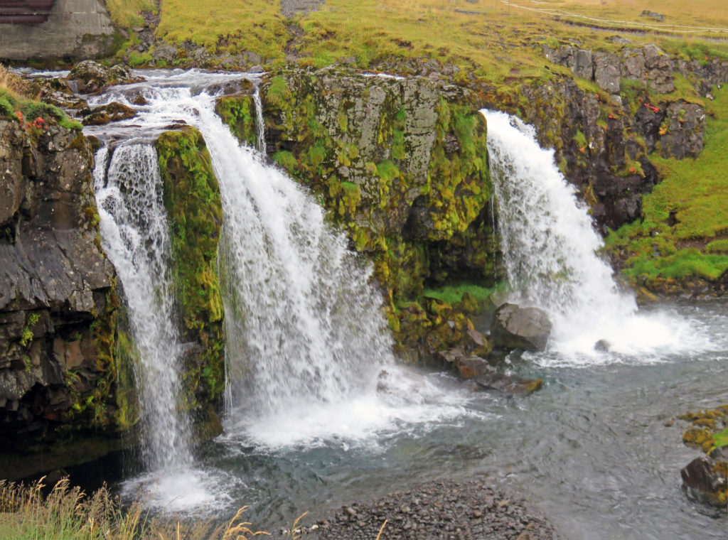
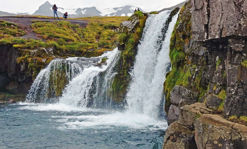
A 1:30 p. m., we arrived at a park containing a very unique waterfall called Hraunfossar Waterfall. A short-paved walk from the parking area brought us to a scenic river overlook with the waterfall on the far side of the Hvita River. The waterfall was fed by the Langjokull Glacier. The glacial meltwater traveled to the Hallmundarhraun lava field where it flowed under the rock and then poured out in thousands of rivulets, forming the very wide picturesque falls. I’d never seen nor heard of anything like it. If there are any other such waterfalls on the planet, I’d be surprised.

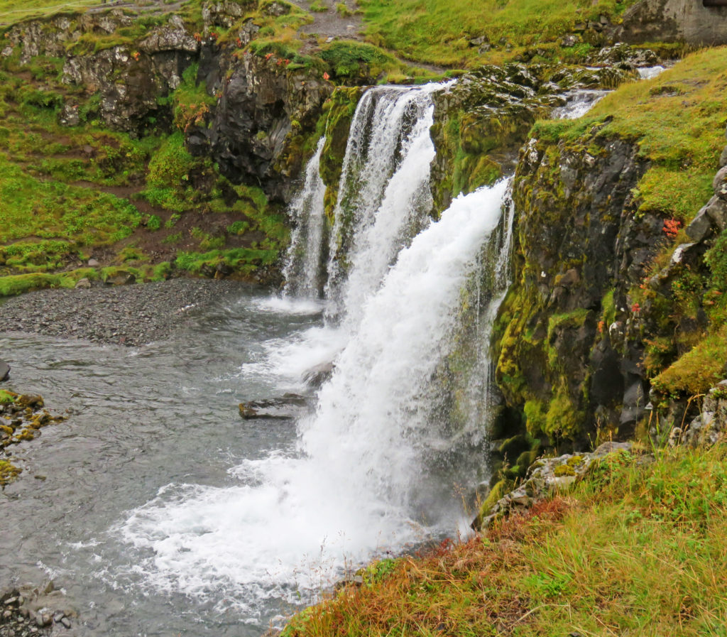
Further along the path was the smaller but very dramatic waterfall, Barnafoss, comprised of a substantial flow moving down a snake-like channel carved in the surrounding lava. We remained long enough for a quick lunch break at a nearby restaurant for those needing refueling.

Later that afternoon we stopped briefly at Reykholt, the site of a 1,000-year-old settlement. The main attraction was “Snorri’s Pool”, an old stone-faced hot water pool used and written about 1,000 years ago by Snorri Sturluson, who is the very famous author of Icelandic sagas. There was an underground tunnel from the outdoor pool to Snorri’s nearby home. The tunnel was a hundred feet or so long and had a spiral staircase inside. Nearby, we viewed the old foundations of Snorri’s dwelling and other buildings.

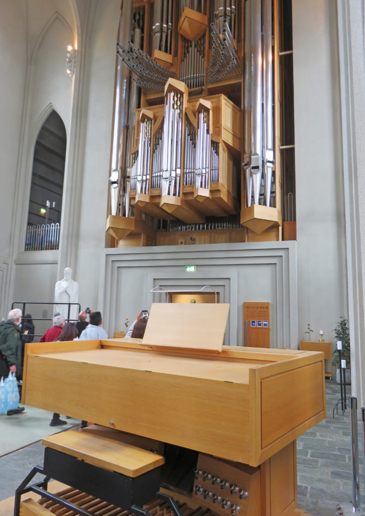
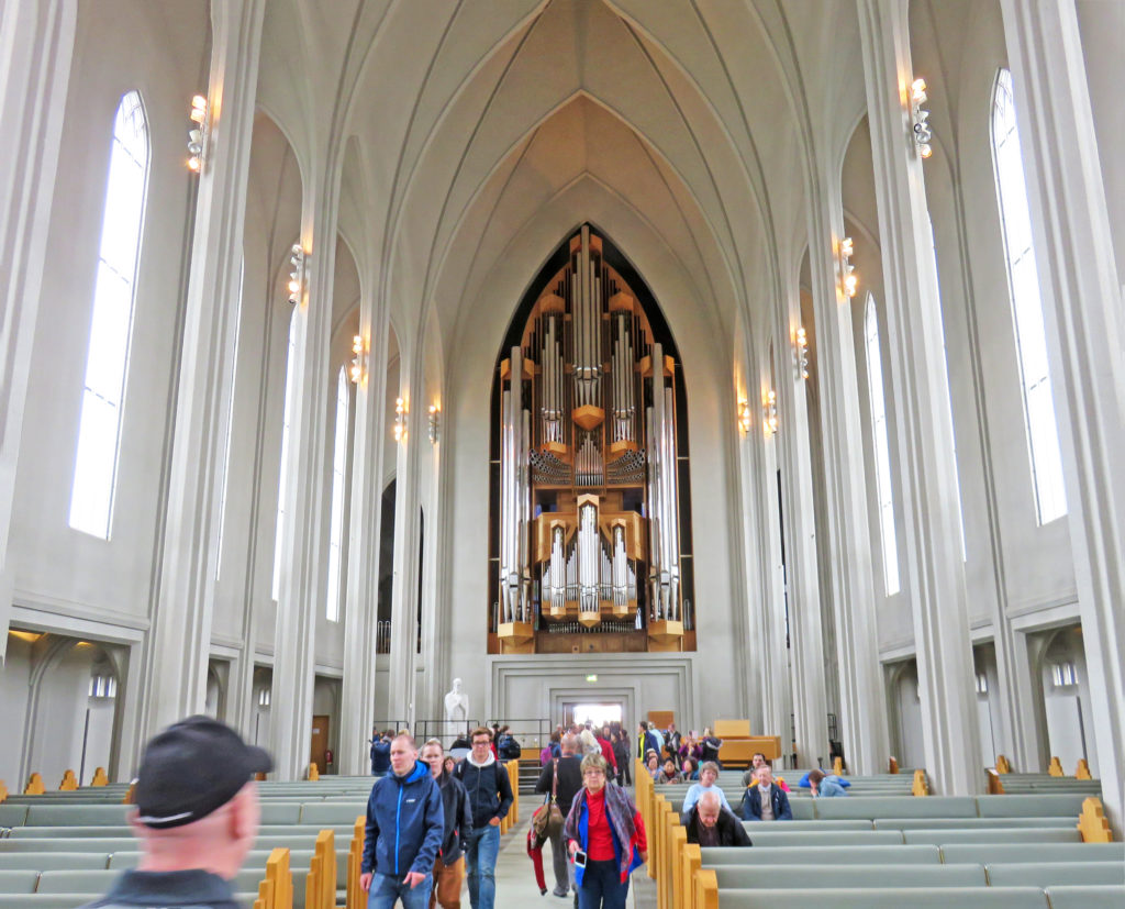
Next to the hot pool was a large modern building that was a boarding school our guide attended as a child. He lived there with 120 or so other children from mid-September to Christmas, and then from January to Easter. Boarding was the only option since the weather made commuting impossible. The nearby hot spring was steaming; it supported this small community. There has been a Lutheran church on the site since 1,000 A.D. or so. The small structure was typically plain but inside was a truly beautiful wooden organ. The prominent manufacturer’s nameplate indicated that the organ was built in Washington, New Jersey (probably in the late 19th or early 20th century).

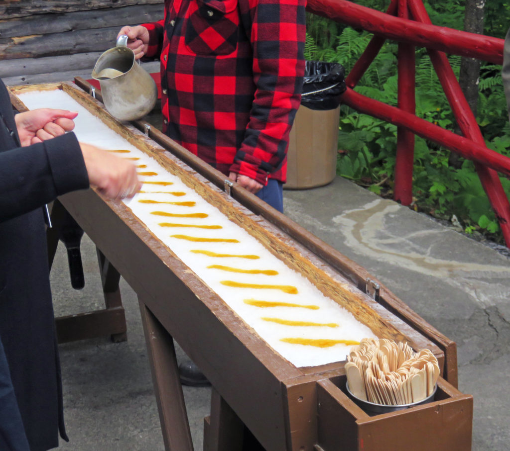
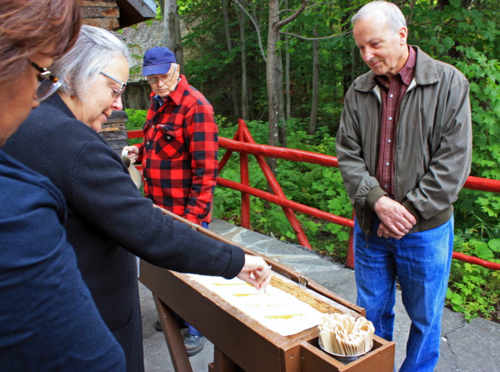
Five minutes down the road, we arrived at Deildartunguhver Hot Springs, Europe’s most powerful hot spring. It was awesome to see it bubbling up along a long stretch enshrouded in steamy mist. The water from this spring is captured and piped many miles to the surrounding towns of Borgarnes and Akranes where it is used for central heating. The hot spring gushes out fifty gallons of boiling water per second and its thermal output is 62 megawatts!

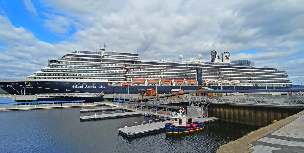
We ended our day in the coastal town of Borgarness, ninety minutes northwest of Reykjavik. At our hotel for the night we said goodbye to our tour guide and all but one of our companions. The rest of them were on a six-day tour and would be dropped off in Reykjavik. We then relaxed in our room, went out to a nearby restaurant and then called it an early night.

Bless,

Kathy


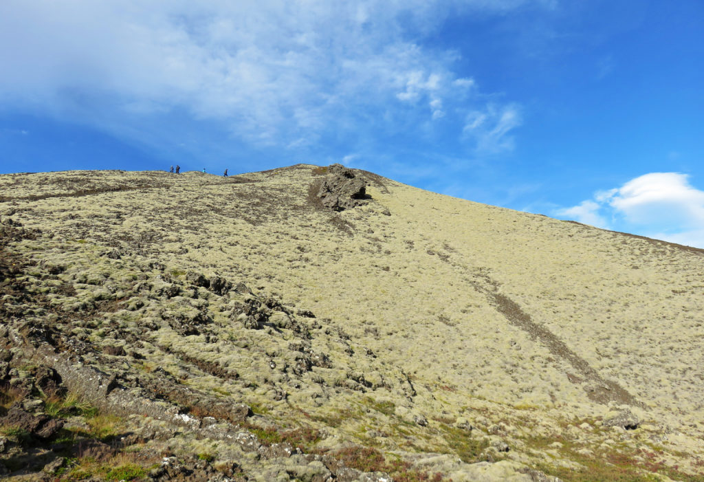
The cone of Grabrok is draped in yellow moss.


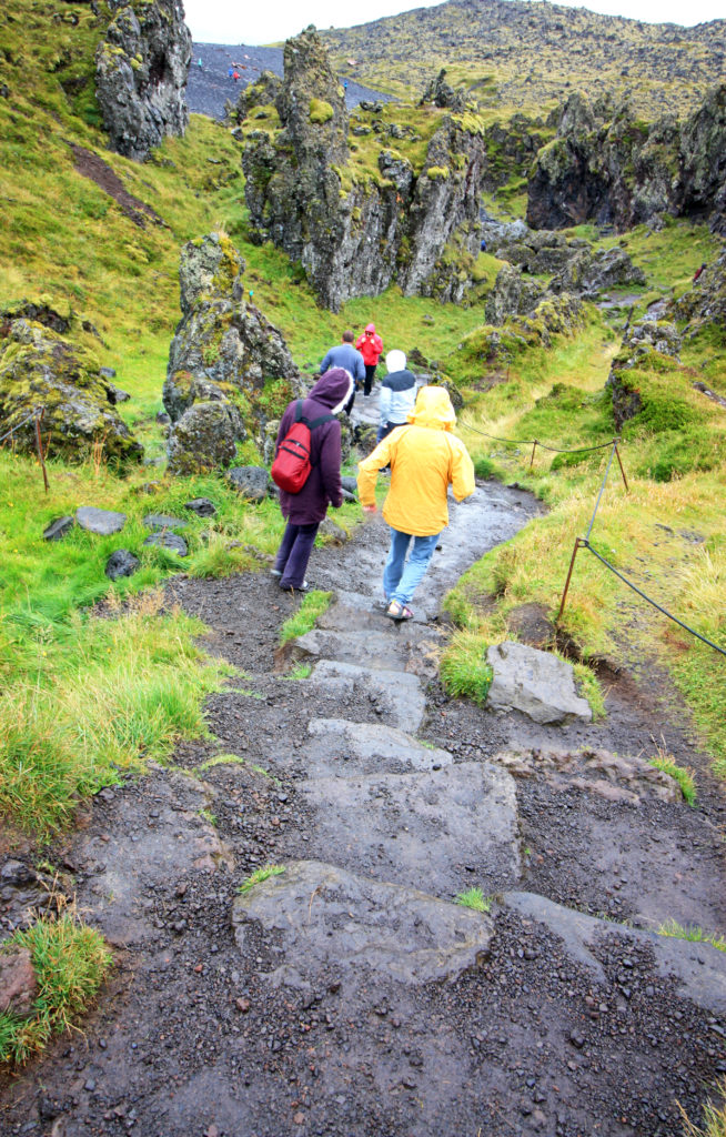
Looking at the twenty minute climb ahead of us.


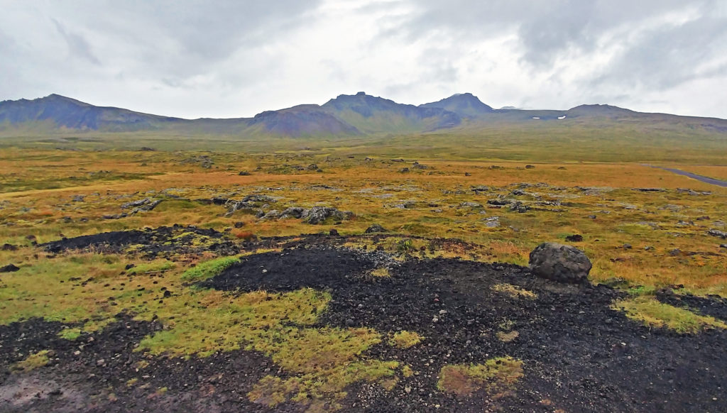
Some of the rugged rocks from the volcano’s lava field.


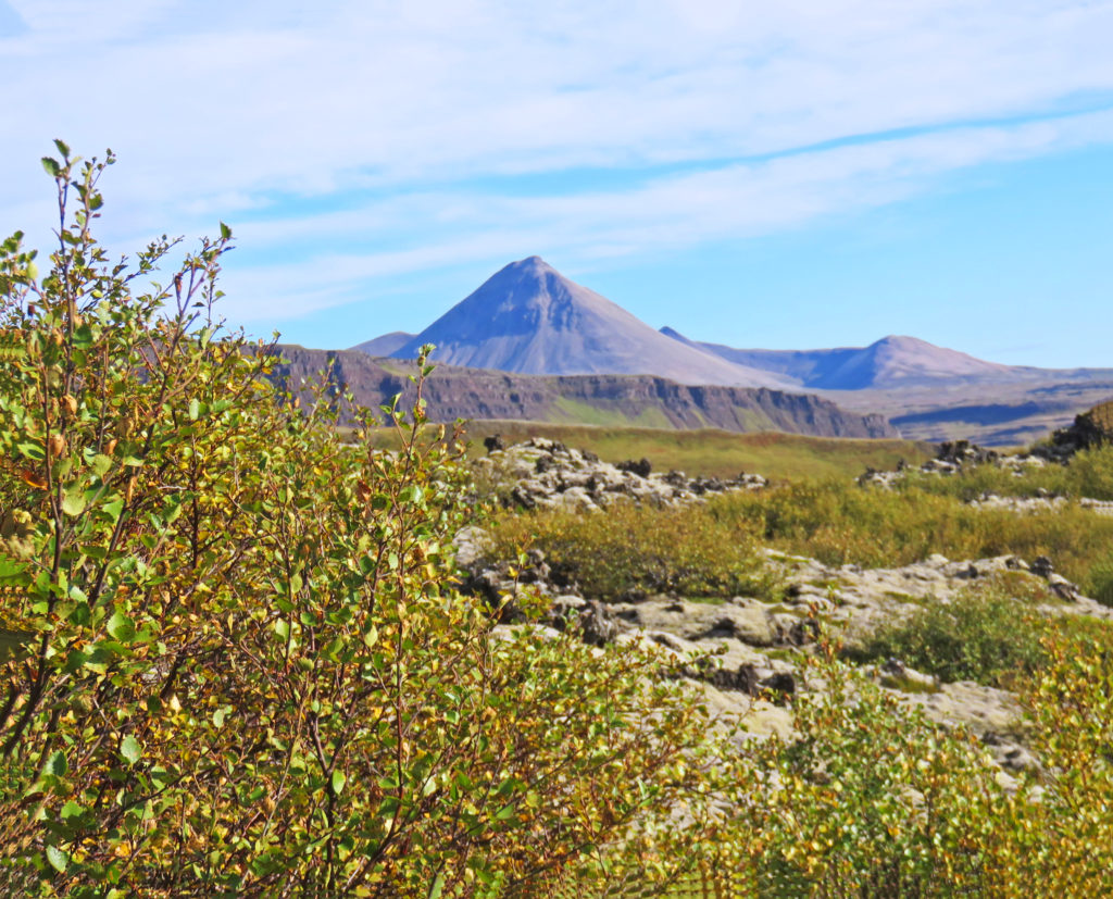
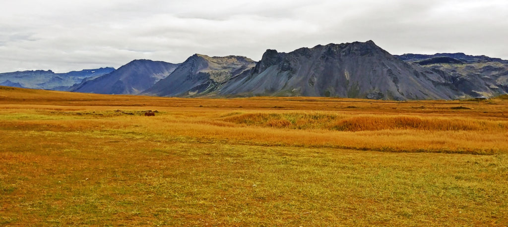
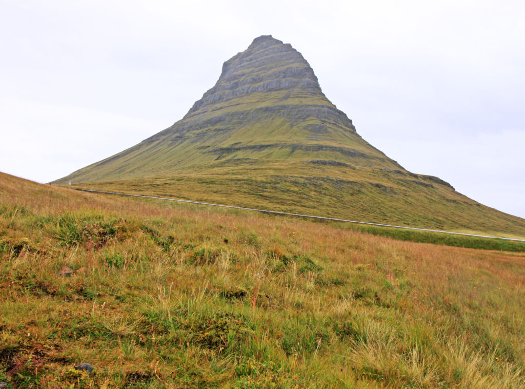
A view of Baula Mountain near Grabrok Crater.


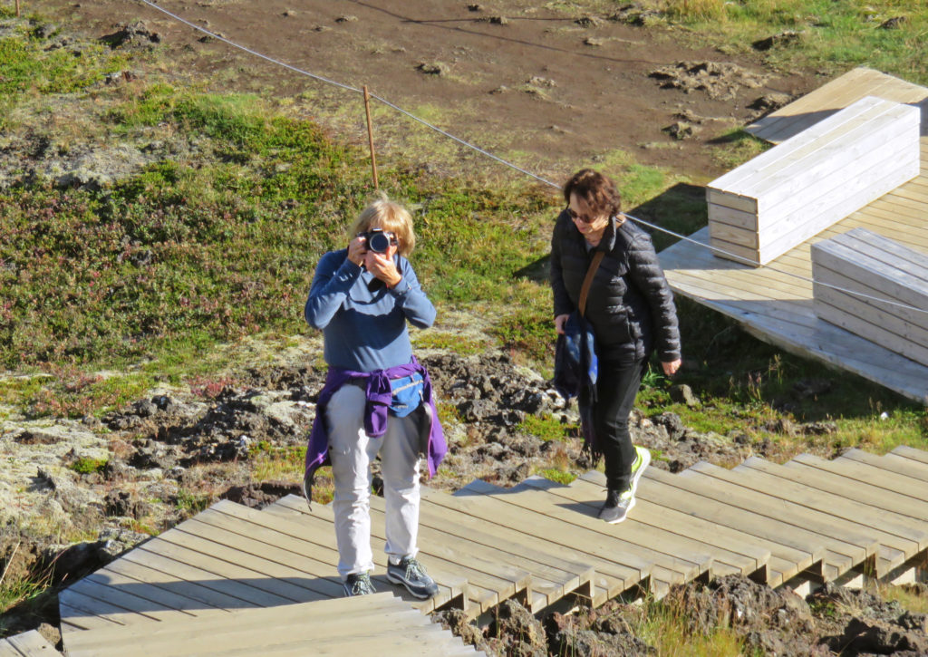
Kathy taking a picture of the wooden path.


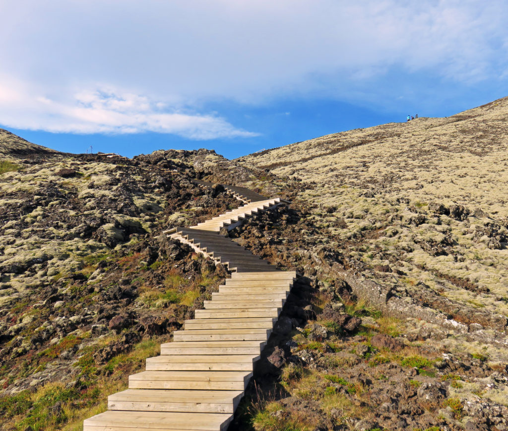
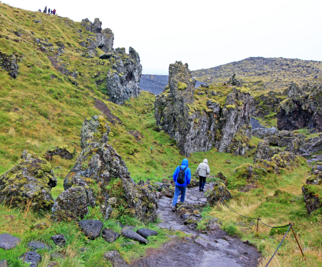
Part of the wooden path to the top of Grabrok.


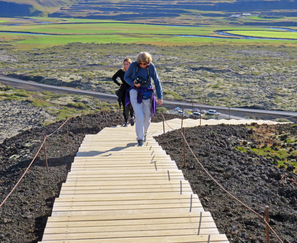
Kathy climbing 300 vertical feet up to the Grabrok crater.


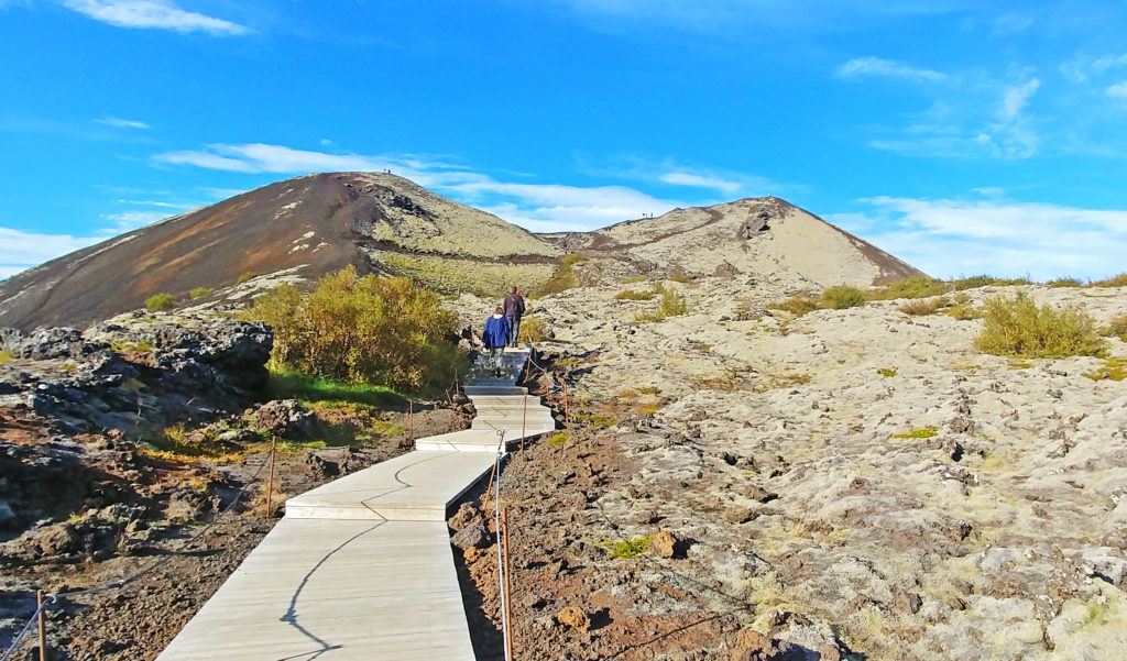
Still climbing up the volcano on a well constructed wooden path.


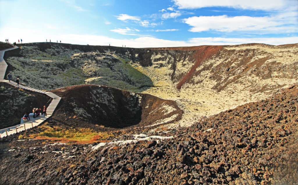
At the top of the volcano and looking into the massive crater.


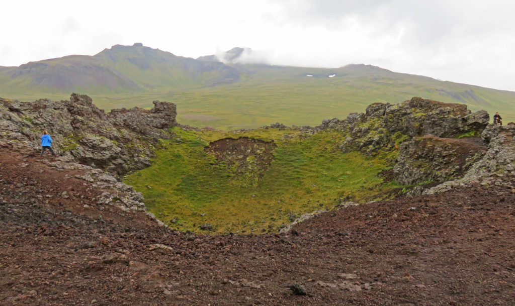
Another little crater within the big Grabrok crater.


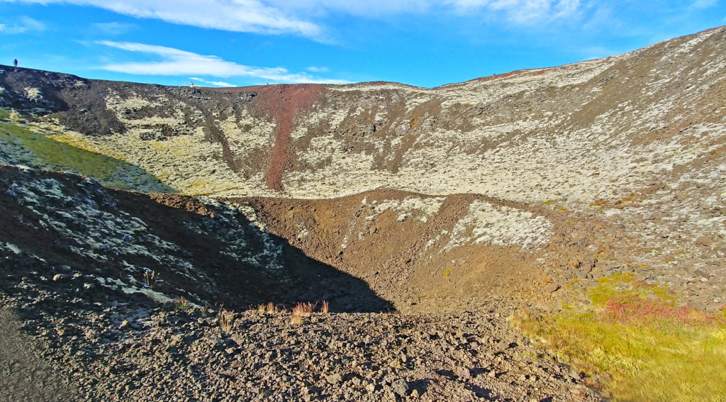
Another shot of the mini crater.


A rim shot of the crater covered in yellow moss


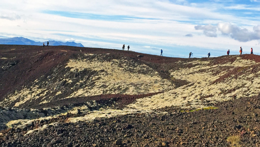
Tourists hiking around the rim of the crater.


A view of the smaller cone Grabrokarfell from the rim of Grabrok.


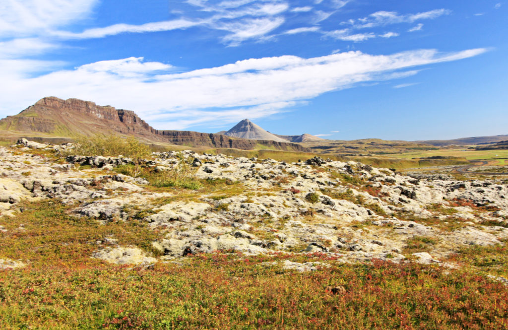
A lava moonscape with Baula Mt. and Hraunsnefsoxl Ridge in the distance.


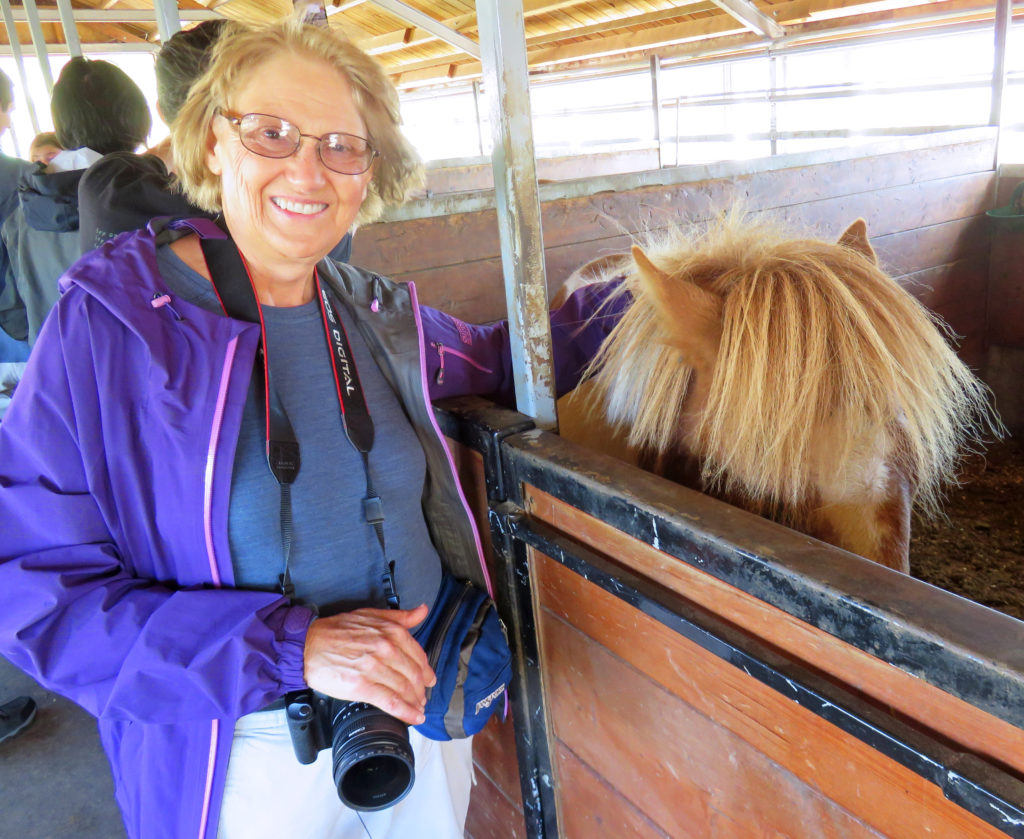
Kathy enjoying the Icelandic horses.


The owner getting a horse ready to leave the barn.


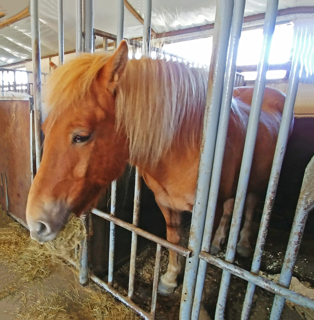
A beautiful horse waiting to be petted.


Another sweet horse posing for us.


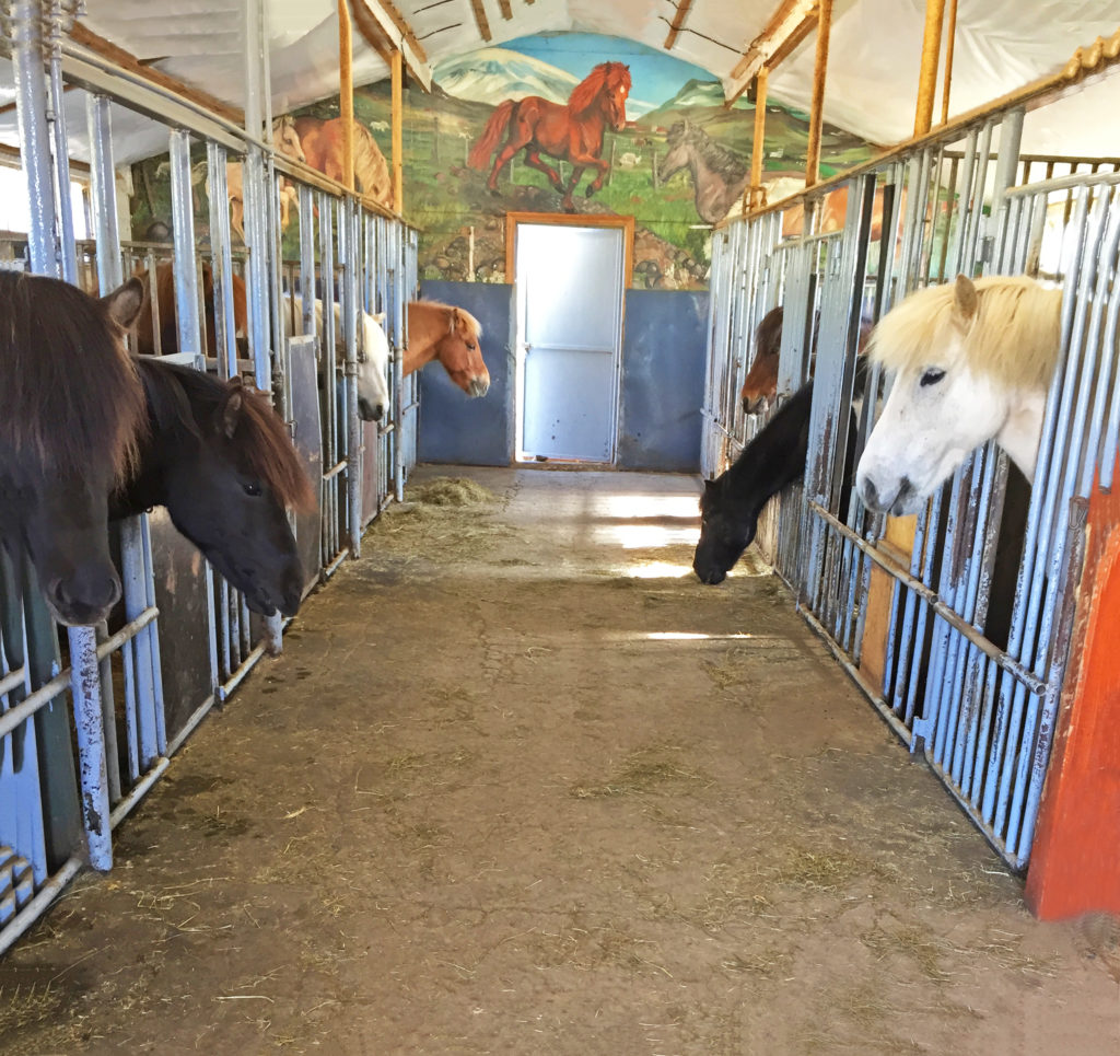
One of horse barns we got to visit.


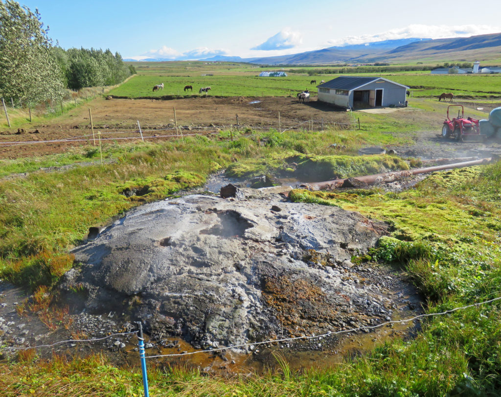
The hot springs on the property heats the house and barns.


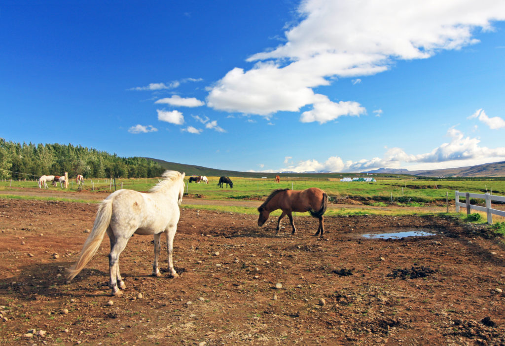
Horses out in the pasture enjoying a gorgeous day.


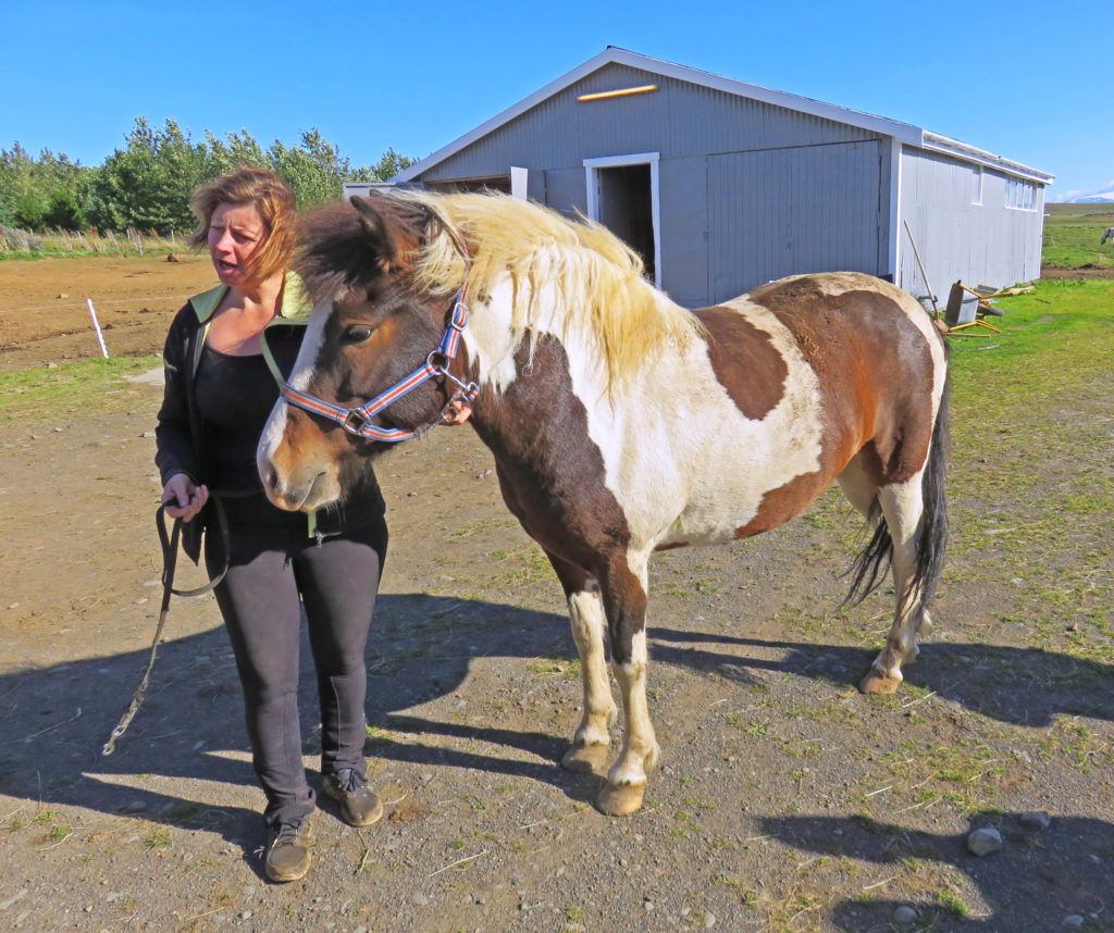
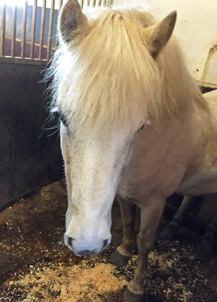
The owner introducing us to one of her horses.


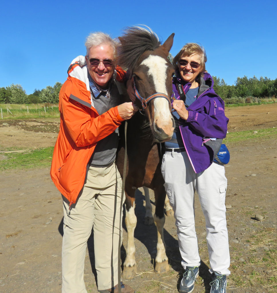
Rodge and I pose with a well mannered horse.


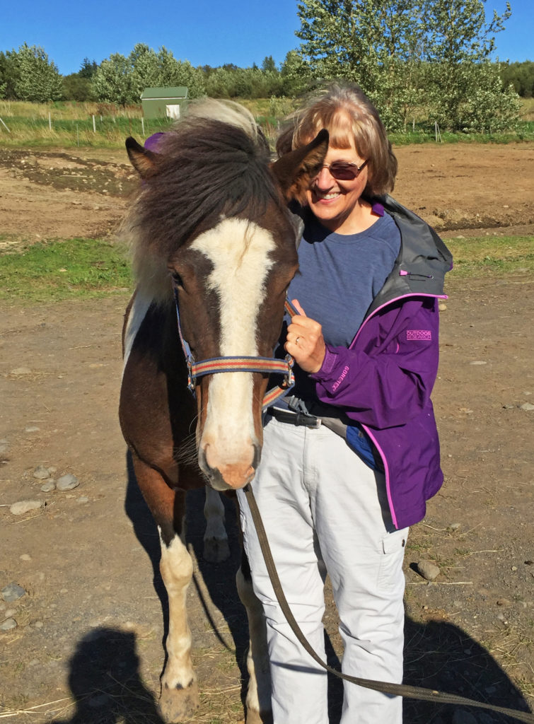
I get up close and personal with the horse.


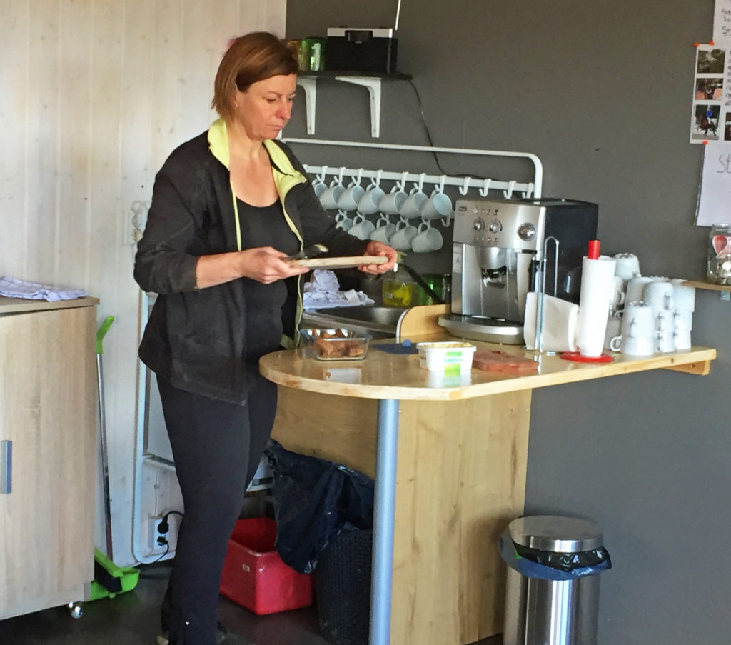
The owner serving us hot cocoa and rye bread.


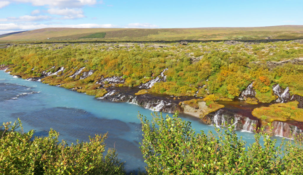
Looking down the Hvita River with the Hraunfossar waterfalls on the right.


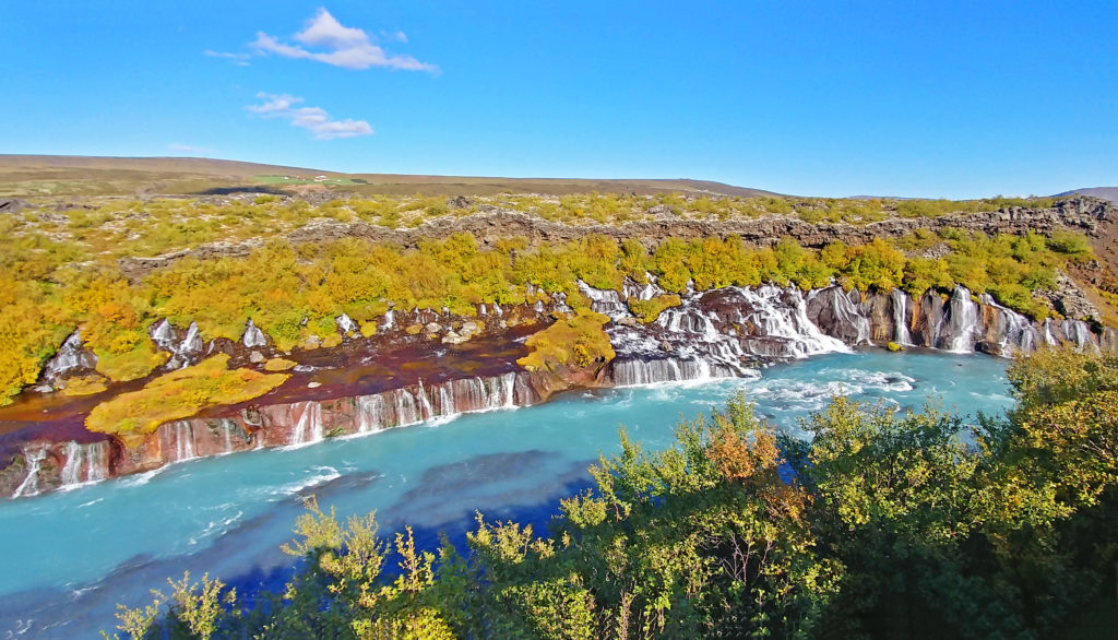
The very wide picturesque Hraunfossar (lava waterfalls).


The waterfalls are fed by glacial meltwater.


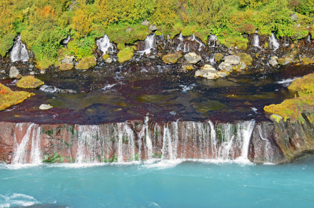
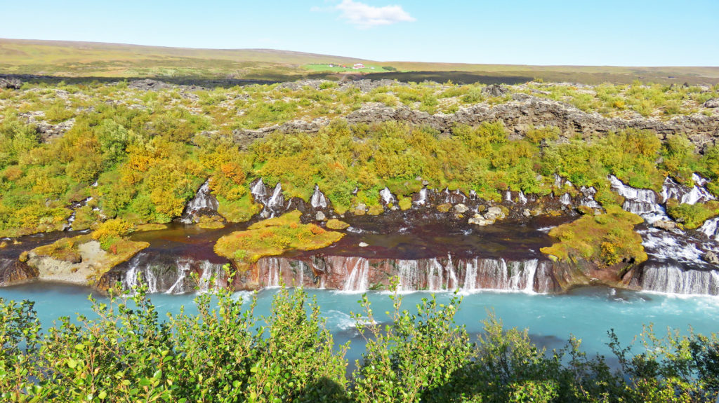
Water from the Langjokull Glacier travels under porous lava fields.


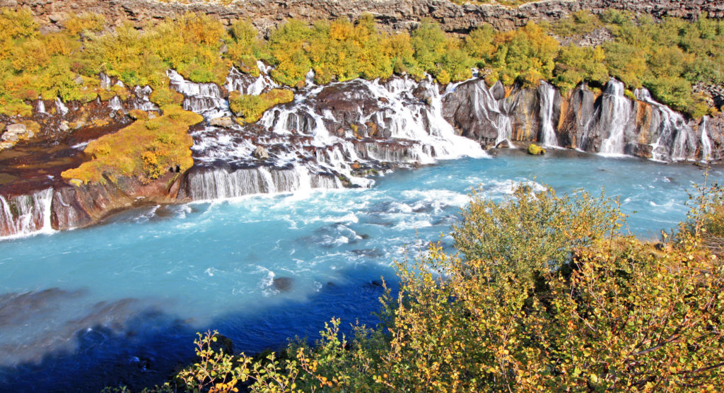
The water eventually pours out from under striped layers of lava.


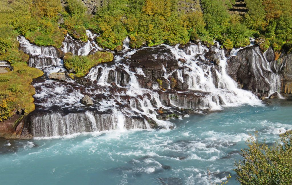
Rivulets of water flow over cliffs into the rushing Hvita River.


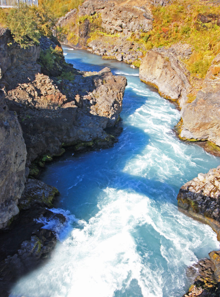
The Hvita River forms the dramatic Barnafoss waterfall.


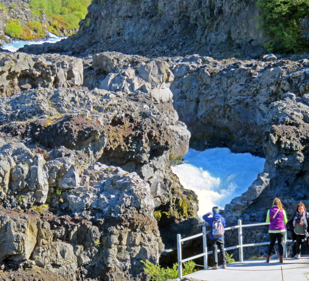
Barnafoss is formed by the Hvita River rushing through a snake-like channel.


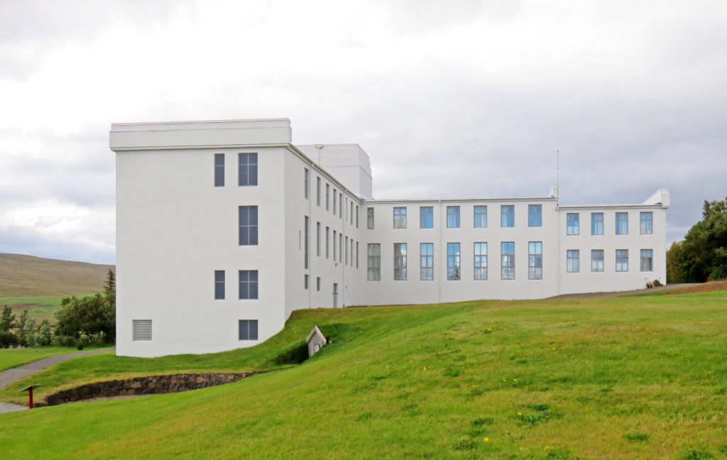
The boarding school in Reykholt that our guide attended as a child.


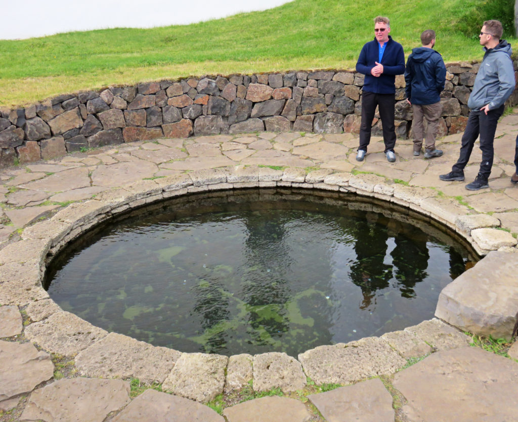
Our guide looks at Snorri’s Pool, named after Icelandic author Snorri Sturluson.


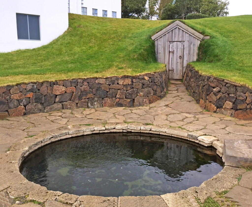
The hot water pool was used and written about 1,000 years ago by Snorri.


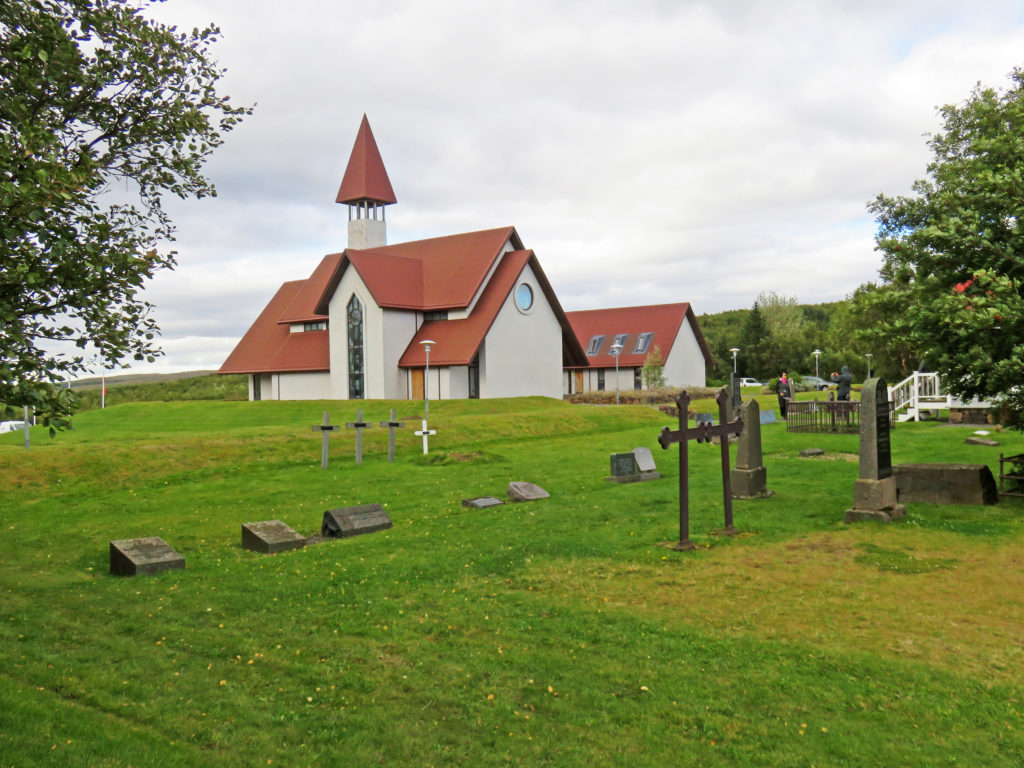
A Lutheran Church on the grounds of Reykholt.


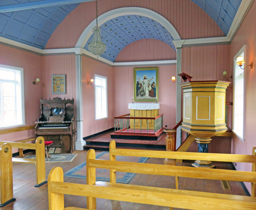
The small plain church had a truly beautiful wooden organ.


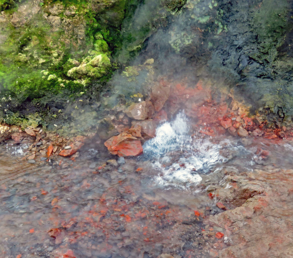
Deildartunguhver Hot Springs is Europe’s most power hot spring.


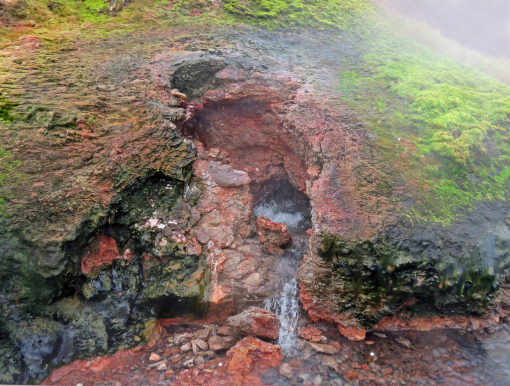
The hot water is piped to the surrounding towns of Borgarnes and Akranes.


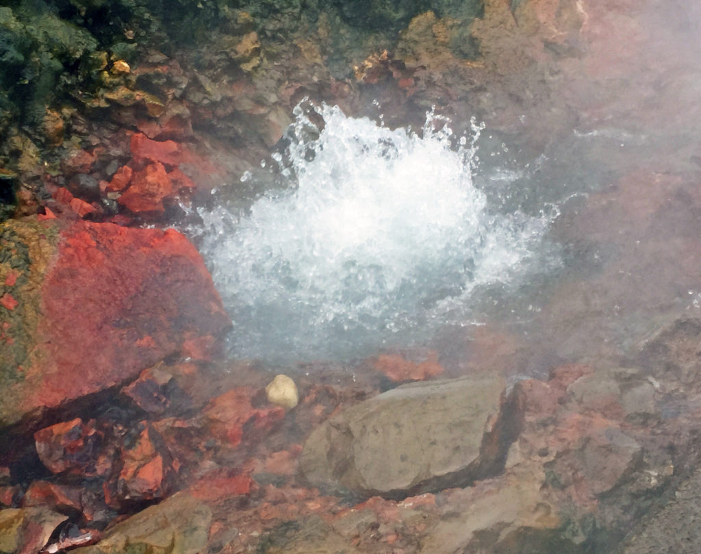
The hot spring gushes out fifty gallons of boiling water per second.


Be the first to comment