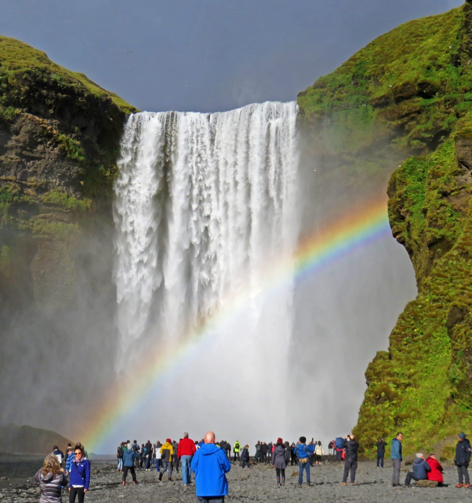
Stunning Godafoss falls cascades thirty-six feet into a blue-green pool of water.
September 5, 2018
We were up early at 6 a.m. and excited about our Trek into northern Iceland. This was the first place where the hot water in our room smelled like sulfur. But we had to remember, we were in Iceland where hot water comes from a geothermal source. After a hearty breakfast we were once again on the road for another exciting day.
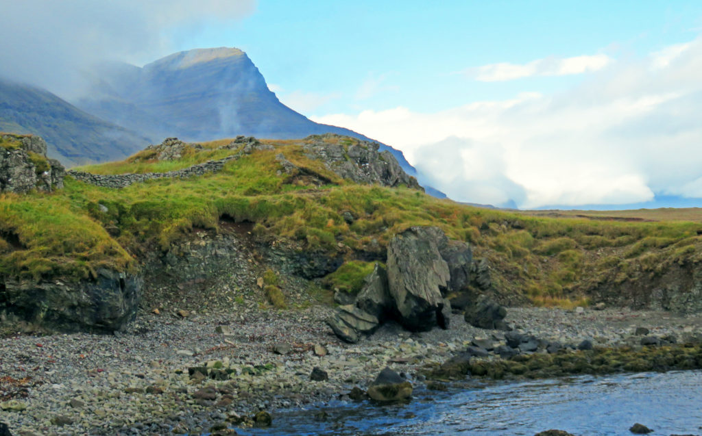
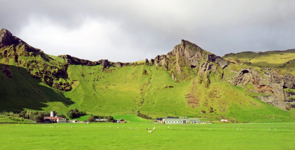
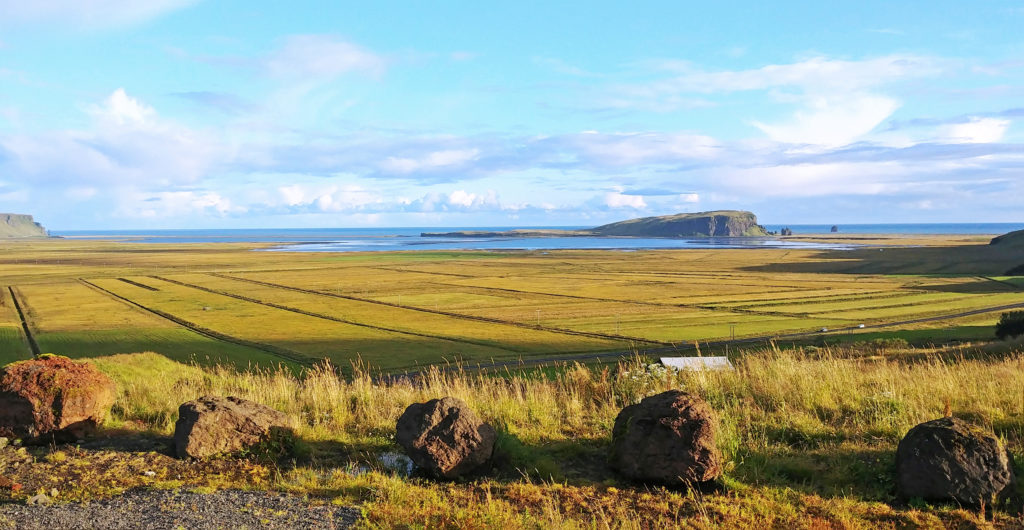
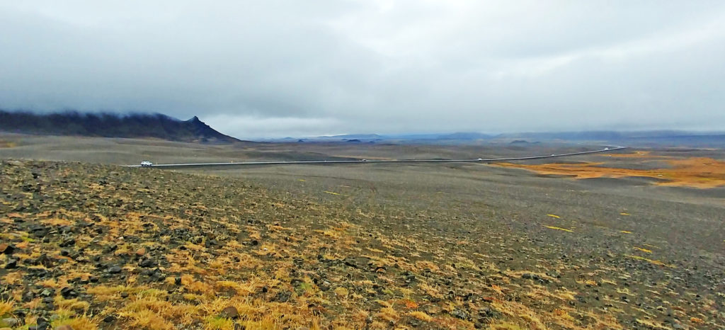
We had a 2-1/2-hour drive to our first destination. Along the way, we were treated to rolling farmland through shallow valleys and, of course, sheep continued to be evident everywhere. Like the sign said in the airport – “Icelandic sheep – Free range since 875”. Just as we were getting used to the pastoral landscape the terrain changed drastically. We were out in the middle of nowhere with volcanic desolation all around us — black rolling hills of ash, small volcanic cones in the distance, and lava outcroppings.
We stopped at a scenic overlook so we could get a better view. We were on the edge of the Highlands of Iceland, a sparsely inhabited plateau that covered most of the interior of the island. The area was mostly an uninhabitable volcanic desert because the water precipitating as rain or snow infiltrated so quickly into the ground that it was unavailable for plant growth. This resulted in a surface of grey, black or brown earth, lava, and volcanic ashes. It looked like a moonscape.
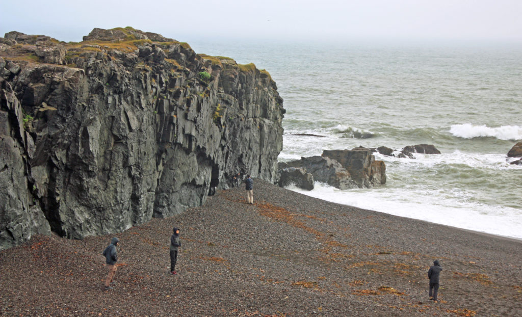
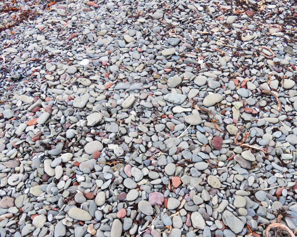
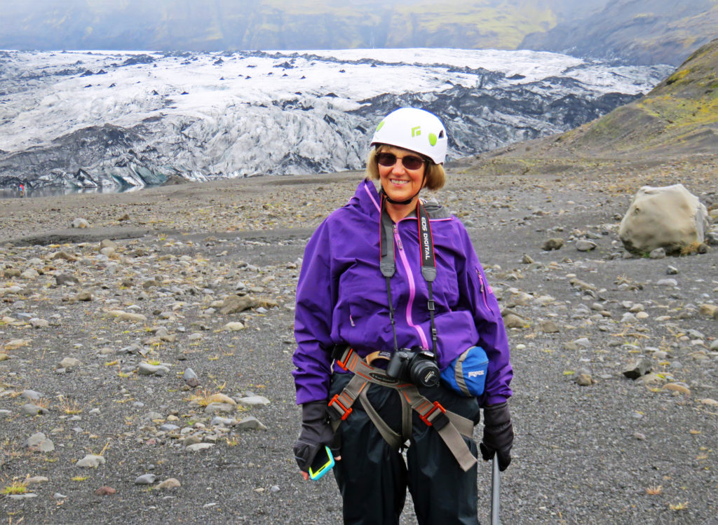
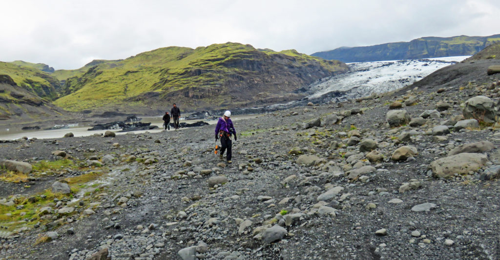
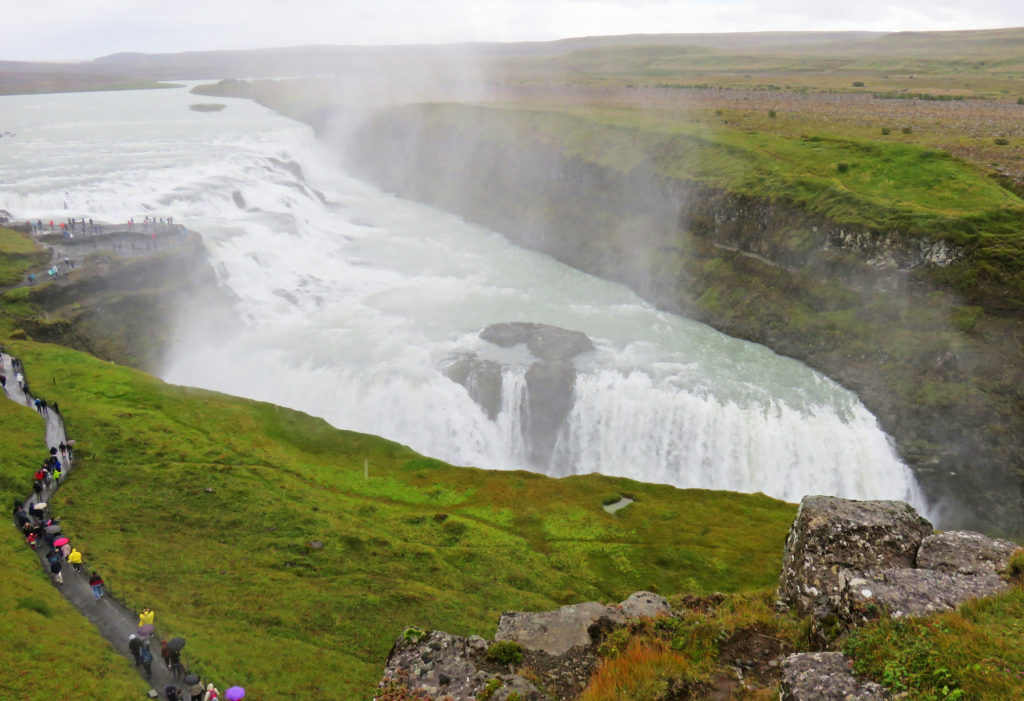
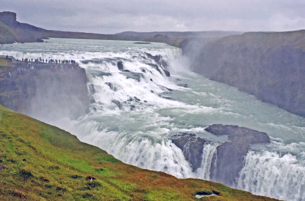
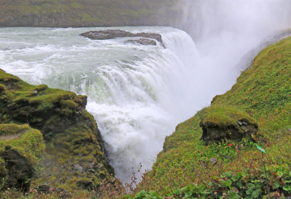
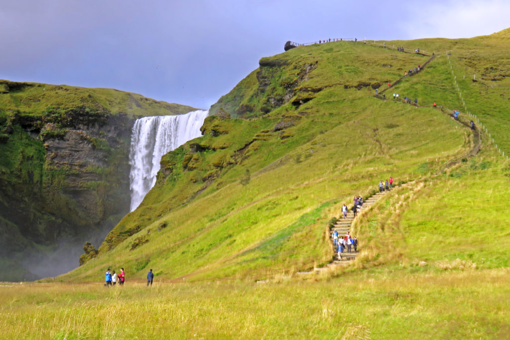
At 10 a.m. we arrived at Dettifoss waterfall, the most powerful waterfall in Europe. After a fifteen-minute walk over a volcanic lava and ash landscape, we reached the falls, coming at them from above. We were greeted by a thundering roar of water and a wet cloud of mist. The falls looked equivalent in size to the American Falls at Niagara Falls, but prettier since the water plummeted 150 feet straight down in a wide sheet with no rocks breaking up the flow on the way down.
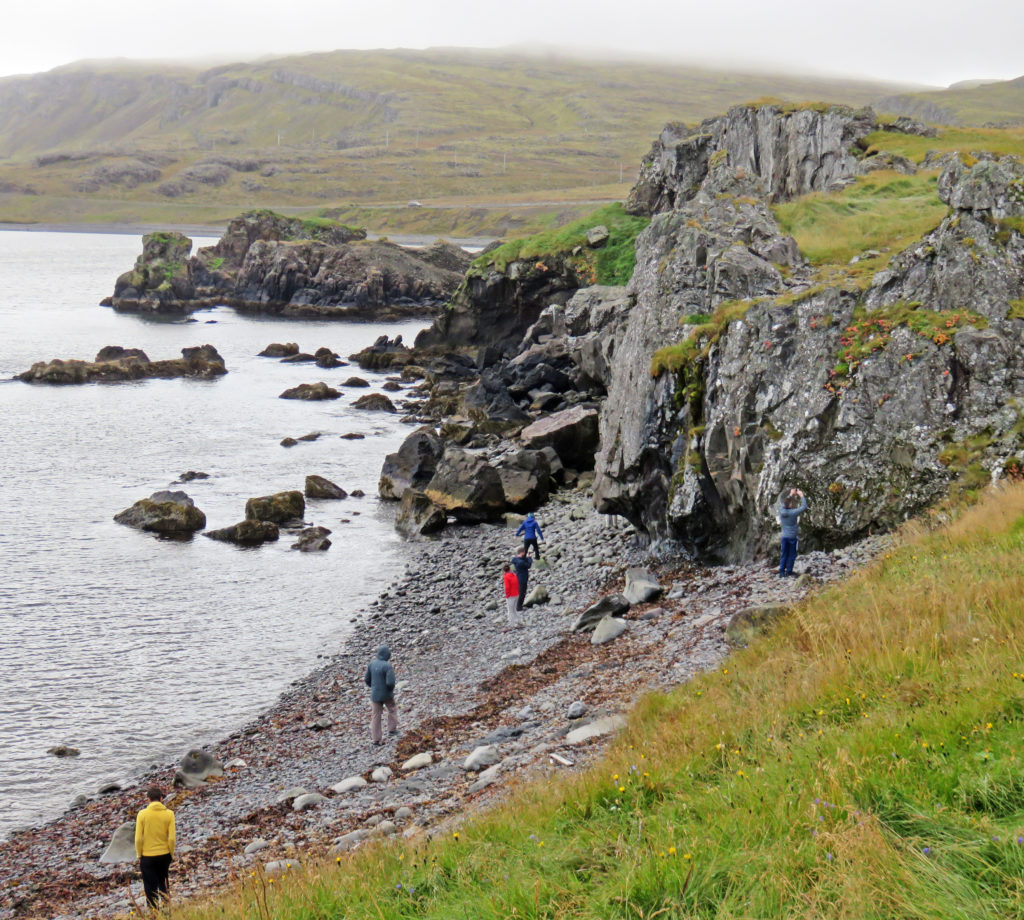
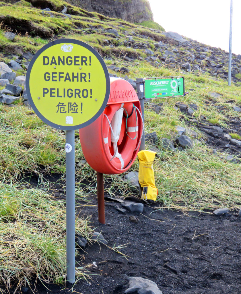
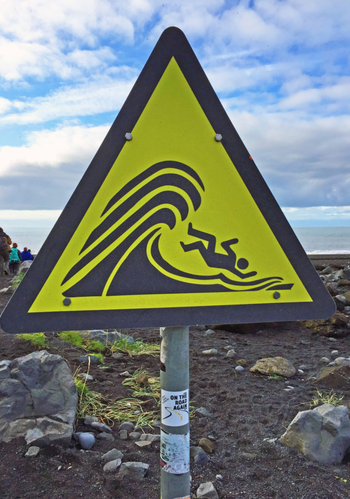
Since the area was very misty and damp and the air temperature was 40° F with some wind, we bundled up to keep warm. It was a potentially dangerous site considering the wet surfaces. Where a similar sightseeing area in the U.S. would have waist-high walls or guardrails, Iceland had thin ropes placed just above knee level; where a U.S. site would have rope warning lines and/or signs, Iceland had nothing. They must figure that stupidity merits its own appropriate reward. Slipping into that chasm would be certain death. If the fall didn’t do it, the fast-running glacial water and isolated location would. That may be why Iceland doesn’t seem to waste resources having rescue assets nearby.
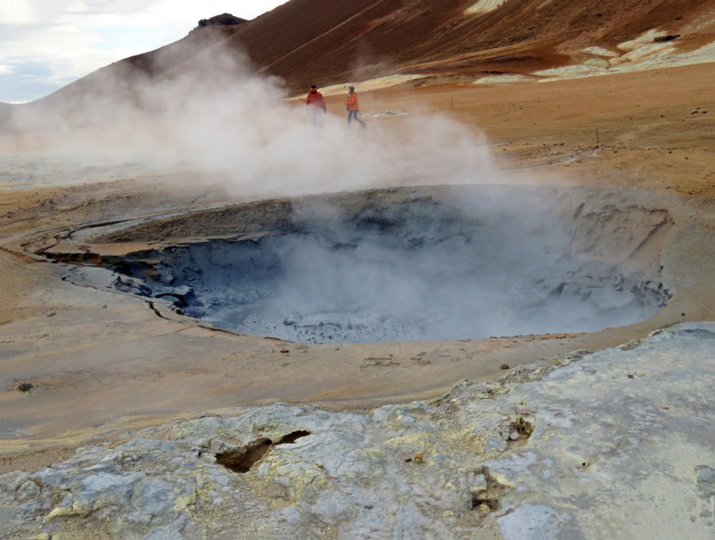
Next, we headed to Namaskard geothermal area. The first thing we noticed when we got out of the van was the rotten egg smell, caused by hydrogen sulfide. The vast area was barren with no vegetation due to poisonous fumes and acidic soil but the terrain was colorful due to the deposit of various sulfur crystals. When we toured the geothermal area, we walked by several bubbling mud pots, fumaroles wafting clouds of steam, and fissures. The fumaroles were my favorite feature. They looked like little stacked-rock ovens hissing and spitting steam. The mountain (Namafjall) looming in the distance also had vents of steam rising from it.
At noon we arrived at Myvatn Nature Baths, a hot springs bath complex. While many of our fellow travelers immersed themselves in the hot, mineral-laden water, we enjoyed a leisurely lunch at a dining area overlooking the bathers and enjoyed some beautiful sunshine while conversing with our guide and some of our fellow travelers.
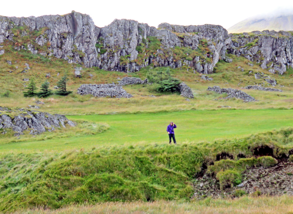
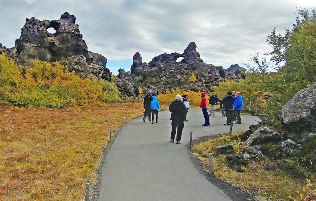
After lunch we were treated to a walk through Dimmuborgir Lava Formations. The area known as “Dark Castles” was formed by a lava-lake, flowing from a large eruption about 2300 years ago. On the site of Dimmuborgir, the lava pooled over a small lake. As the lava flowed across the wet sod, the marsh water boiled with vapor rising through the lava, forming lava pillars. Some of the pillars were several meters in diameter. As the lava continued flowing towards the lower ground, the crust collapsed, leaving the hollow pillars of solidified lava standing.
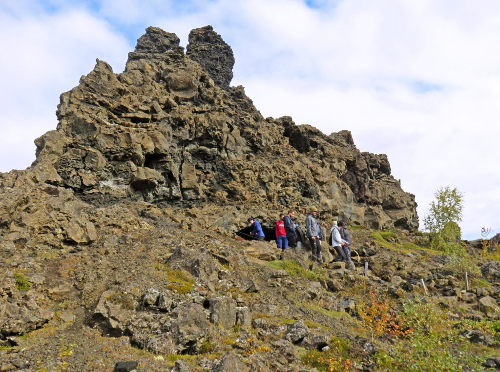
We hiked on one of the many paths and explored lava pillars, caves, rugged crags and towering rocks. Some of the rocks were sixty-five feet tall. We climbed up to the most famous formation “The Church” which is a cave opens at both ends with a dome like ceiling. From there we had an awesome view of Hverfjall, a huge volcano crater created during a short but powerful eruption some 2,800 years ago.
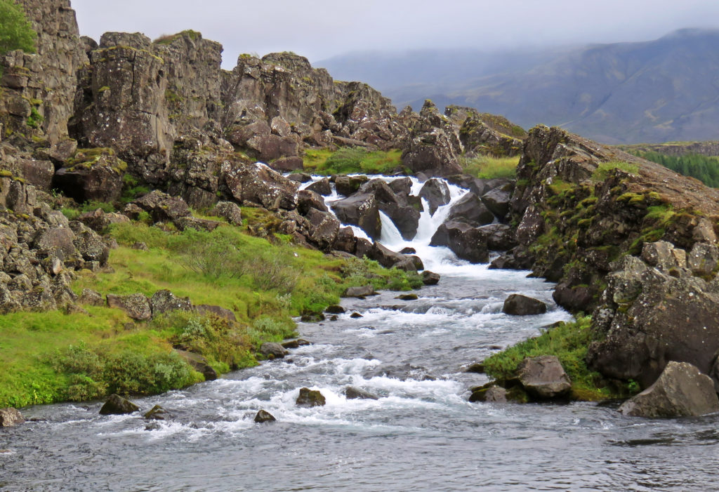
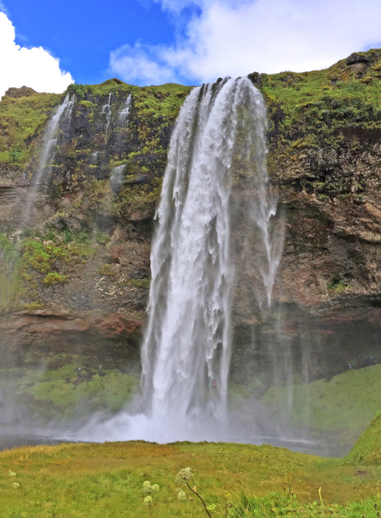
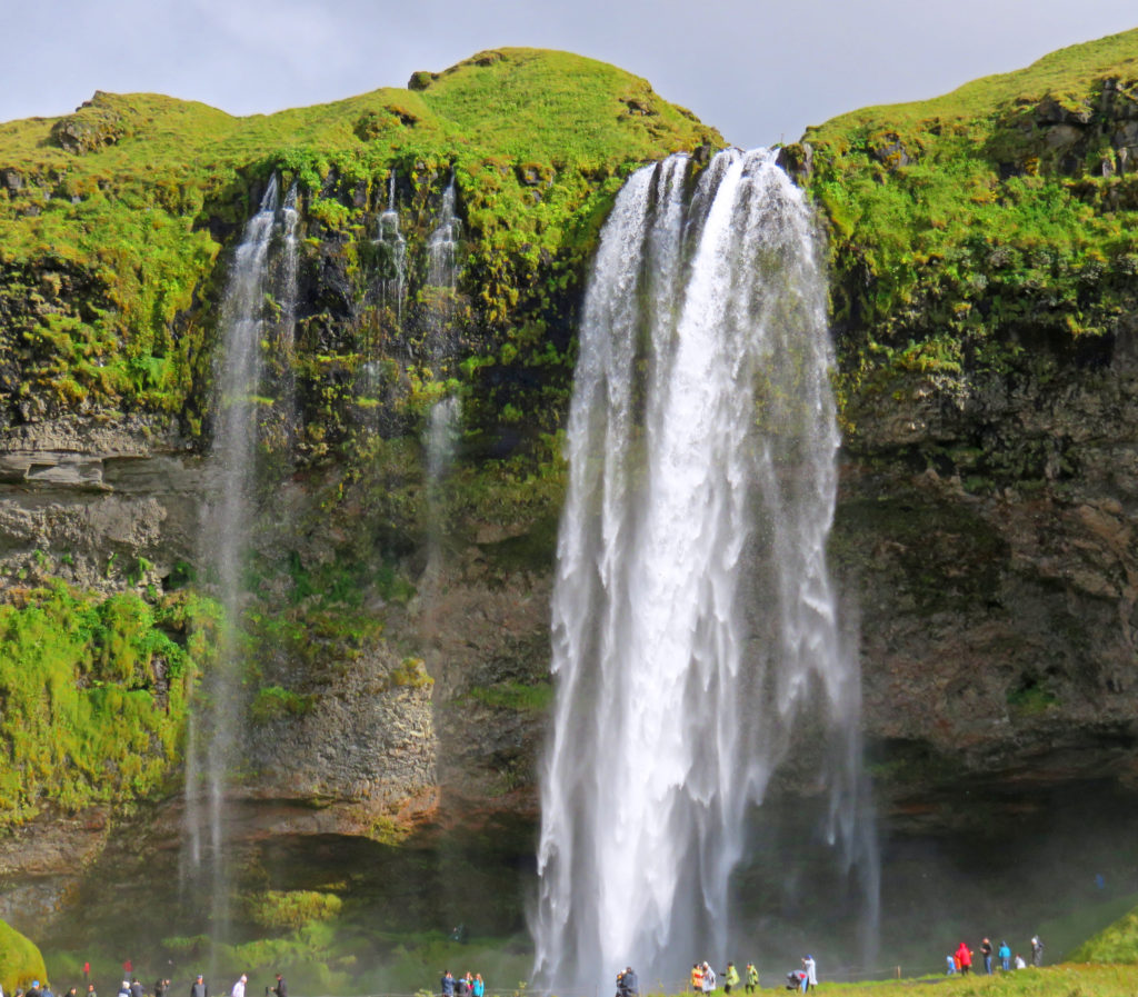
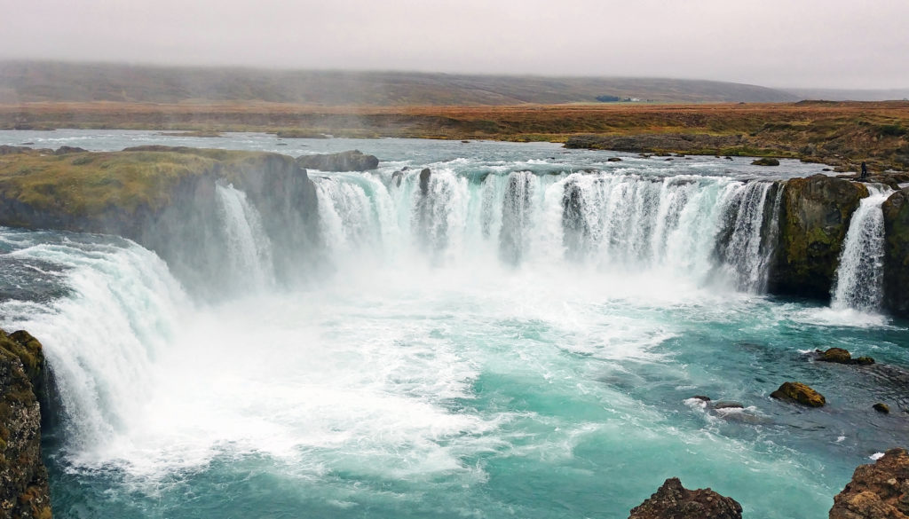
Later in the afternoon, we stopped at Godafoss waterfall, known as the “Waterfall of the Gods.” The falls got its name when Christianity was declared the official religion of Iceland, and the locals threw their Norse pagan god statues into the waterfall. It was a short walk from the parking lot along the downstream of the Skjalfandafljot River (the strongest white-water rapids we saw during the entire trip) to the upper side of the falls. Very dramatic. About a ¼ scale version of Niagara Falls in both height (36 feet) and layout; there were two parts – one straight and one horseshoe with a slight separation between the two parts. Many tourists on both sides of the falls were closely competing vigorously for this year’s Darwin Award.
We were on the road once more passing through an area of rolling hills and farms, scrub brush, and trees! We passed several stands of pine trees that appeared to have been deliberately planted and were being managed. We then moved into an area with much higher mountains on both sides of the road wreathed in clouds. We arrived in the center of Akureyri, the second largest city in Iceland. It had a modern look. The tallest building was a large Lutheran church on a hill near the city center – not ostentations, but dramatic and the largest church we’ve seen so far; all others have been of a small, plain design with small steeples topped by crosses. We walked around a bit and had dinner in a local café. We toured a bookstore – neat with English and Icelandic books, local authors, translated best sellers. I walked up many flights of stone steps to the church and got a terrific view of the area.
On our way to our hotel in Dalvik, a fishing village in North Iceland, our guide sprung a surprise stop on us at a “Christmas House”. The stop was in a somewhat isolated location outside of the nearest town and just off the road. It was one of those retail establishments that sells Christmas-related items all year and consisted of two buildings. One was a combination home and gift shop/farmer’s market outlet; the other was a large, red, two-story wood structure designed to look like Santa’s workshop, including a set of Santa’s clothing hanging out to dry.
Bless,
Kathy
Isolated volcanic desolation of the Icelandic Highlands.
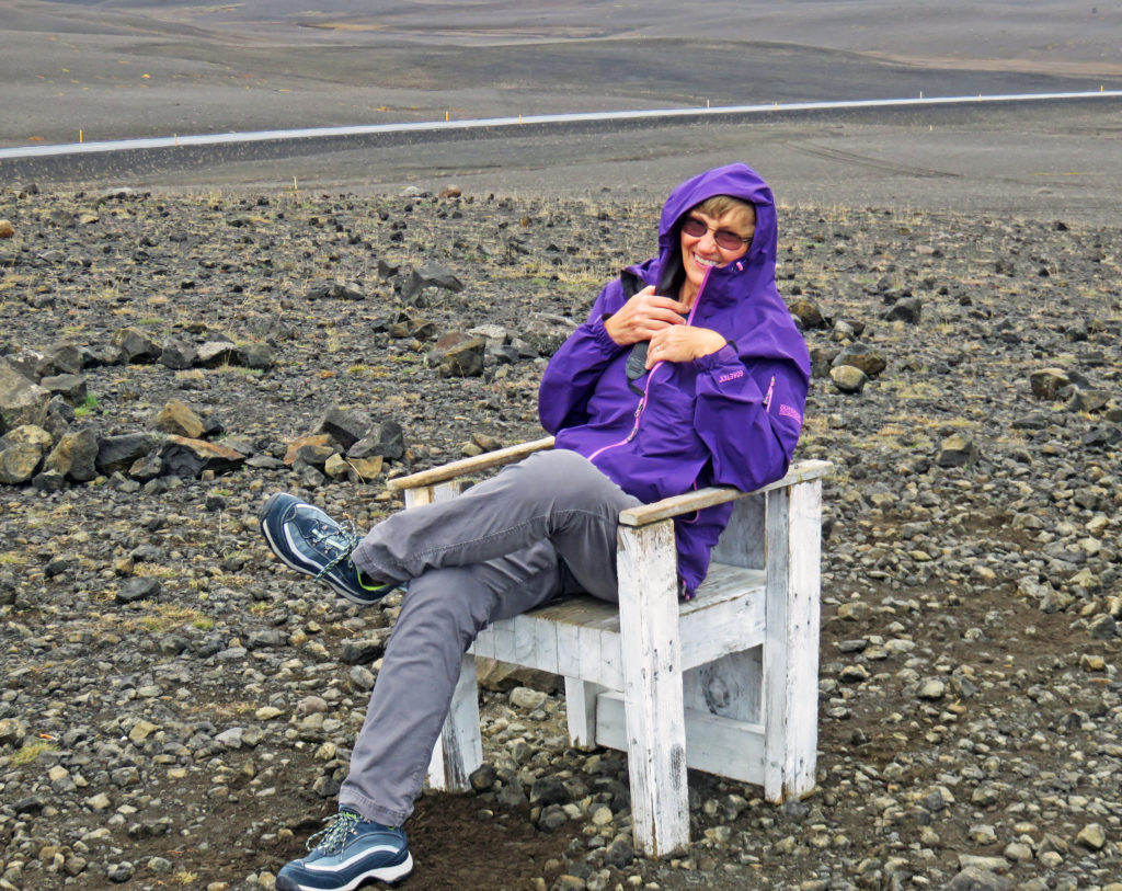
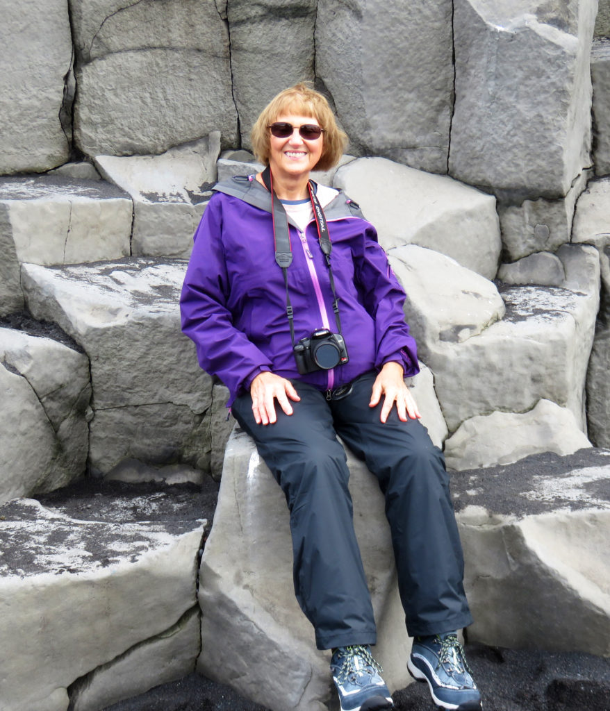
Kathy sitting out in the middle of “Nowhere”.
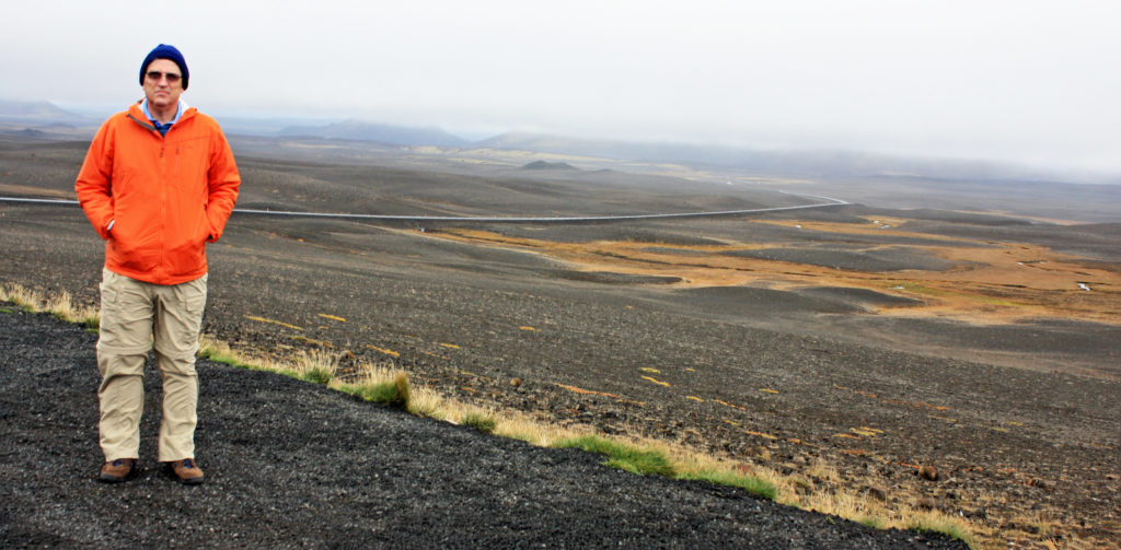
Rodge standing in the eerie moonscape of the Highlands.
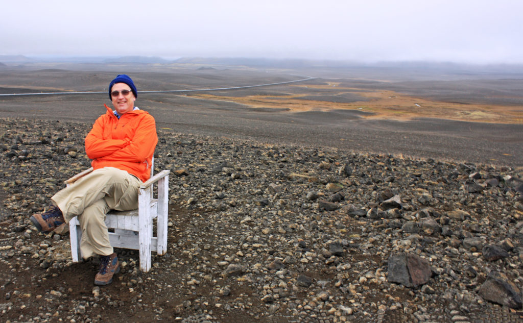
Rodge posing in an uninhabitable volcanic desert.
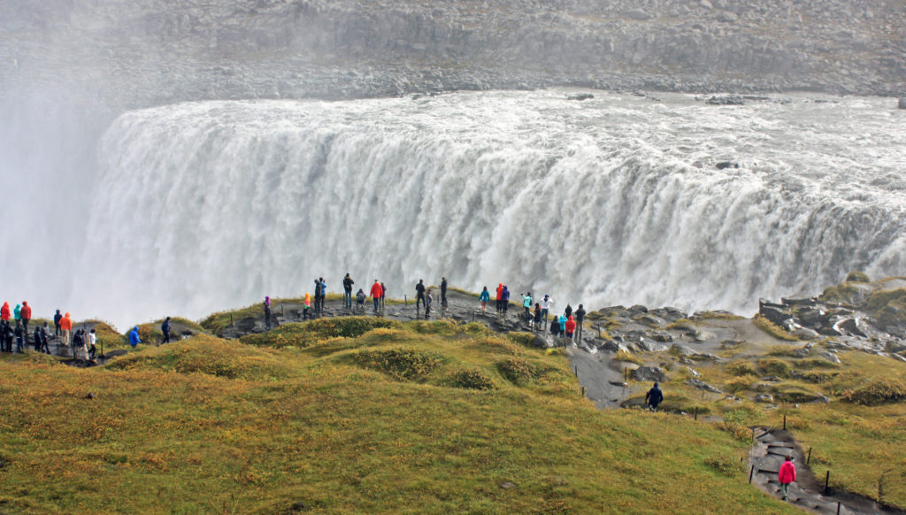
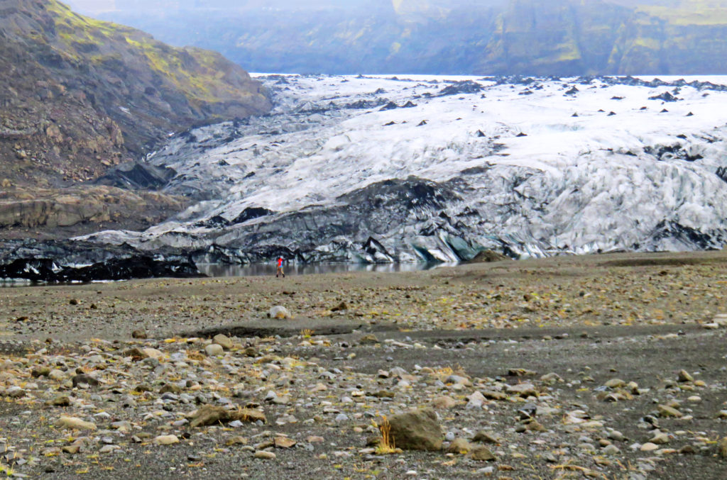
Dettifoss waterfall, the most powerful waterfall in Europe.
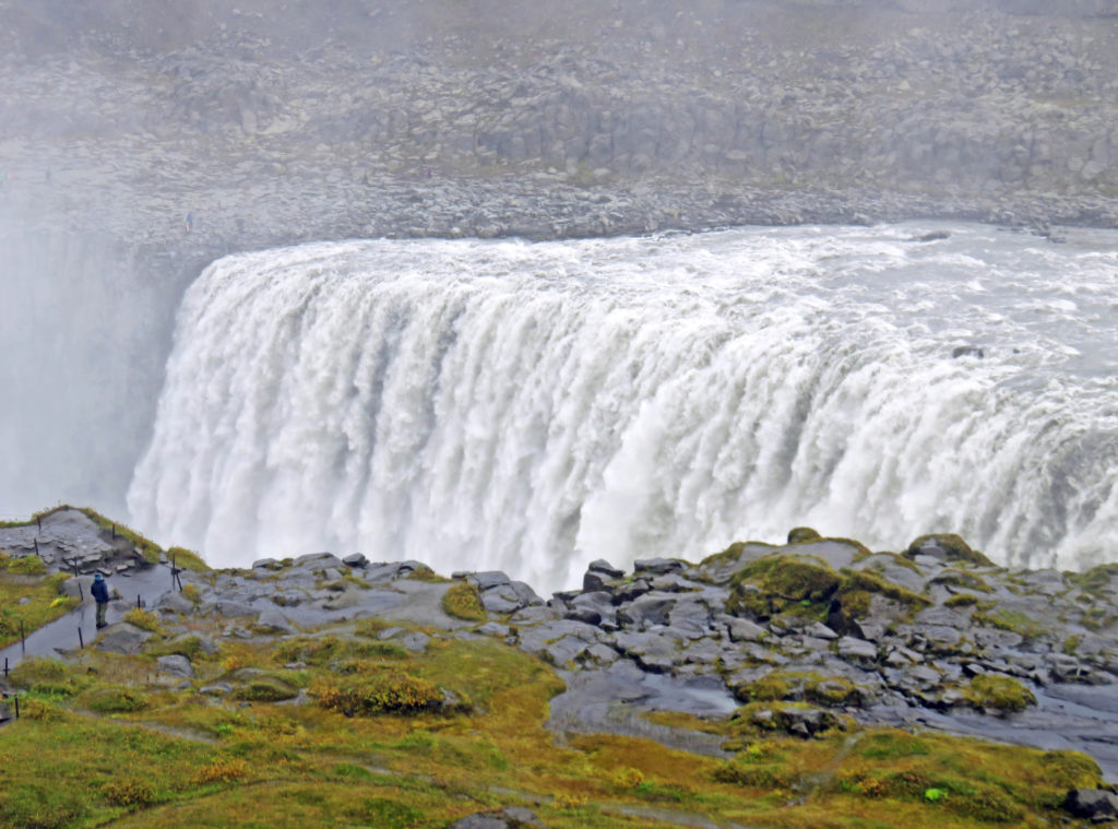
We were greeted by a thundering roar of water and a wet cloud of mist.
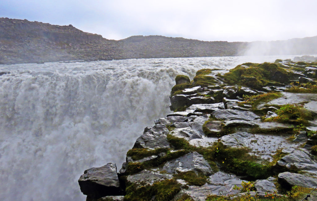
There is a vastness and a rawness to the nature of Dettifoss.
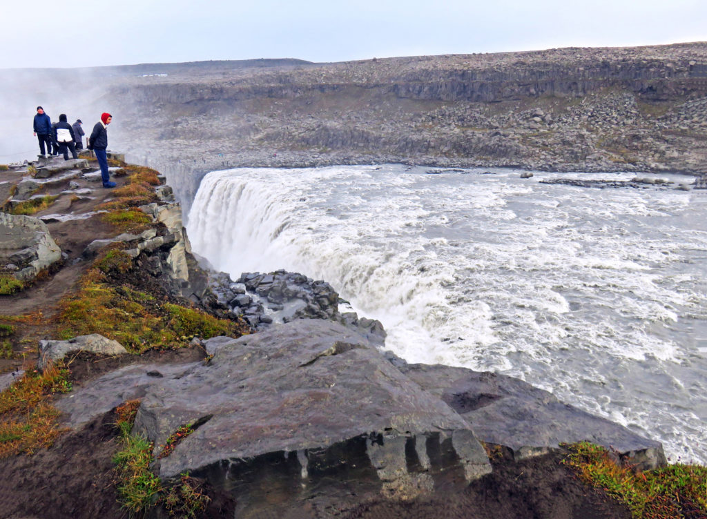
A brave tourist peers over the edge of Dettifoss.
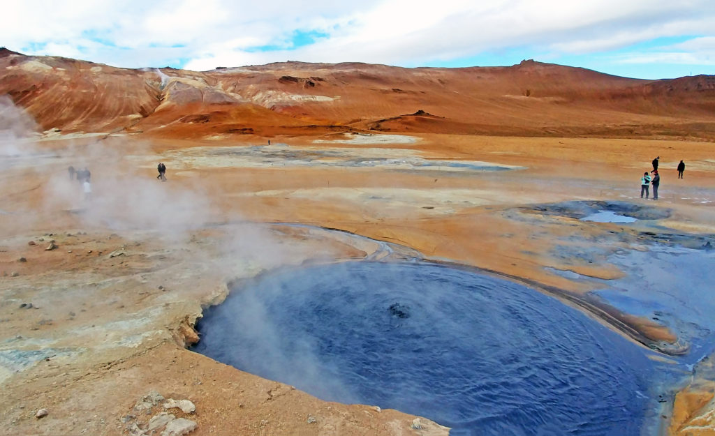
A colorful hot water pool at Namaskard geothermal area.
Tourist standing at the top of Namafjall Mountain overlooking Namaskard.
Steam rising from a bubbling mud pot.
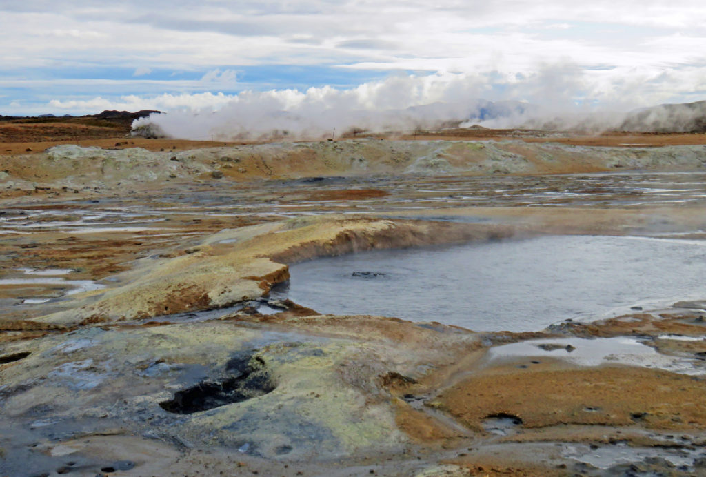
The colorful landscape was the result of the deposit of various sulfur crystals.
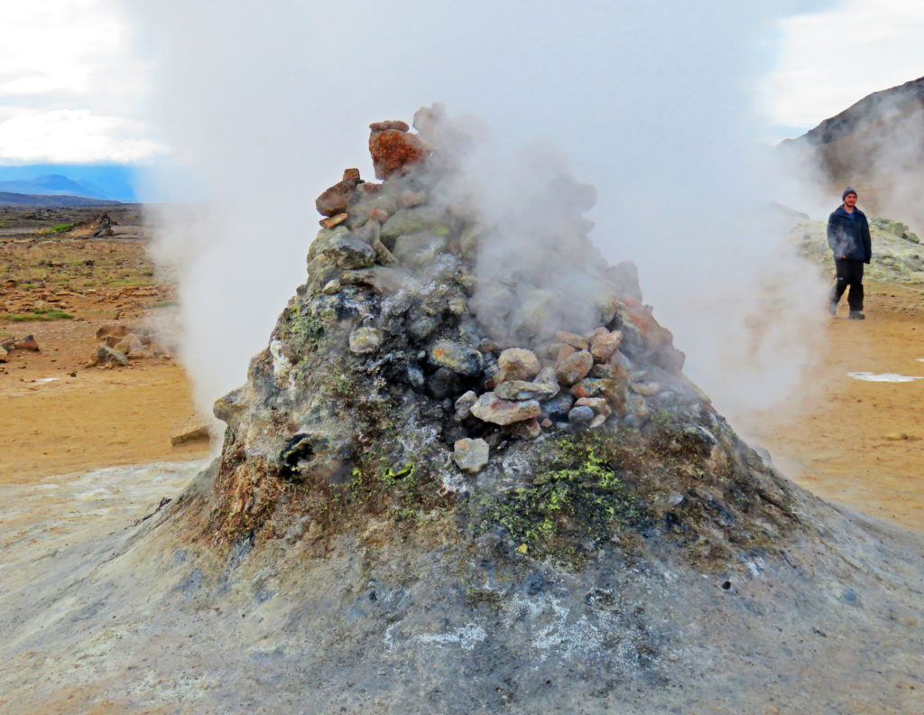
The fumarole looked like a stacked-rock oven hissing and spitting steam.
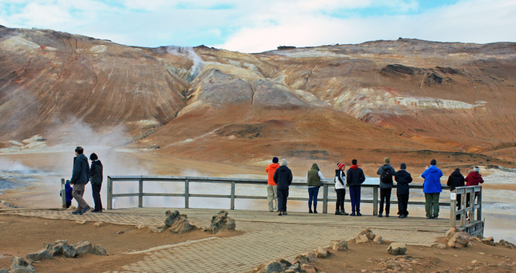
The area was barren with no vegetation due to poisonous fumes and acidic soil.
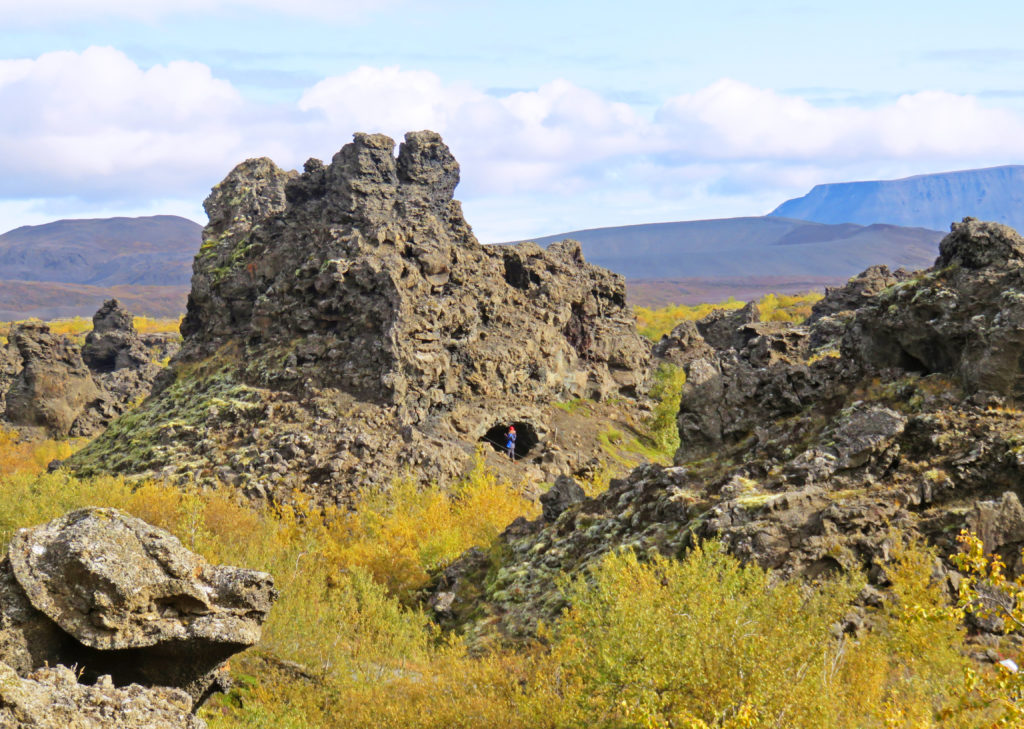
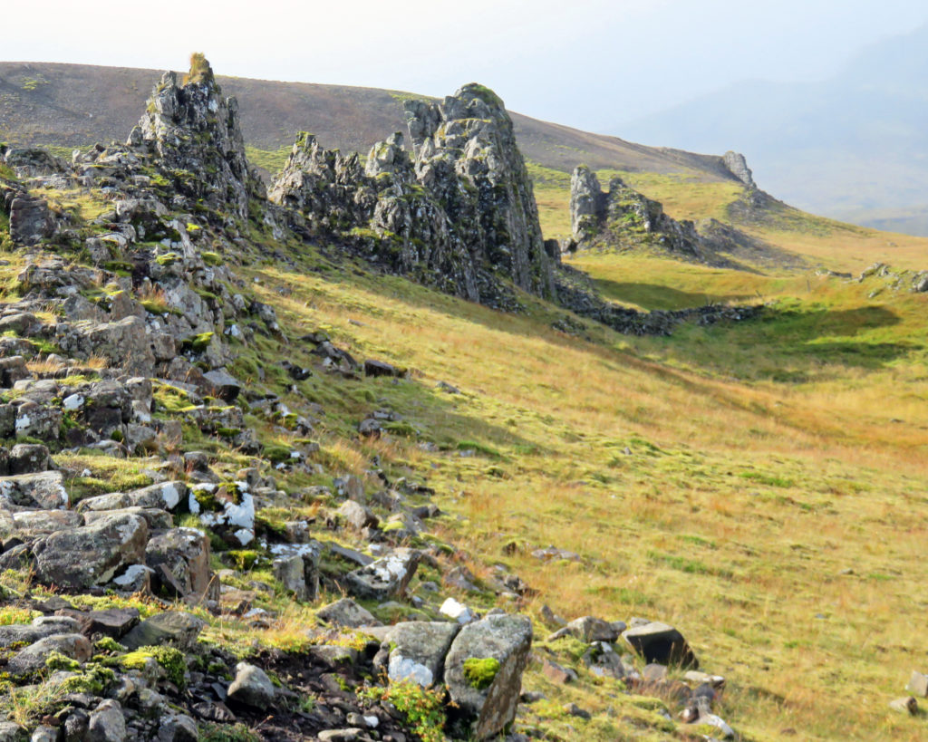
Lava pillars, caves and rugged rocks stand at Dimmuborgir Lava Formations.
Some of the rocks were sixty-five feet tall.
The area known as “Dark Castles” was formed about 2,300 years ago.
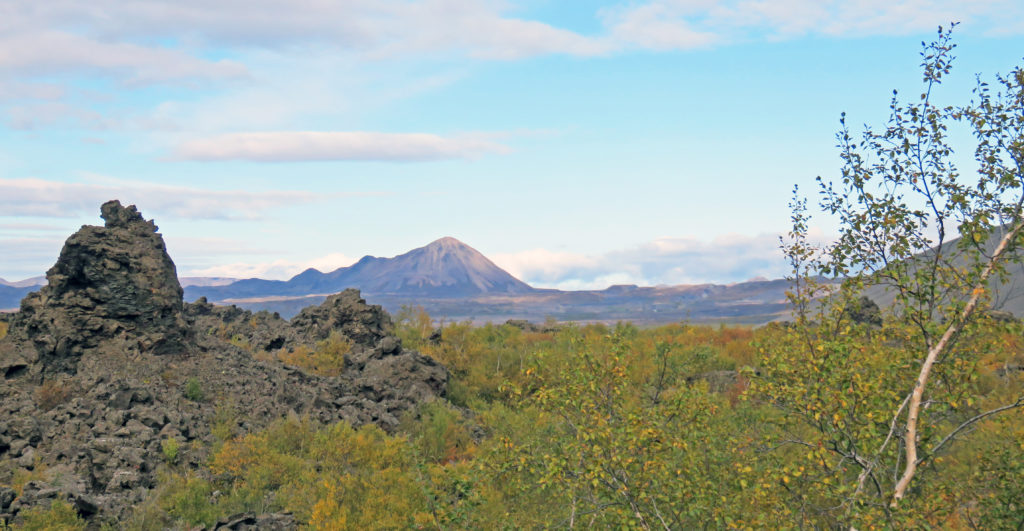
A view of Hverfjall volcano crater from Dimmuborgir.
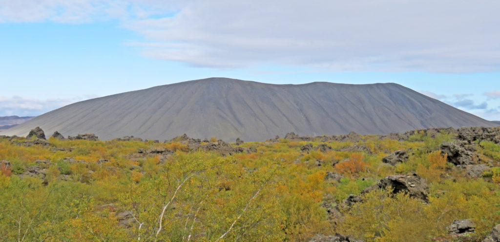
Hyverfjall was created during a short but powerful eruption 2,800 years ago.
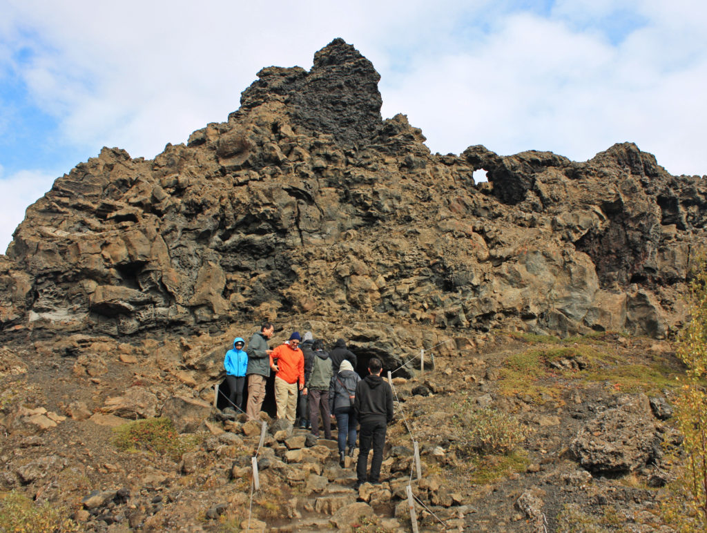
Tourists climbing up to the famous formation “The Church” .
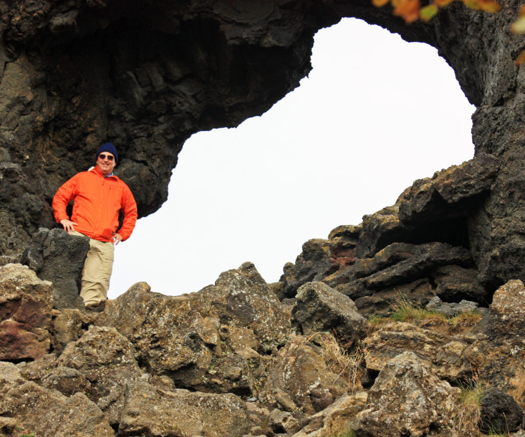
“The Church” which is a cave, opens at both ends with a dome like ceiling.
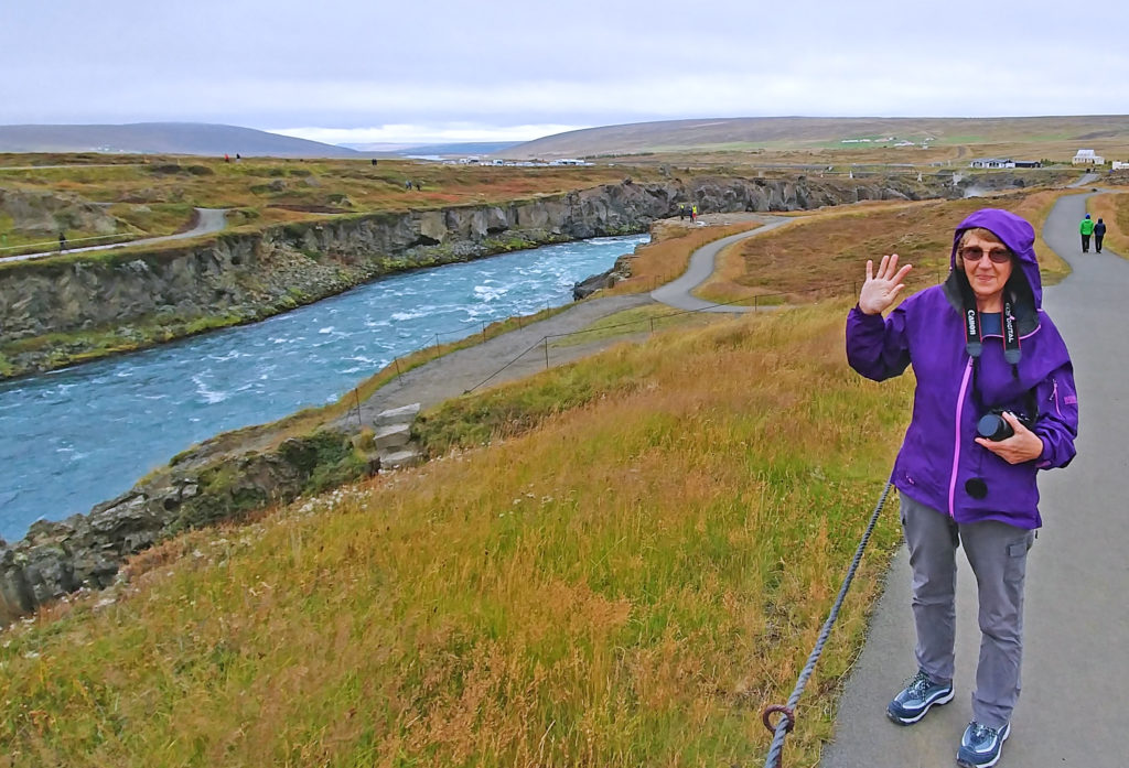
Kathy walking along the Skjalfandafljot River to Godafoss Waterfall.
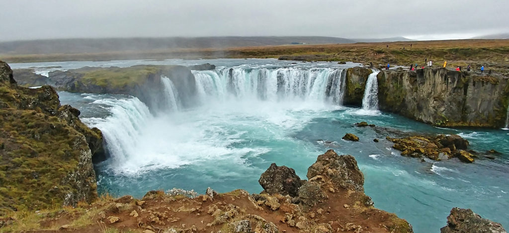
Godafoss the “Waterfall of the Gods”
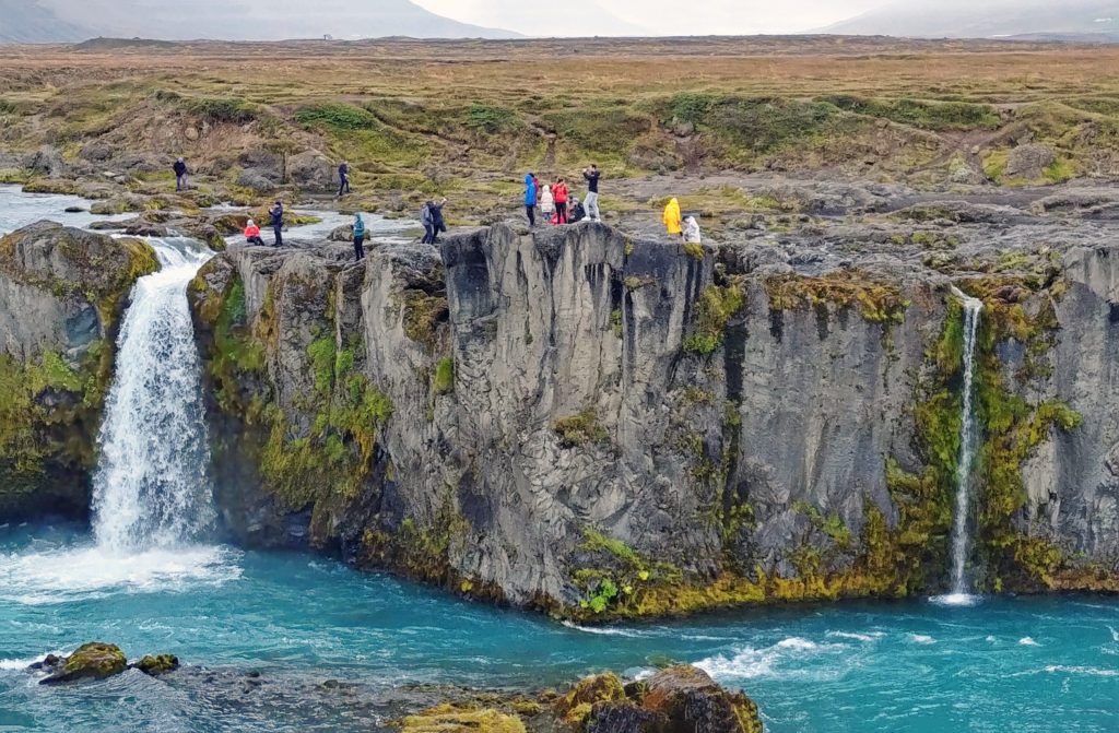
Many tourists were closely competing vigorously for this year’s Darwin Award.
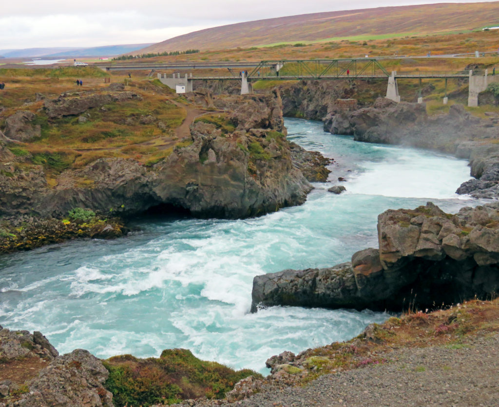
The turbulent white-water rapids of the Skjalfandafljot River.
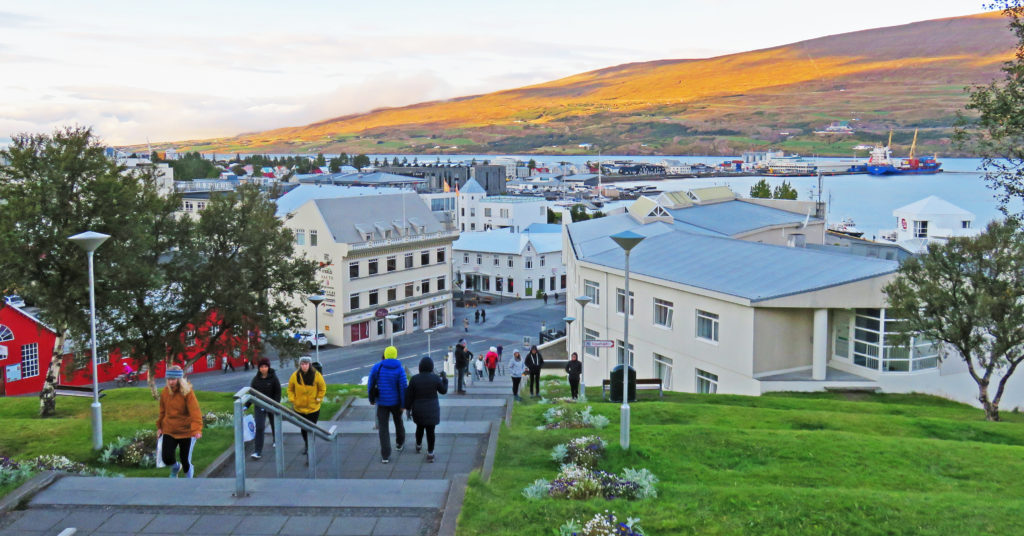
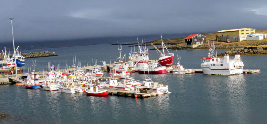
We arrived in Akureyri, the second largest city in Iceland.
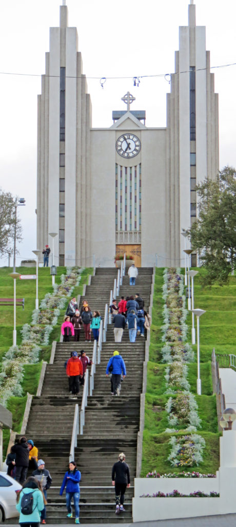
The tallest building was a large Lutheran church on a hill near the city.
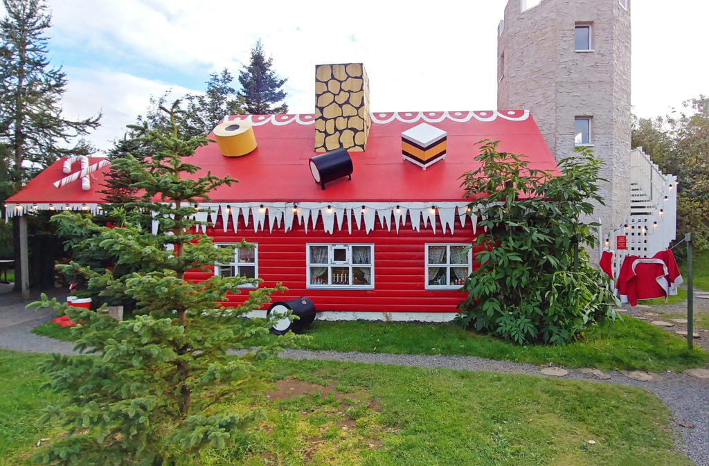
A large, red, two-story wooden structure that looked like Santa’s workshop.
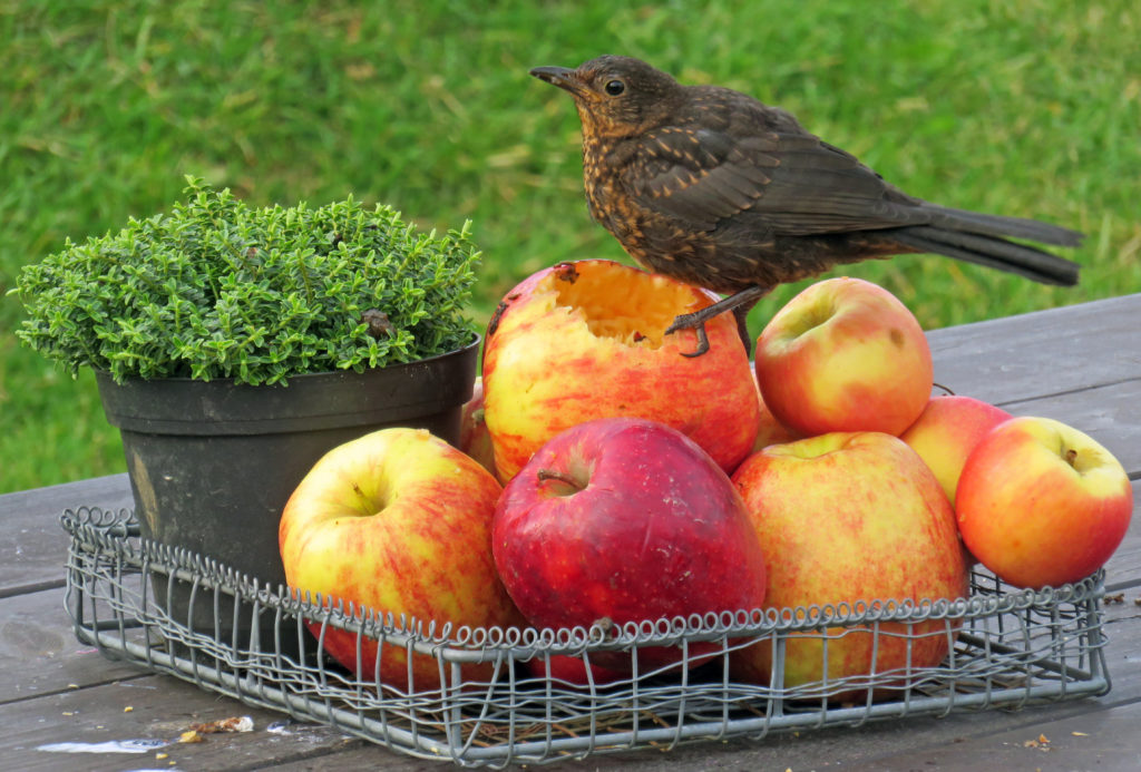
A tiny bird enjoys an afternoon snack of juicy apples.
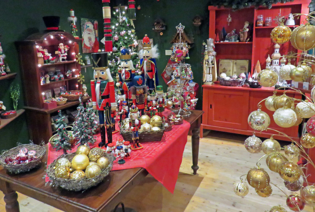
Tree ornaments and Christmas gifts on display inside the gift shop.
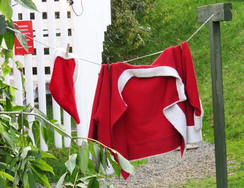
A set of Santa’s clothing hanging out to dry.