The Magnificent Snaefelles Peninsula!
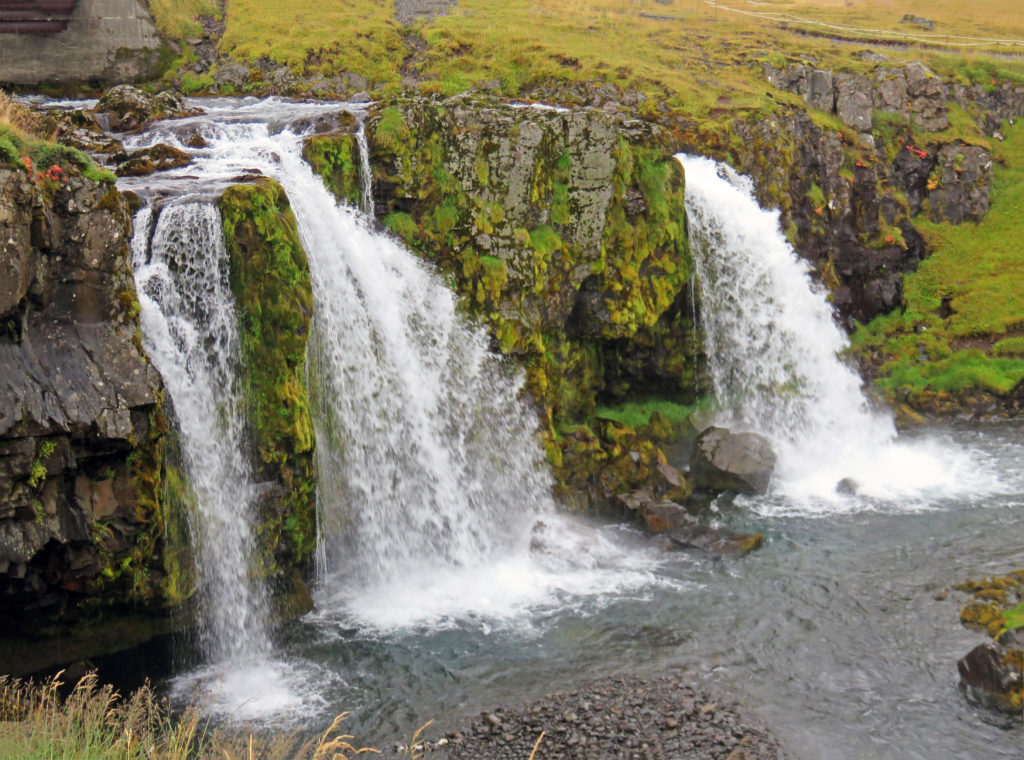
Breathtaking Kirkjufellsfoss waterfall.
September 8, 2018
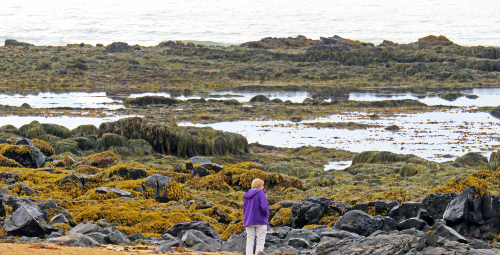
We awoke early and enjoyed a hearty breakfast. It was an overcast rainy day but we looked forward to exploring the Snaefelles Peninsula in West Iceland. We boarded the Artic Adventures van with fifteen new tourists who would share the day with us. Our first stop was Ytri-Tunga. The beach was home to a large seal colony. In Iceland most of the beaches were covered with black volcanic sand but here the sand was a golden-brown color.
We walked along the misty beach climbing over huge rocks covered with algae. Rodge was able to see and capture pictures of harbour seals basking on rocks in the distance with his telephoto lens. Seals live there year-round, but the months of June and July are a more favorable time to see them.
Twenty miles down the road we stopped at Arnarstapi, a beautiful coastal village at the foot of Mt. Stapafell. Arnarstapi used to be an important trading post and vibrant fishing village but now is a busy center for tourism. We walked around the small harbor surrounded by basalt columns, ravines and grottoes. The boats in the protected harbor were lodged up against the basalt walls. We didn’t stay too long because of the rain.
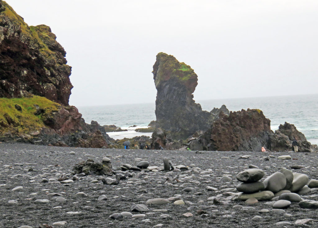
On the way to our next stop, we drove along the shore where we were surrounded by the ocean on our left and flat land and tall volcanic mountains on our right. It was a pretty dramatic contrast. When we arrived at our destination, we were at Djupalonssandur Beach. We hiked down a steep pathway to the beach. Along the way we passed through incredible lava formations. The black pebble beach was breathtaking with powerful huge waves crashing against the rocks.
Along the beach, we found pieces of a shipwreck randomly strewn around. The wreckage was from a British fishing ship called the Epine GY7 that was destroyed there on March 13, 1948. Fourteen men lost their lives that day and five lived. The ruins from the ship were kept on the beach as a memorial to the fishermen.
At 1 p.m. we arrived at Snaefellsness National Park. We stopped for a caving tour at Vatnshellir lava tube cave, created in a volcanic eruption some 8,000 years ago. We did not elect to pay extra to go underground (been there, done that already in a previous spelunking adventure that was enough to last the rest of my life) so we stayed in the van and finished off our lunches while relaxing and watching the drizzle outside.
After our spelunkers boarded the van, we continued on to Saxholl crater. The worn-down basaltic cone of lava was composed of red rock and coated in young vegetation. The crater was formed when the volcano erupted four thousand years ago. Saxholl was easy to climb because it had stairs with rusty-orange iron steps going right to the summit. The 109-meter-tall crater was a popular spot to see views of the Atlantic Ocean and the surrounding Snaefellsjokull glacier but since it was cloudy, we were only treated to views of the oval shaped crater.
As we rounded out our day we headed to our last destination, Kirkjufell “Church Mountain”, one of the most majestic mountains in Iceland. Kirkjufell takes its name from its resemblance to a church steeple, sharpened at the top with long curved sides. The mountain rises 1,519 feet above sea level and many people recognize it as being “Arrow Head Mountain” on Game of Thrones. Kirkjufell is not a volcano but is a stack of layers of sedimentary and extrusive igneous rocks. During the last Ice Age, it was shaped by erosion. The mountain changes color every season from summer green to winter white.
Close by we visited Kirkjufellsfoss waterfall. From a distance, the waterfall appeared as one mass stream, but as we got closer there were actually three falls all running in the same river. It was fed by the glacial waters of the Snaefellsjokull glacier and dropped fifty-four feet over a rocky hill. We spent time photographing the picturesque mountain and waterfall.
It was time to get underway for our return to Reykjavik. It was a two-hour non-stop traverse of coastal areas and then a cut cross-country (rural of course) to the south. We ended up going through the Hvalfjordur Tunnel, a four-mile road under the Hvalfjordur fjord 541 feet below sea level. When we arrived in Reykjavik, we said good bye to our guide and fellow travelers. It had been another amazing day exploring Iceland.
Bless,
Kathy
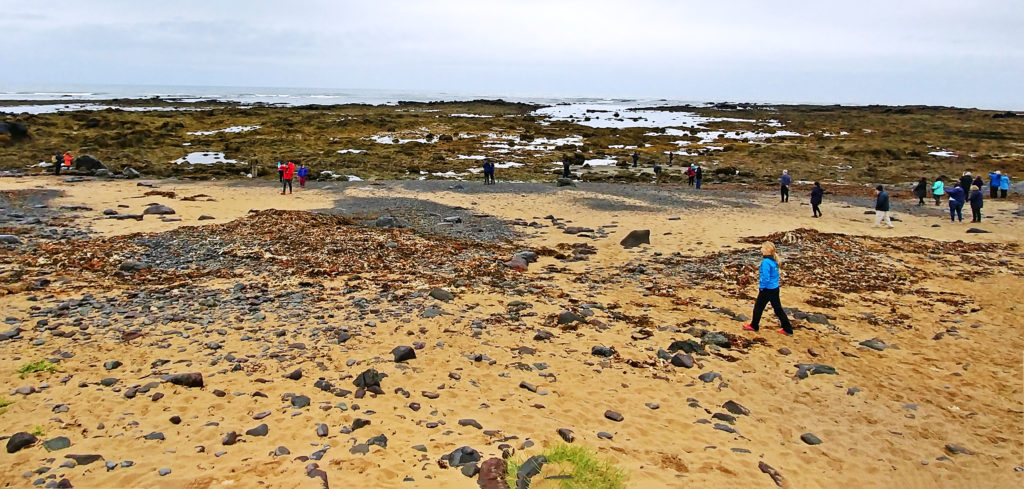
Ytri-Tunga Beach is one of the few golden-brown beaches in Iceland.
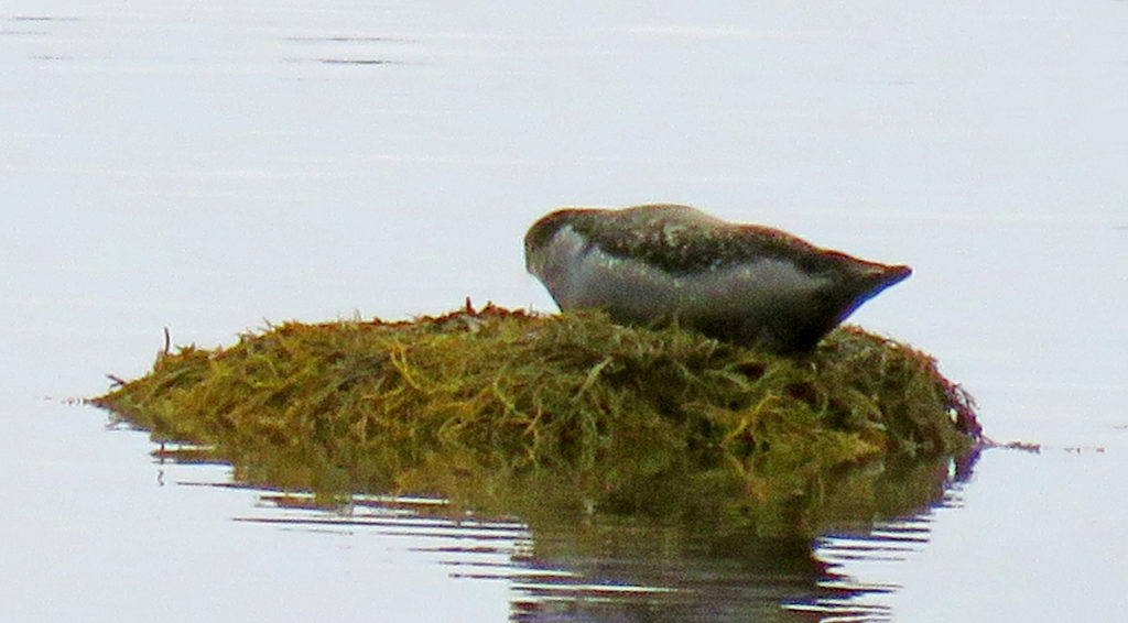
Ytri-Tunga Beach is home to a large Harbour seal colony.
Kathy exploring Ytri-Tunga Beach.
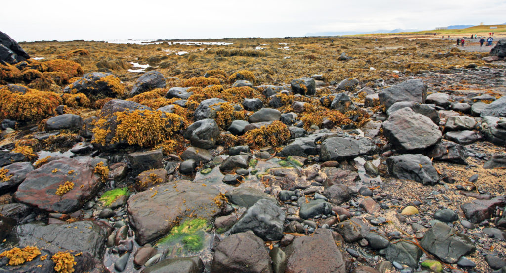
Ytri-Tunga Beach is covered with seaweed, moss, rocks and little pools of water.
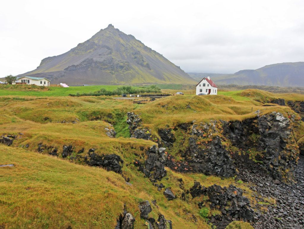
We stopped at Arnarstapi, a beautiful coastal village at the foot of Mt. Stapafell.
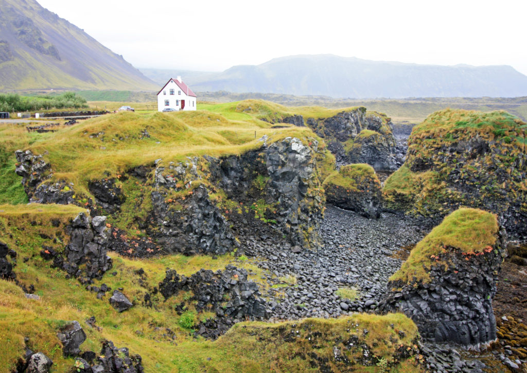
Arnarstapi is surrounded by ravines and basaltic rock from volcanic activity.
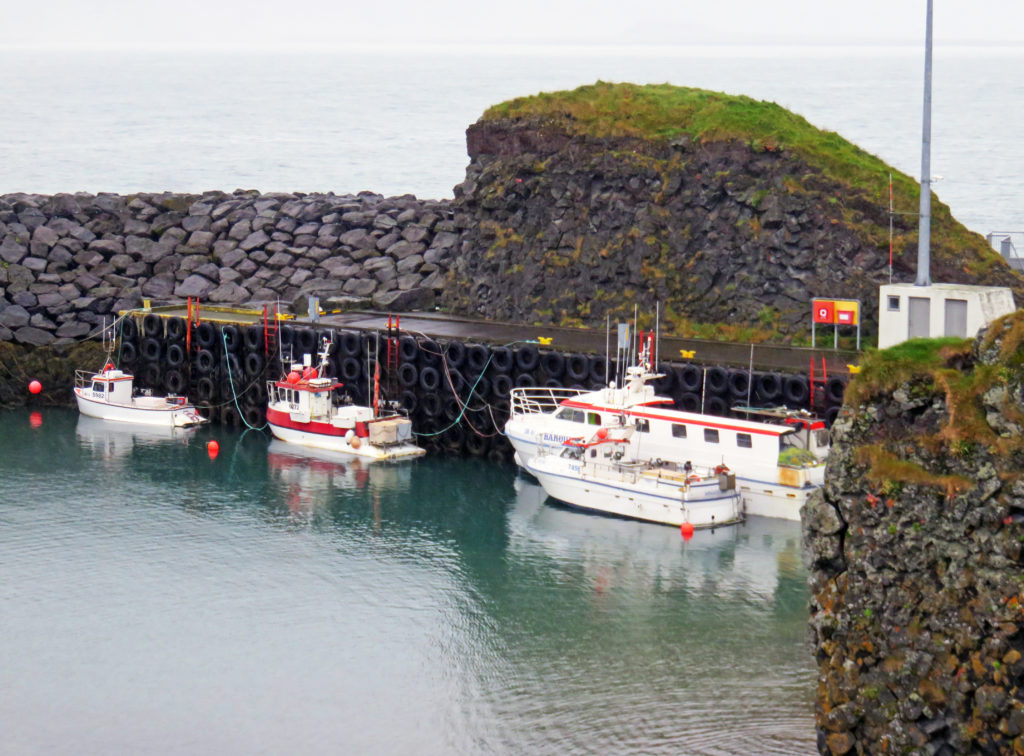
The boats in the protected harbor are lodged up against basalt walls.
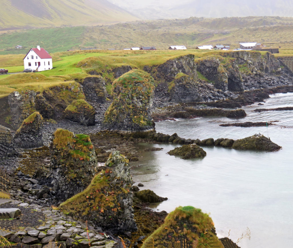
Arnarstapi, once a vibrant fishing village is now a center for tourism.
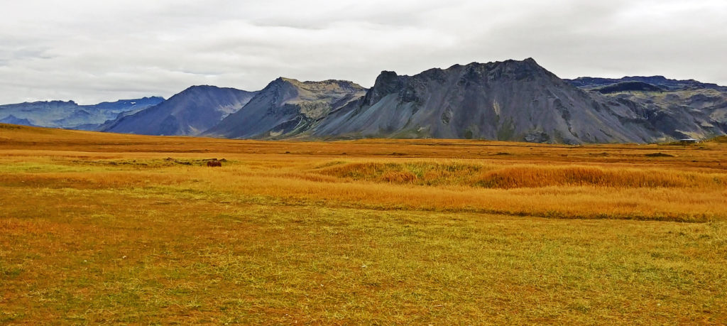
We saw breathtaking mountains to the north as we drove along the ocean shore.
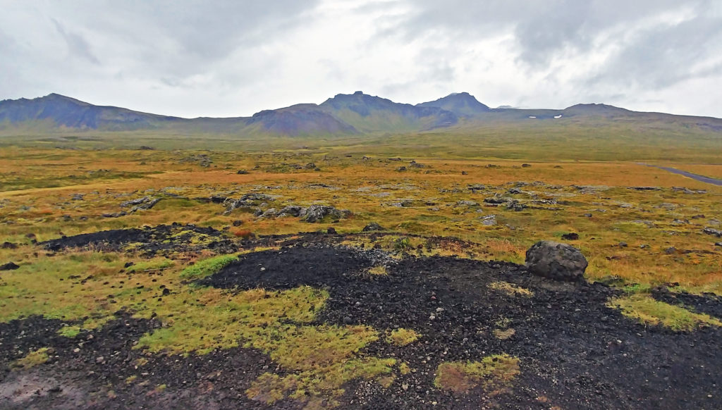
More spectacular countryside draped in moss covered lava.
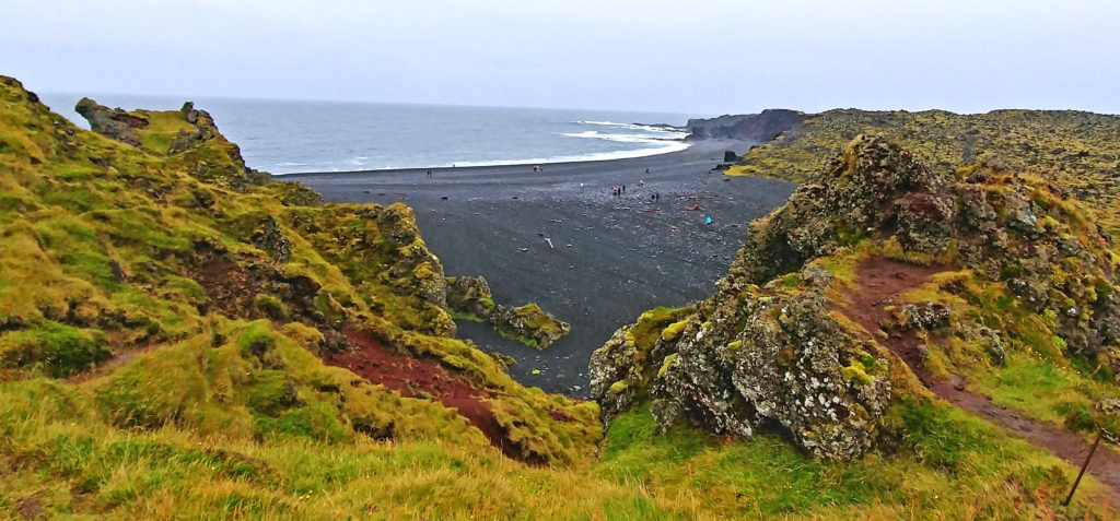
Looking down on Djupalonssander, a black pebbled beach.
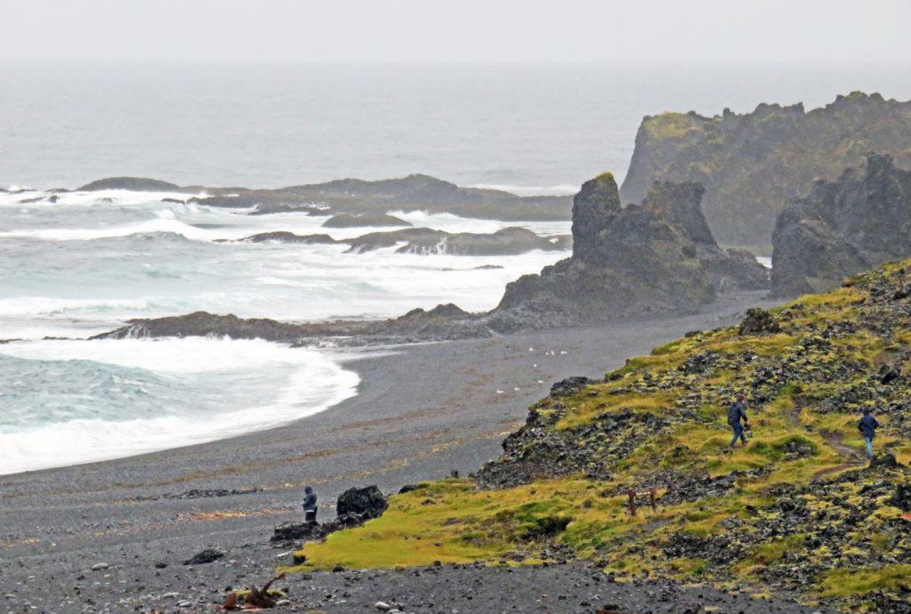
The black beach was breathtaking with powerful waves crashing against rocks.
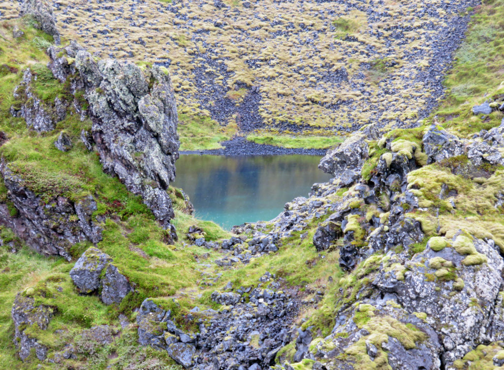
A fresh water lagoon by Djupalonssander Beach.
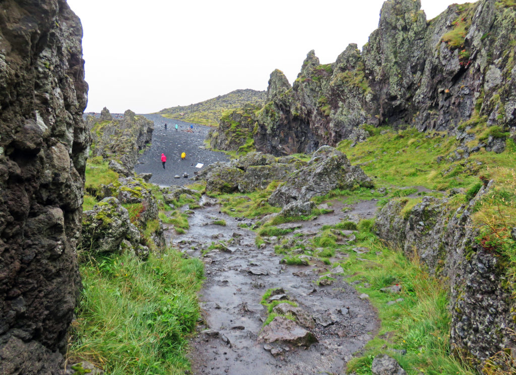
A trail down to Djupalonssander Beach.
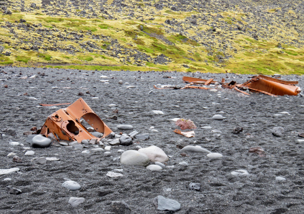
The wreckage from a British fishing ship Epine GY7, that was destroyed in 1948.
Tall basaltic columns on Djupalossandur beach.
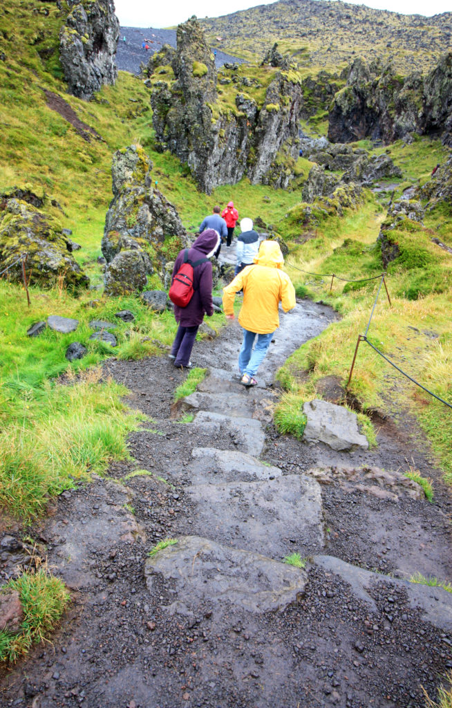
People trek down a steep trail to Djupalossandur beach.
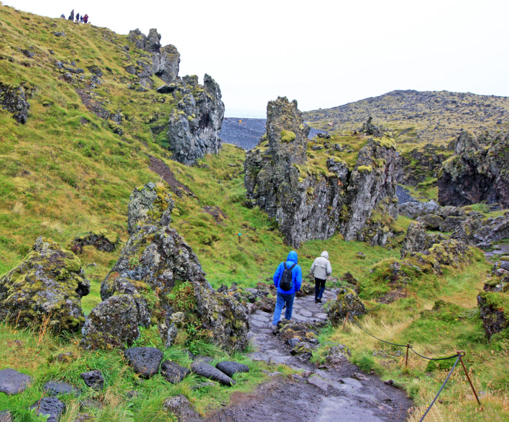
Hikers pass through incredible lava formations on their way to the beach.
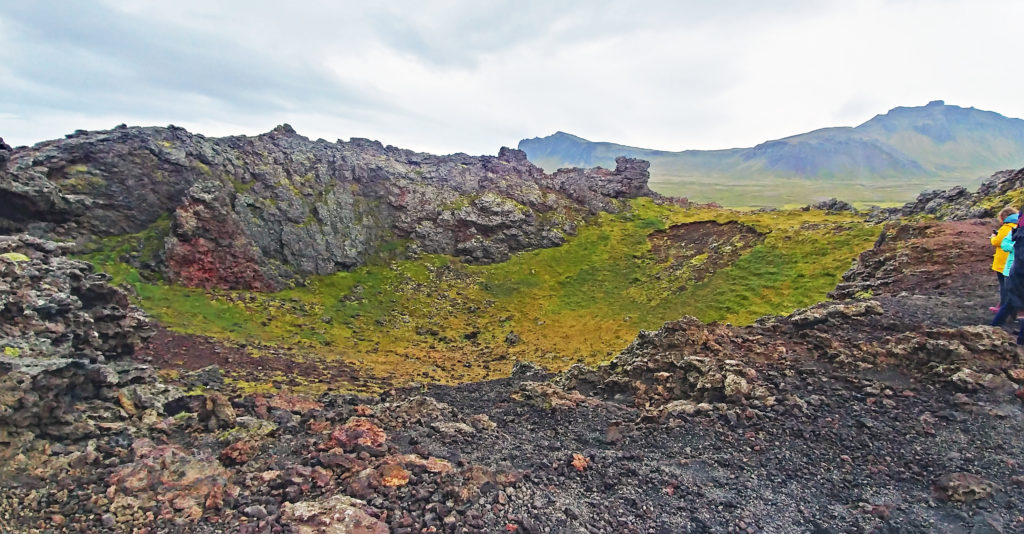
Saxholl Crater is a worn-down basaltic cone of lava coated young vegetation.
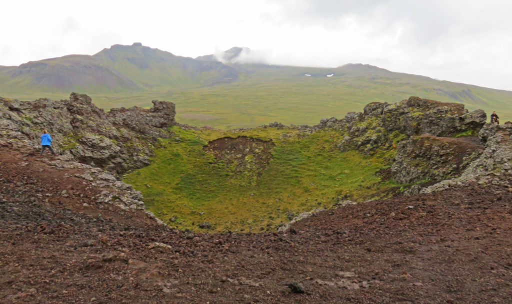
Saxholl is a 109-meter-tall crater that formed 4,000 years ago.

People walking down the rusty-orange iron steps from the crater summit.
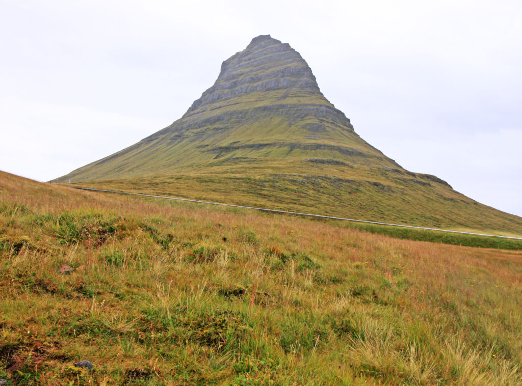
Mount Kirkjufell is one of the most majestic mountains in Iceland.
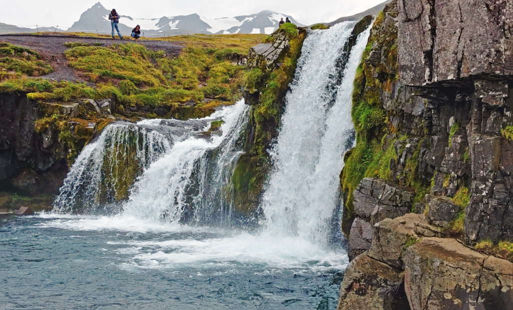
Kirkjufellsfoss waterfall drops fifty-four feet over a rocky hill.
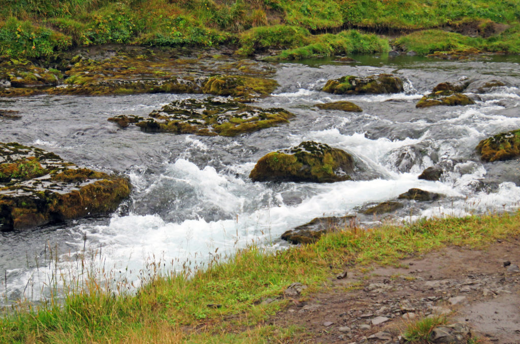
The waterfall flows into the turbulent Kirkjufellsa River
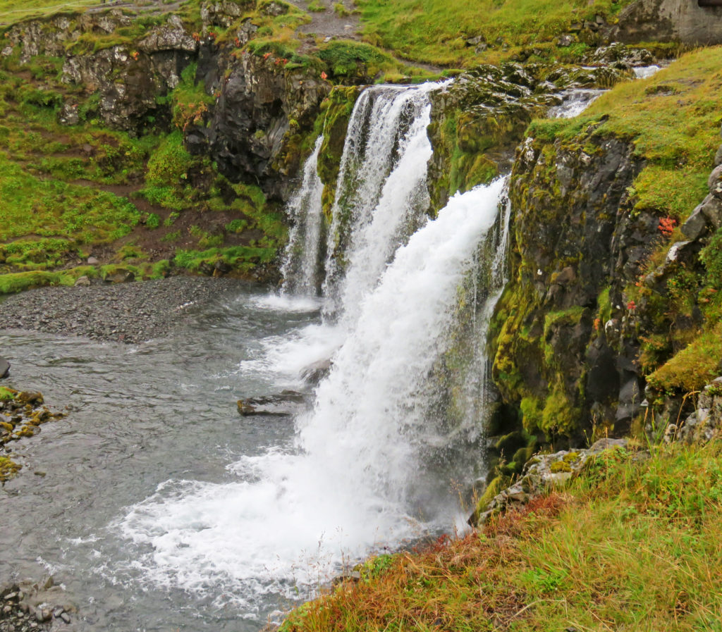
The waterfall is fed by the glacial waters of the Snaefellsjokull glacier.
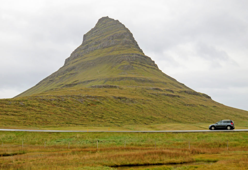
Kirkjufell is made up of layers of sedimentary and extrusive igneous rocks.


Leave a Reply