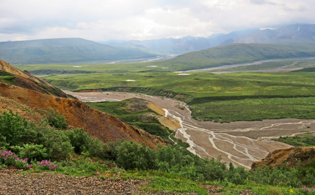
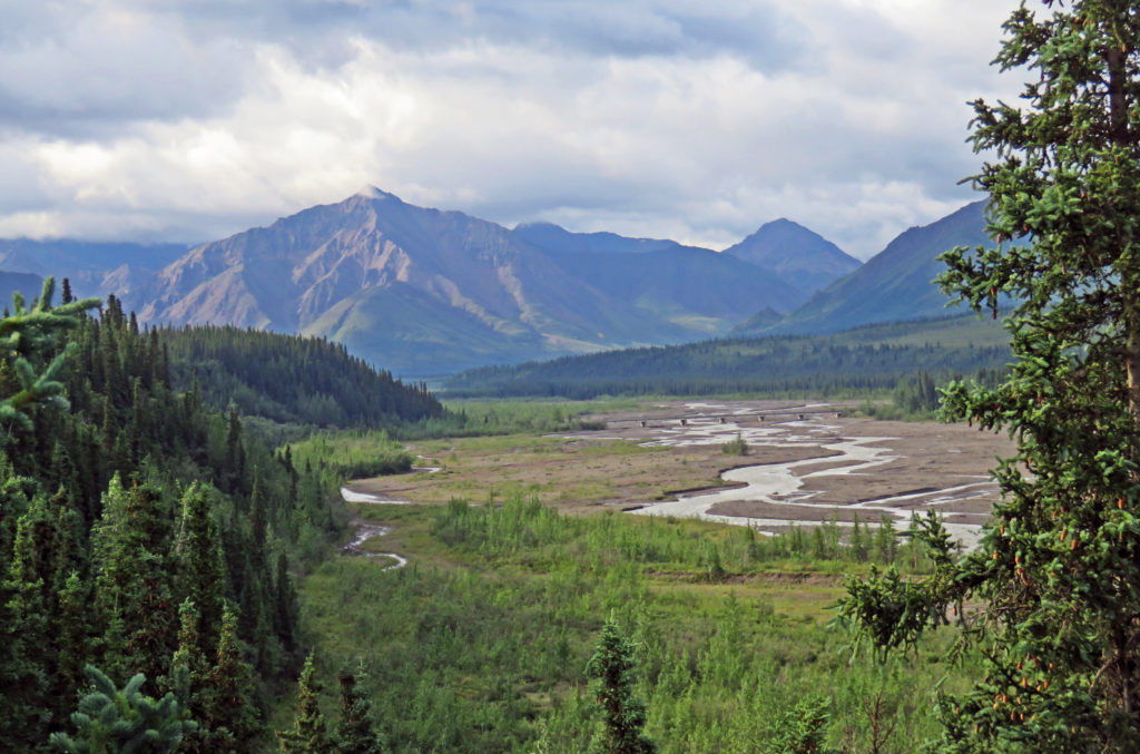
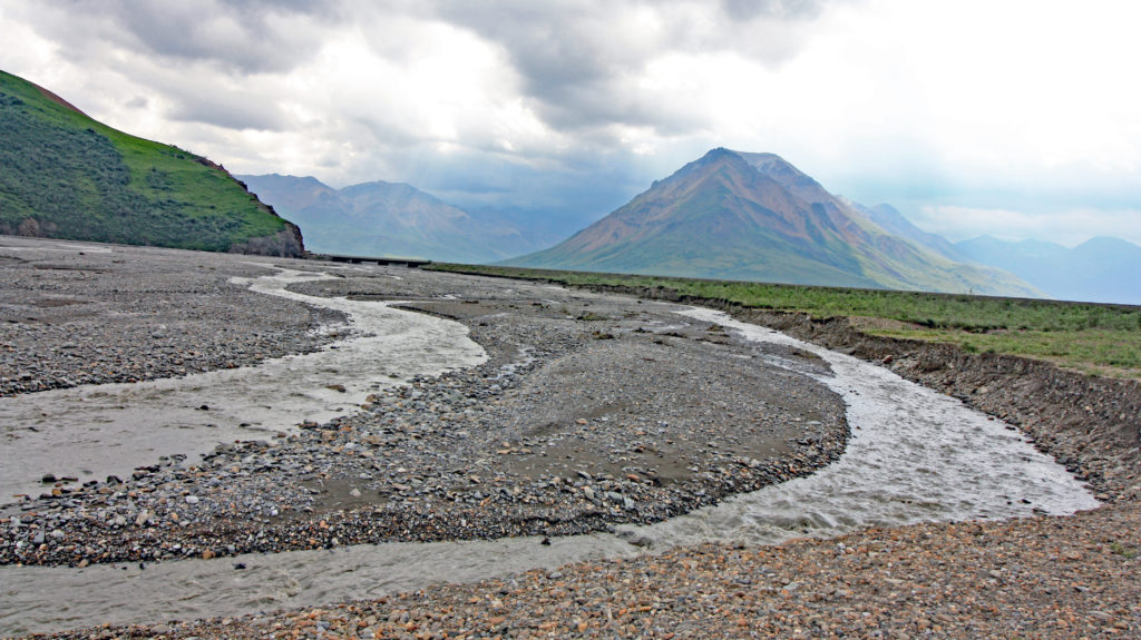
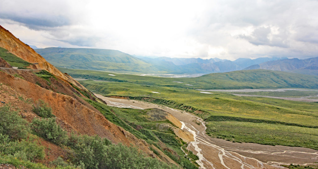
A glorious view of braided rivers and majestic mountains from Polychrome Pass.
July 21,2017
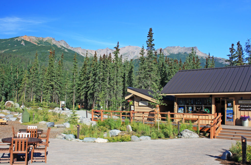
After a hearty breakfast, we headed to the McKinley Resort Main Lodge and boarded a National Park Service bus to begin our 8-hour long Tundra Wilderness Tour. Our driver/trained naturalist has been doing this tour each summer for fifteen years and said, “Every day is different with no telling what will be seen or happen.” Our tour group was full of expectations as we rode to the Park Entrance.
Denali National Park and Preserve was established in 1917 as Mount McKinley National Park. In 1980 the park was renamed Denali, a native Athabascan name meaning “Great One” or “High One”. It took longer to change the name of America’s highest peak. The name of the 20, 310 feet high peak was changed from Mount McKinley to Mount Denali in 2015. The park covers six million acres of land on both sides of the Alaska Range.
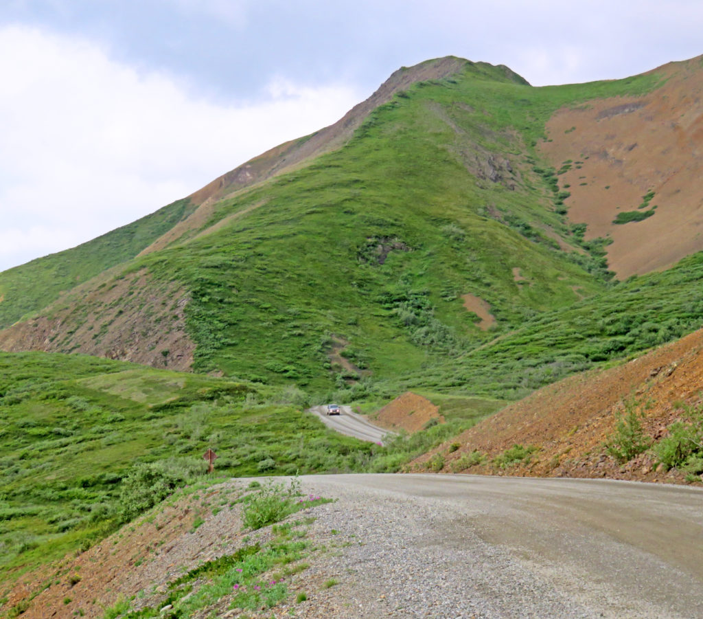
The only road into Denali is 92 miles long and parallels the Alaska Range. Beyond mile 15, access to the road is restricted primarily to park buses. The bus system reduces traffic and roadside disturbances so one can better see the stunning landscape and wildlife. Less traffic also helps protect Denali’s wilderness ecosystem. Cyclists and hikers are welcome on the road. Often, they will jump on one of the buses and ride to a desired trailhead or cycling spot. As we started our journey along the Park Road I realized we would be involved in the celebration of Denali’s 100th birthday.
When we started the tour, the driver told us to yell out, “Stop!” when anyone saw wildlife and, if safe to do so, he would stop for viewing from inside the bus. Since he had to focus on driving, he had to rely on the forty sets of eyes in the back to spot the critters. The bus was also equipped with a roof mounted zoom camera that was under the driver’s control. The video was displayed on a set of drop-down LCD screens spaced down both sides of the bus. That feature helped a lot, especially for those riders without binoculars or cameras with telephoto lenses.
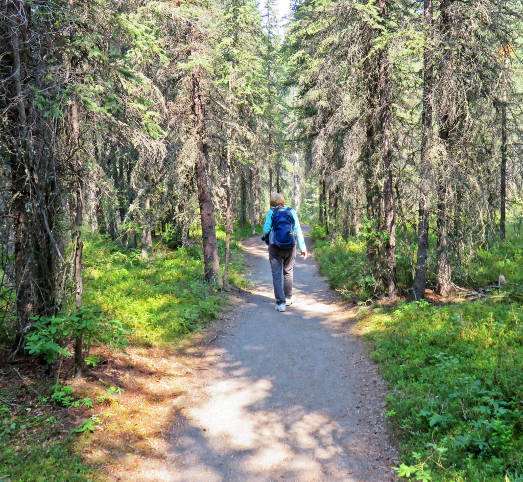
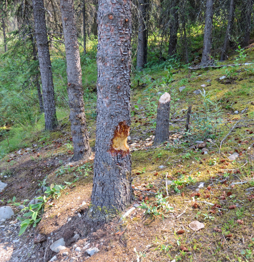
We were greeted by a crisp sunny morning as our bus left the Denali Visitor Center (elevation 1,585 feet) and headed out on Park Road. For the next 106 miles (roundtrip) we traveled up and down in elevation through mountain passes and valleys. For fifteen miles, we rode through boreal forests, also known as the taiga. White and black spruce, birch, aspen and balsam poplar trees covered the land. A covey of grouse scurrying across the road was our first “Stop!” wildlife sighting.
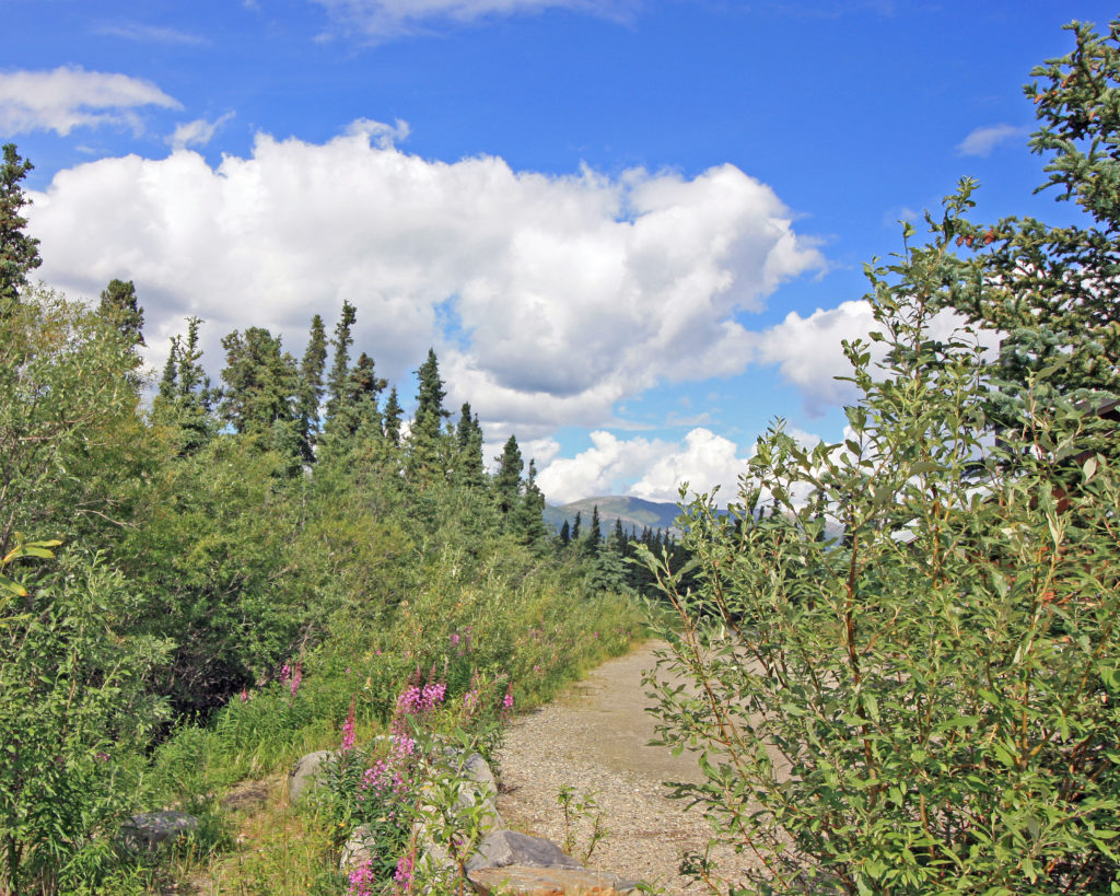
A couple miles past the Savage River Campground we came to the Mile 15 checkpoint. A park ranger welcomed us and allowed our tour bus to continue. We left the two-lane paved road and climbed to Primrose Ridge (elevation 3,200 feet) on a narrow gravel road. As we climbed, we watched the landscape transition from forested taiga to treeless tundra. The tree-line in Denali lies around 3,000 feet.
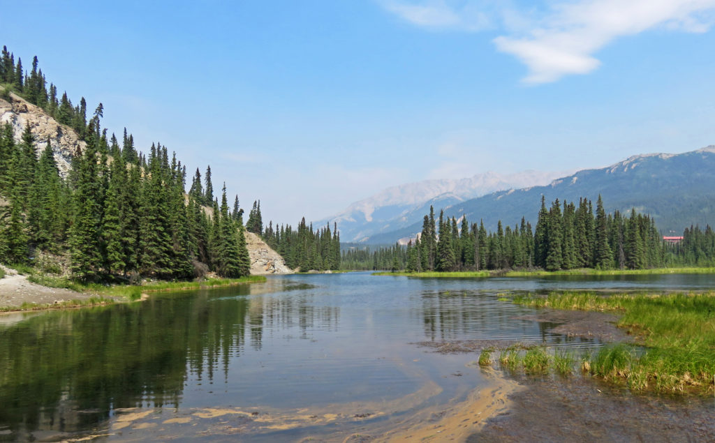
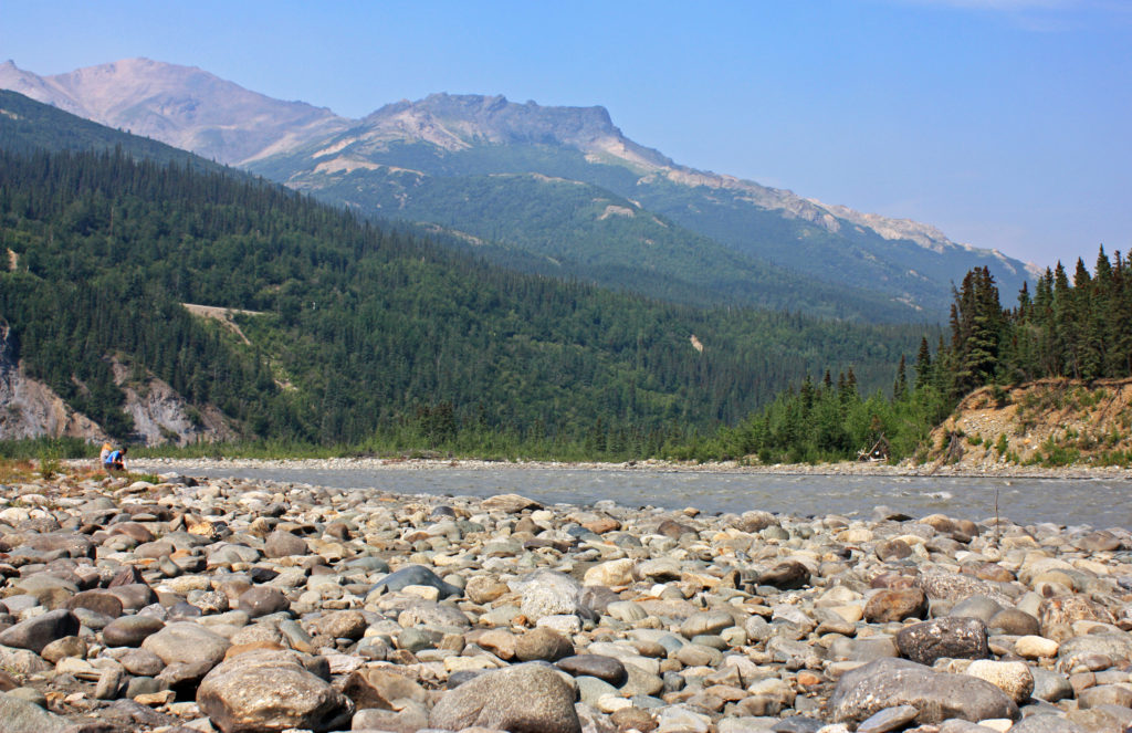
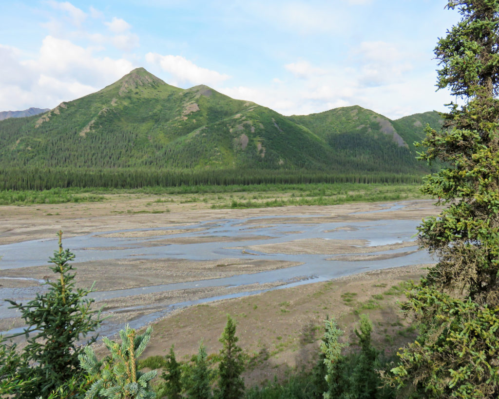
We rolled down Primrose Ridge into the Sanctuary River Valley. We were still on the lookout for Mount Denali and wildlife. At mile 30, we had our first break at the Teklanika rest stop. It felt so good to get off the bus and stretch my legs. The scenery was magnificent with views of the Teklanika River coursing through the beautiful valley. In the distance, the mountains of the Alaska Range formed a natural backdrop. Blooms of pink fireweed scattered in the terrain added color to the landscape portrait.
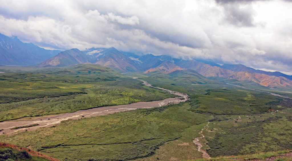
The Teklanika River is a braided river. Such rivers are usually wide but shallow. They typically form on fairly steep slopes and carry large amount of coarse-grained sediments. When the river’s flow decreases, the sediments get deposited on the river bed leaving behind small temporary islands of sands that cause the river’s channel to split. Braided rivers exist near mountainous regions, especially those with glaciers.
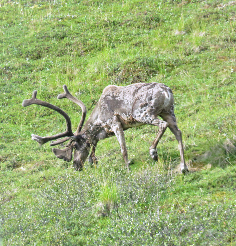
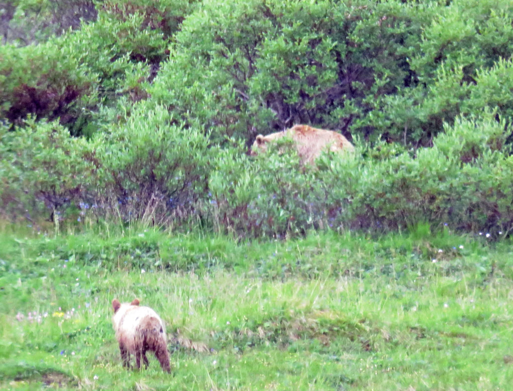
We climbed 400 feet into the tundra among treeless rolling vistas. All at once we heard multiple shouts of “Stop!” There about 100 feet away on the left side of the bus, we saw a huge caribou munching on tundra flora. We gazed at the patchy brown-colored herbivore and took pictures. It was our first major sighting and we were excited. As we continued our climb up to Sable Pass, elevation 3,900 feet, I heard another “Stop!” A mamma grizzly bear was spotted with her cub. While mamma was preoccupied in some bushes, the cub was busy exploring its surroundings. Amazing!
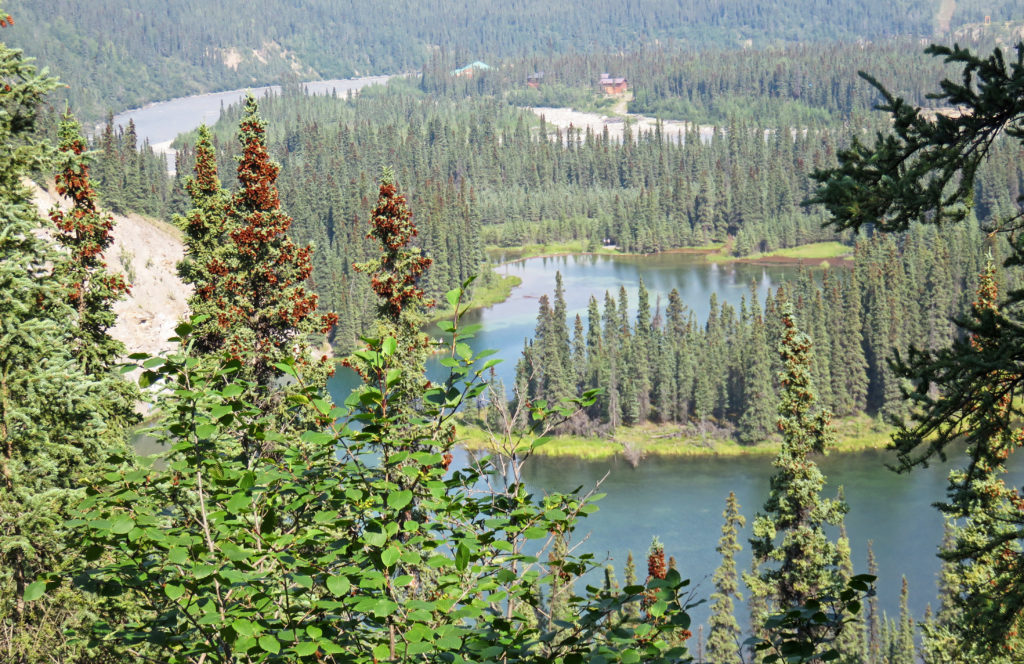
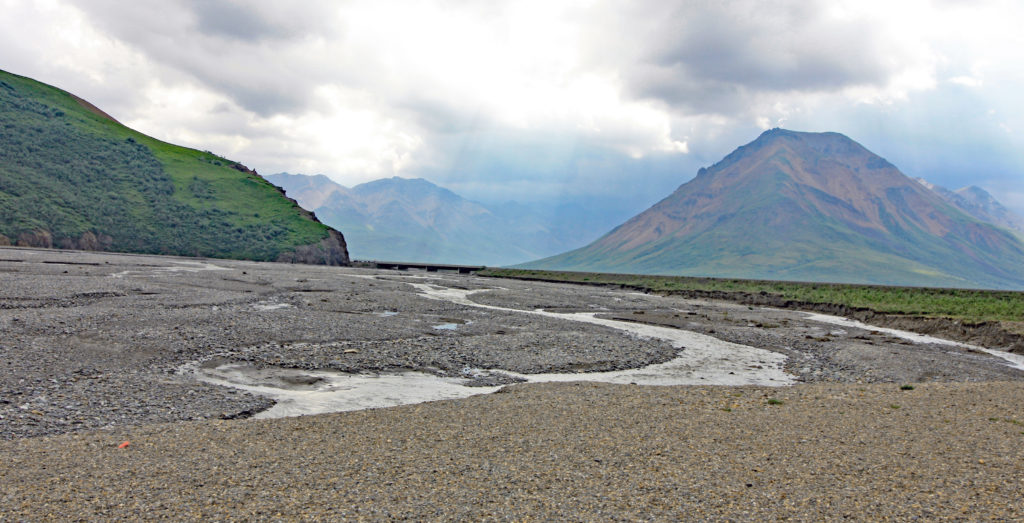
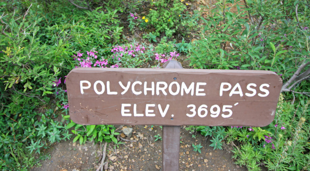
After ascending Sable Pass we coasted 845 feet downhill to the East Fork River Valley. Before we could explore the U-shaped valley, we were climbing once again. This time we were riding up to beautiful Polychrome Pass, one of the most spectacular and fear-inducing sections of the tour. That portion of the narrow one-lane road required the driver’s full attention due to the steep grade, sharp turns, nonexistent shoulders and breathtaking 1,000-foot drop-offs. Our bus driver said, “If you get scared, do what I do and close your eyes”.
When we arrived at the top of Polychrome Pass, elevation 3,695 feet, the scene was spectacular. The vastness of the park was in full view with braided rivers wandering back and forth throughout the colorful valley floor and the Alaska Mountains glistening in the distance. Polychrome Pass gets its name from the colorful volcanic rocks that can be seen from the overlook. The bright colors of Polychrome Pass were created by magma that welled up and spilled over older sedimentary rock layers. The basalt, rhyolite and andesite rocks color the area in brown, yellow, tan. white, orange, and purple hues.
On our descent to the Toklat River, elevation 3,035 feet, there was another “Stop” moment. We saw a lone grizzly bear walking through vegetation along the valley floor. We arrived at the Toklat Rest Stop for another break. We could see little white dots on the mountain ridges overlooking the rest area. With some magnification we discovered they were Dall sheep. The sheep favor wind-blown ridges and steep cliff faces where they can roam beyond the easy reach of wolves. They dine on the flowers and grasses in the summertime and mosses and lichens in the winter.
We were at the 53-mile halfway point and it was time to turn around and head back. As we were getting on the bus our driver spotted a bear ambling toward the rest area. Needless to say, we all jumped on the bus pronto. So far, the tour had been amazing but my only regret was that I hadn’t seen Mount Denali. It had been obscured by clouds. Our bus driver told us that the elusive mountain is covered in clouds two-thirds of the time partly because of the Alaska Range. The range bisects Alaska and is the meeting point for cold dry systems from the north and warm moist systems from the south. As the systems collide they often produce lots of clouds, obscuring the mountain.
We had many critter sightings on our return trip. We saw a momma grizzly bear and two cubs browsing for berries, several small herds of caribou including stags with huge velvet covered antlers, and a momma bear laying in the grass on her belly with her feet splayed out behind her. My favorite discovery was a big bull moose. Bullwinkle spent several minutes ducking in and out of thickets as he grazed. We were all waiting for the great reveal. He finally walked in the open and posed by a running stream.
Even though Mount Denali was a “no-show”, it was a glorious day. We saw Denali National Park in all its splendor. The majestic mountains, glacier-carved river valleys, meandering silt-laden rivers and magnificent wildlife all wove into a living masterpiece. It was a unique, unforgettable experience. We owe tremendous thanks to the people who had the foresight and determination to set aside this pristine wilderness for future generations.
In awe,
Kathy
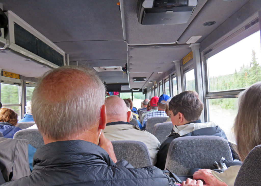
On the bus and ready to go for our tour.
A beautiful view at Teklanika rest stop.
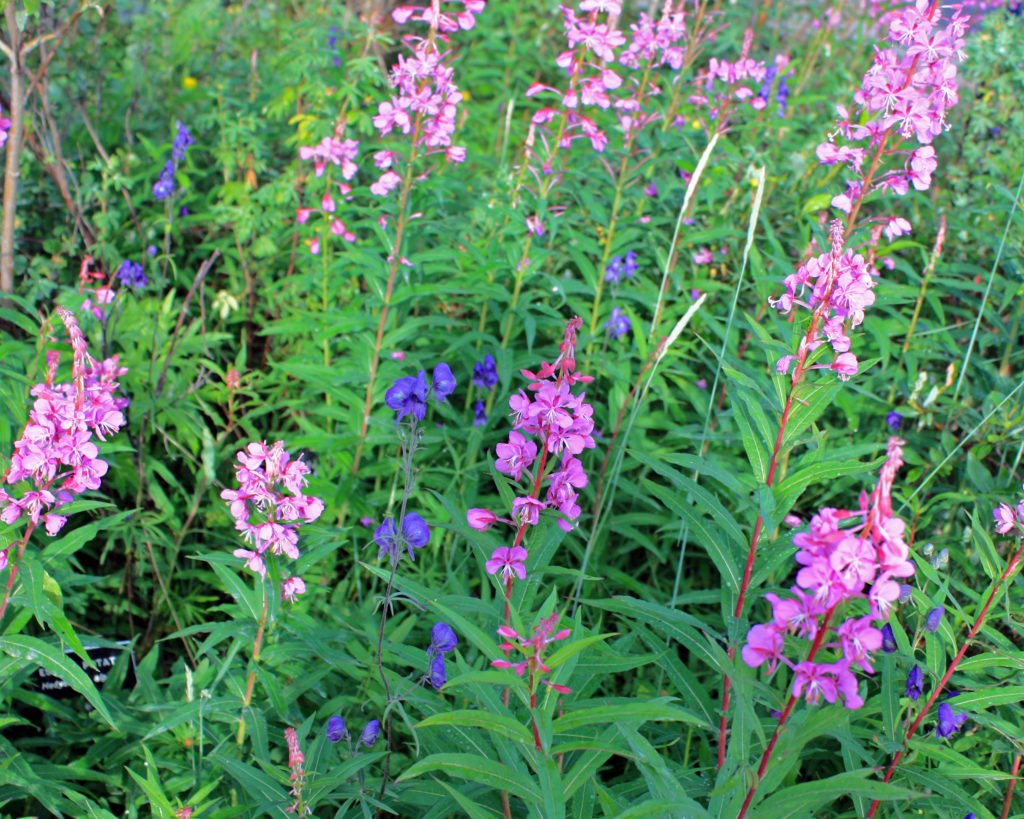
Blooms of pink fireweed scattered with purple lupine.
The Teklanika River coursing through the beautiful valley.
The Teklanika River, is an example of a braided river.
The river is made up of deposits of sediment from glacial streams.
The gravel bars formed by braided rivers are travel corridors used by animals.
A caribou munching on tundra flora.
A mamma grizzly bear and her cub
At the top of Polychrome Pass.
A view across the valley from Polychrome Pass.
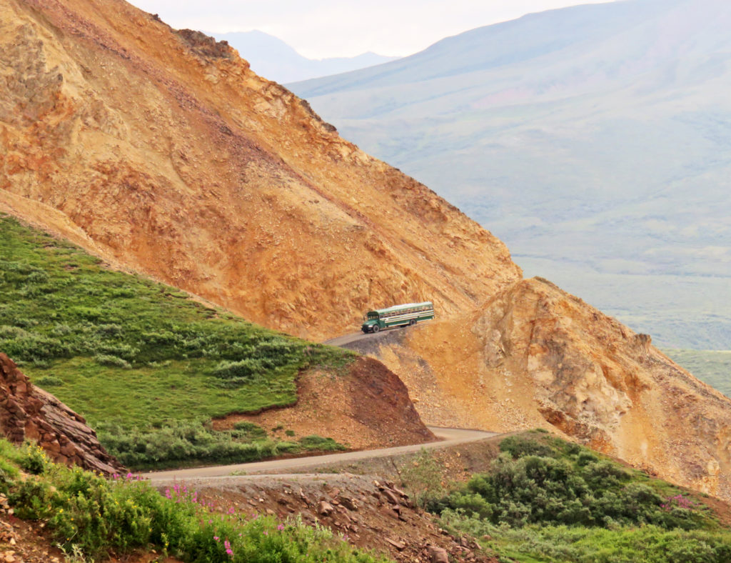
A tour bus climbing up the colorful pass.
A majestic view of the Alaska Range from Polychrome Pass.
We leave Polychrome pass and head down to the Tolkat River.
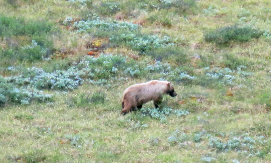
A lone grizzly bear walking through vegetation along the valley floor.
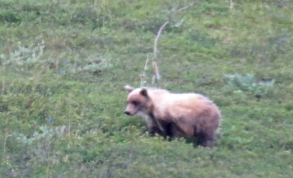
Another grizzly bear meditating.
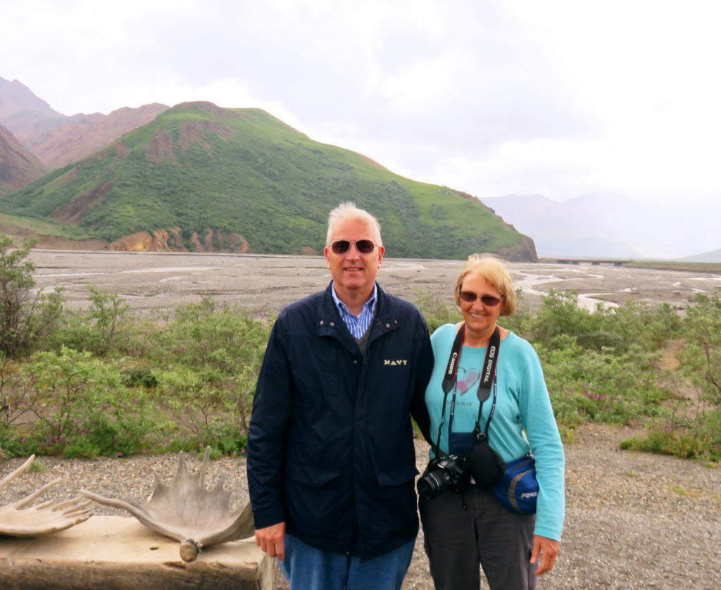
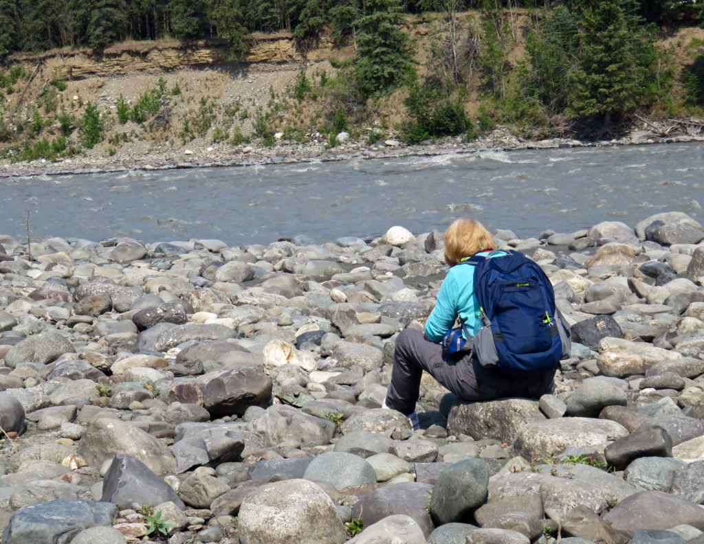
Rodge and Kathy posing in front of the Teklanika River.
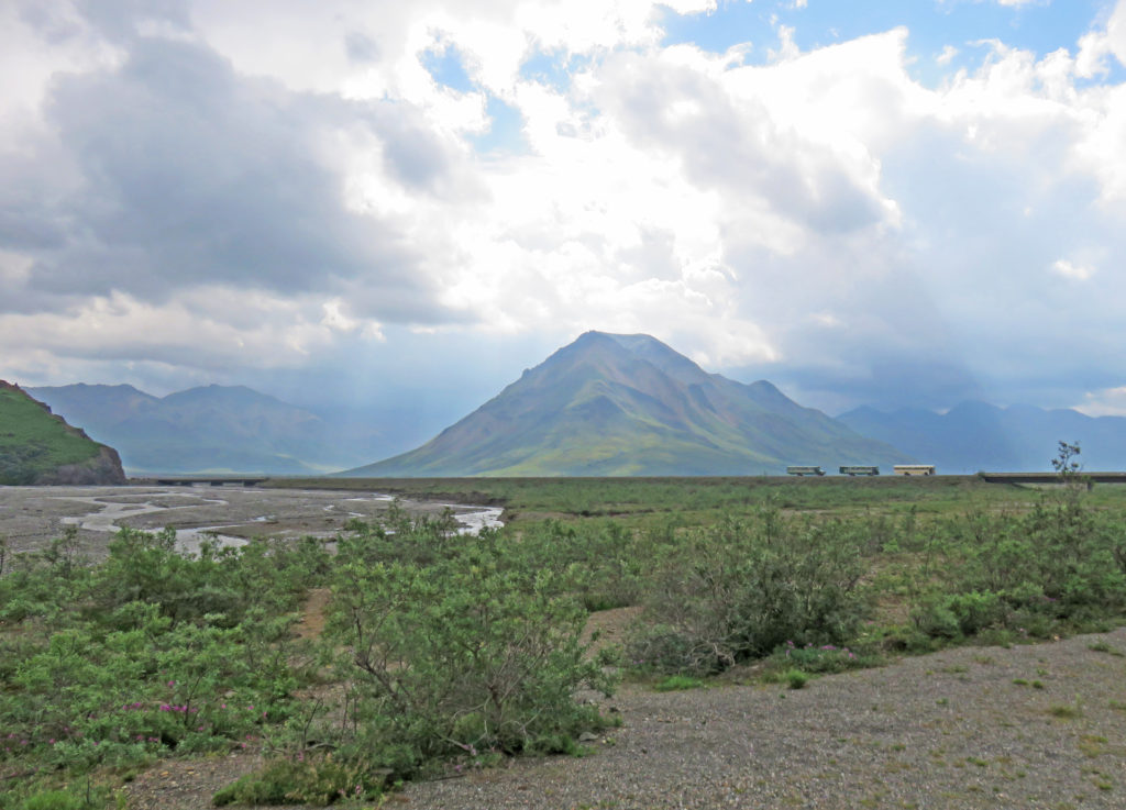
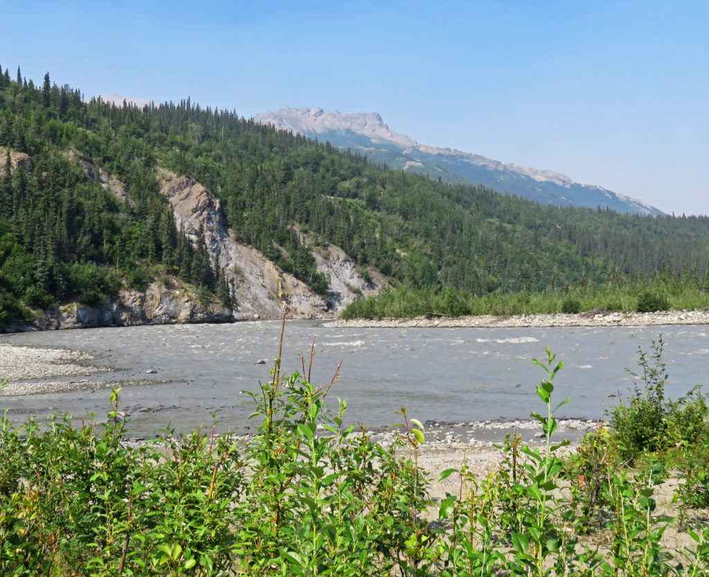
More views of the Teklanika River valley on our return trip.
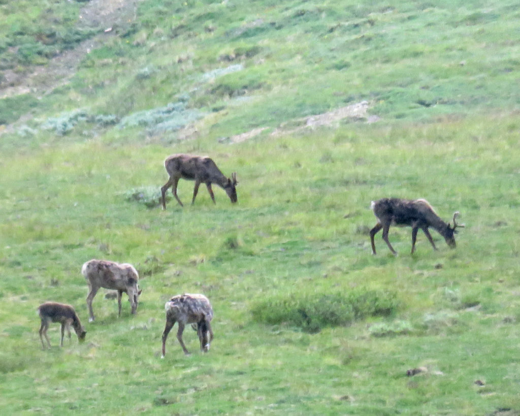
A small herd of caribou grazing on a hillside.
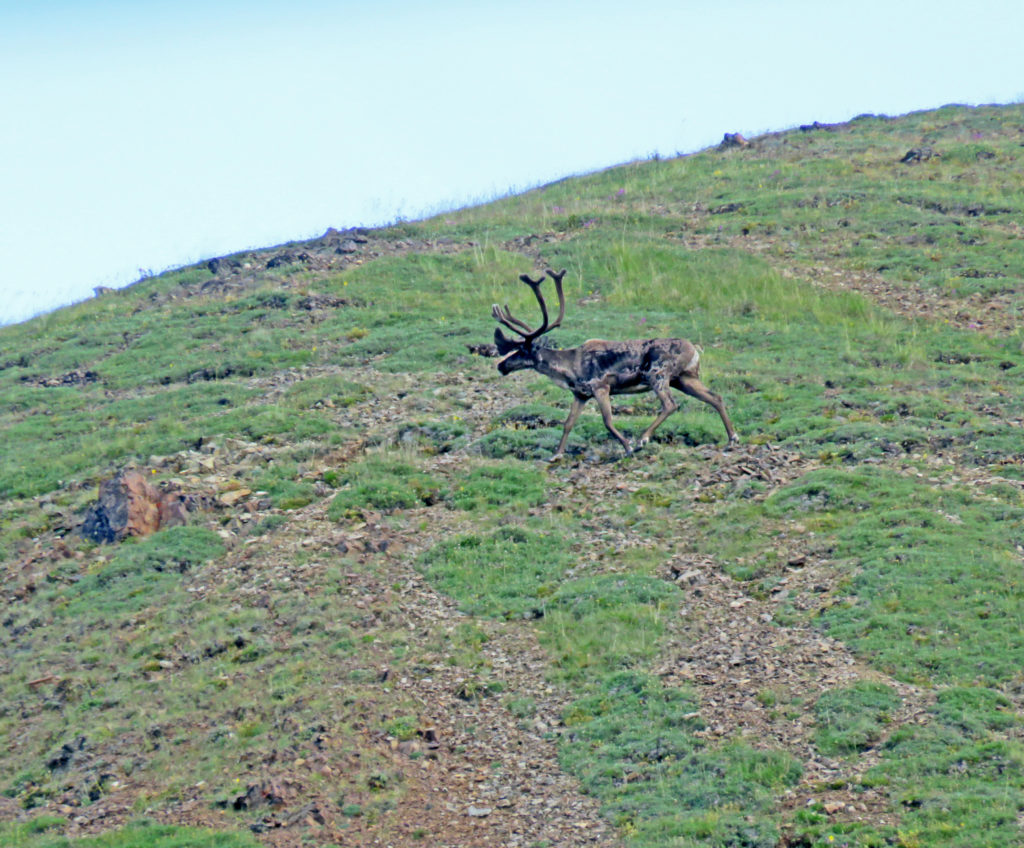
A stag with huge velvet covered antlers.
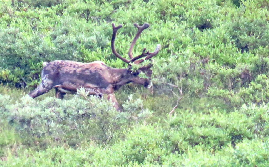
A close-up of a stag.
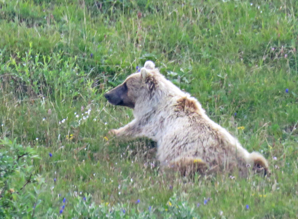
A momma bear laying in the grass with her feet splayed out behind her.
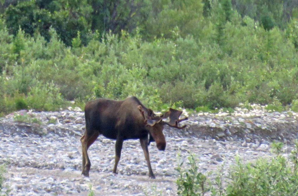
A bull moose ambling along a running stream.